De Cocksdorp in Texel, North Holland, Netherlands — Northwestern Europe
De Posthoorn
⎯⎯⎯
The Post Horn
Photographed by Andrew Ruppenstein, June 1, 2026
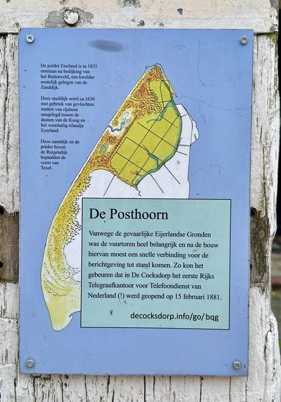
1. De Posthoorn / The Post Horn Marker
Note that: 1) The small text in the upper left is repeated on all 12+ similar markers in De Cocksdorp as it is, effectively, the origin story of the area, and 2) the URL provided on the marker seemingly does not work.

Vanwege de gevaarlijke Eijerlandse Gronden was de vuurtoren heel belangrijk en na de bouw hiervan moest een snelle verbinding voor deberichtgeving tot stand komen. Zo kon het gebeuren dat in De Cocksdorp het eerste Rijks Telegraafkantoor voor Telefoondienst van Nederland (!) werd geopend op 15 februari 1881.
De polder Eierland is in 1835 ontstaan na bedijking van het Buitenveld, een kwelder oostelijk gelegen van de Zanddijk.
Deze stuifdijk werd ca. 1630 met gebruik van gevlochten matten van rijshout aangelegd tussen de duinen van de Koog en het voormalig eilandje Eyerland.
Deze zanddijk en de polder boven de Ruigendijk bepaalden de vorm van Texel.
The Post Horn
The lighthouse was crucial due to the treacherous Eijerlandse Gronden (Eijerland Shoals), and its construction necessitated the establishment of a rapid communication link. Consequently, the Netherlands' first State Telegraph Office for telephone services (!) opened in De Cocksdorp on February 15, 1881.
The Eierland polder was created in 1835 following the diking of the Buitenveld, a salt marsh situated east of the Zanddijk.
This drift-sand dike was constructed around 1630—using woven brushwood mats—between the dunes of De Koog and the former islet of
This sand dike and the polder north of the Ruigendijk determined the shape of Texel.
Topics.
this page online
Location. 53° 9.423′ N, 4° 52.401′ E. Marker is in De Cocksdorp, Noord-Holland (North Holland), in Texel. It is on Kikkertstraat, on the right when traveling east. Touch for map. Marker is at or near this postal address: Kikkertstraat 42-44, De Cocksdorp, Noord-Holland 1795 AE, Netherlands. Touch for directions.

Regionally, this marker is on the German Wadden Sea. Globally, it is in Europe, the European Union, Atlantic Europe, the Benelux Low Countries, the Schengen Area, Western Europe, and the Western World. Historically, it finds itself in what was once the Holy Roman Empire.
Other nearby markers. At least 8 other markers are within walking distance of this marker: De Cocksdorp - Kikkerstraat 47 (a few steps from this marker); De Strekdam / The Breakwater (within shouting distance of this marker); De Cocksdorp - Kikkertstraat 59, Polderhuis (within shouting distance of this marker); De Gele Buurt / The “Yellow Neighborhood” (within shouting distance of this marker); Stengweg
Photographed by Andrew Ruppenstein, June 1, 2026
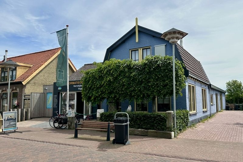
2. De Posthoorn / The Post Horn Marker - wide view
The marker is visible here mounted to a wooden post (middle left, by the bicycles).
Credits. This page was last revised on June 22, 2026. It was originally submitted on June 21, 2026, by Andrew Ruppenstein of Lamorinda, California. This page has been viewed 18 times since then. Photos: 1. submitted on June 21, 2026, by Andrew Ruppenstein of Lamorinda, California. 2. submitted on June 22, 2026, by Andrew Ruppenstein of Lamorinda, California.
