Waterford in County Waterford, Munster, Ireland — Irish South-West ((Éire) North Atlantic Ocean)
Brick Lane
Waterford Treasures
Photographed by Ian Lefkowitz, May 16, 2026
1. Brick Lane Marker
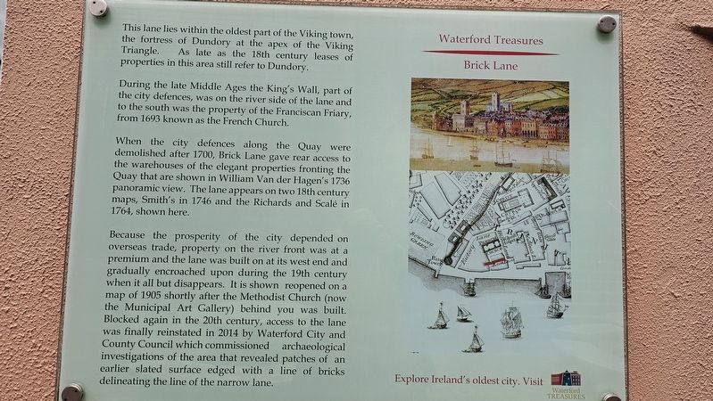
This lane lies within the oldest part of the Viking town, the fortress of Dundory at the apex of the Viking Triangle. As late as the 18th century leases of properties in this area still refer to Dundory.
During the late Middle Ages the King’s Wall, part of the city defences, was on the river side of the lane and to the south was the property of the Franciscan Friary, from 1693 known as the French Church.
When the city defences along the Quay were demolished after 1700, Brick Lane gave rear access to the warehouses of the elegant properties fronting the Quay that are shown in William Van der Hagen’s 1736 panoramic view. The lane appears on two 18th century maps, Smith’s in 1746 and the Richards and Scalé in 1764, shown here.
Because the prosperity of the city depended on overseas trade, property on the river front was at a premium and the lane was built on at its west end and gradually encroached upon during the 19th century when it all but disappears. It is shown reopened on a map of 1905 shortly after the Methodist Church (now the Municipal Art Gallery) behind you was built. Blocked again in the 20th century, access to the
this page online
Erected by Waterford Treasures.
Topics. This historical marker is listed in these topic lists: Forts and Castles • Roads & Vehicles.
Location. 52° 15.644′ N, 7° 6.407′ W. Marker is in Waterford, Munster, in County Waterford. It is at the intersection of Greyfriars Street and Coffee House Lane, on the right when traveling north on Greyfriars Street. Touch for map. Marker is at or near this postal address: 1 Greyfriars Street, Waterford, Munster X91 CF95, Ireland. Touch for directions.

Regionally, this marker is in the Ancient East. Globally, it is on the Atlantic Ocean, in the North Atlantic Region, in Europe, on the Island of Ireland, on the Celtic Fringe, in the European Union, in Atlantic Europe, on one of the British Isles, in the Western World, and in the Anglosphere.
Other nearby markers. At least 8
Photographed by Ian Lefkowitz, May 16, 2026
2. Brick Lane Marker
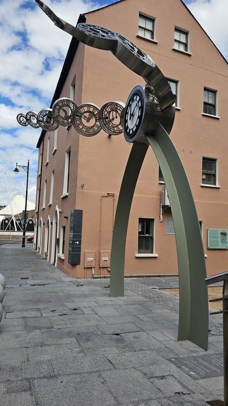
The marker is located behind 'Tempus Fugit,' the public art piece next to the Irish Museum of Time.
Photographed by Ian Lefkowitz, May 16, 2026
3. Brick Lane
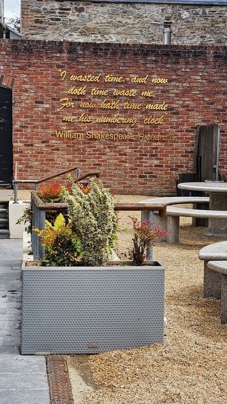
Looking at the modern Brick Lane, now home to the Irish Museum of Time.
Credits. This page was last revised on June 23, 2026. It was originally submitted on June 23, 2026, by Ian Lefkowitz of New York, New York. This page has been viewed 16 times since then. Photos: 1, 2, 3. submitted on June 23, 2026, by Ian Lefkowitz of New York, New York. • Andrew Ruppenstein was the editor who published this page.
