Kimball in Marion County, Tennessee — The American South (East South Central)
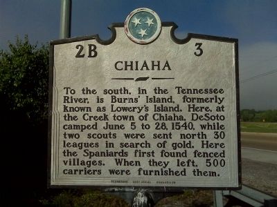
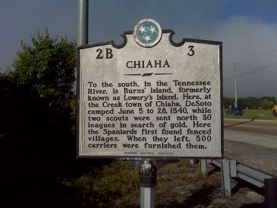
Chiaha
Erected by Tennessee Historical Commission. (Marker Number 2B-3.)
Topics and series. This historical marker is listed in this topic list: Native Americans. In addition, it is included in the Tennessee Historical Commission series list. A significant historical date for this entry is June 5, 1910.
Location. 35° 2.488′ N, 85° 41.349′ W. Marker is in Kimball, Tennessee, in Marion County. Marker is on U.S. 64/72, 0.1 miles north of Interstate 24, on the right when traveling east. There is a small gravel pull off to park at in front of the marker. Touch for map. Marker is in this post office area: Jasper TN 37347, United States of America. Touch for directions.
Other nearby markers. At least 8 other markers are within 3 miles of this marker, measured as the crow flies. Bean-Roulston Graveyard (approx. half a mile away); Fort McCook (approx. 1.7 miles away); McReynolds High School (approx. 1.8 miles away); Christ Church Episcopal (approx. 2.2 miles away); James Thomas Fitz-Gerald, Jr. (approx. 2.2 miles away); Marion Post No. 62 (approx. 2.2 miles away); Christmas Night Shootout (approx. 2.2 miles away); Birthplace of Jobyna Lancaster Ralston-Arlen (approx. 2.3 miles away).
Credits. This page was last revised on June 16, 2016. It was originally submitted on May 5, 2010, by Currey Russell of Indian Mound, Tennessee. This page has been viewed 1,343 times since then and 31 times this year. Photos: 1, 2. submitted on May 5, 2010, by Currey Russell of Indian Mound, Tennessee. • Kevin W. was the editor who published this page.

