Saint Marys in Perth County, Ontario — Central Canada (North America)
The Quarry
Historic St. Marys
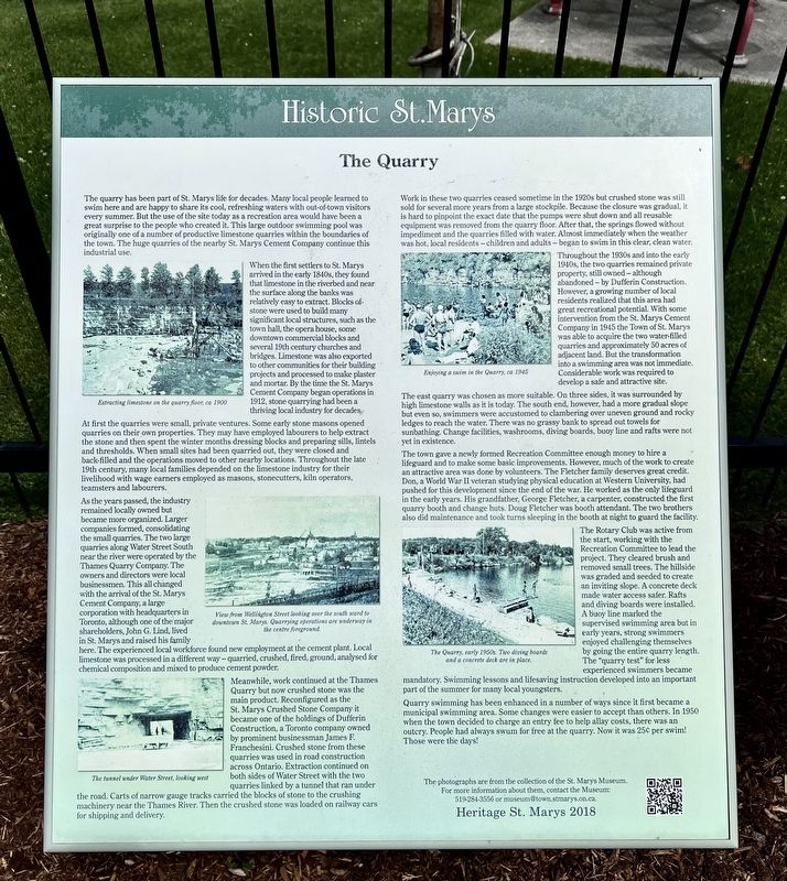
Photographed by Tim Boyd, June 21, 2026
1. The Quarry Marker
When the first settlers to St. Marys arrived in the early 1840s, they found that limestone in the riverbed and near the surface along the banks was relatively easy to extract. Blocks of stone were used to build many significant local structures, such as the town hall, the opera house, some downtown commercial blocks and several 19th century churches and bridges. Limestone was also exported to other communities for their building projects and processed to make plaster and mortar. By the time the St. Marys Cement Company began operations in 1912, stone quarrying had been a thriving local industry for decades.
At
this page online
As the years passed, the industry remained locally owned but became more organized. Larger companies formed, consolidating the small quarries. The two large quarries along Water Street South near the river were operated by the Thames Quarry Company. The owners and directors were local businessmen. This all changed with the arrival of the St. Marys Cement Company, a large corporation with headquarters in Toronto, although one of the major shareholders, John G. Lind, lived in St. Marys and raised his family here. The experienced local workforce found
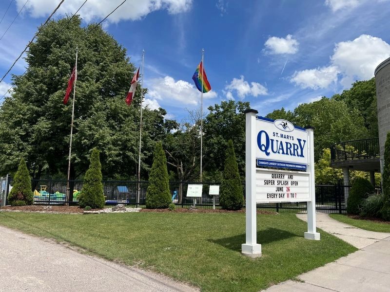
Photographed by Tim Boyd, June 21, 2926
2. The Quarry Marker
The larger marker below the rainbow flag
Meanwhile, work continued at the Thames Quarry but now crushed stone was the main product. Reconfigured as the St. Marys Crushed Stone Company, it became one of the holdings of Dufferin Construction, a Toronto company owned by prominent businessman James F. Franchesini. Crushed stone from these quarries was used in road construction across Ontario. Extraction continued on both sides of Water Street with the two quarries linked by a tunnel that ran under the road. Carts of narrow gauge tracks carried the blocks of stone to the crushing machinery near the Thames River. Then the crushed stone was loaded on railway cars for shipping and delivery.
Work in these two quarries ceased sometime in the 1920s but crushed stone was still sold for several more years from a large stockpile. Because the closure was gradual, it is hard to pinpoint the exact date that the pumps were shut down and all reusable equipment was removed from the quarry floor. After
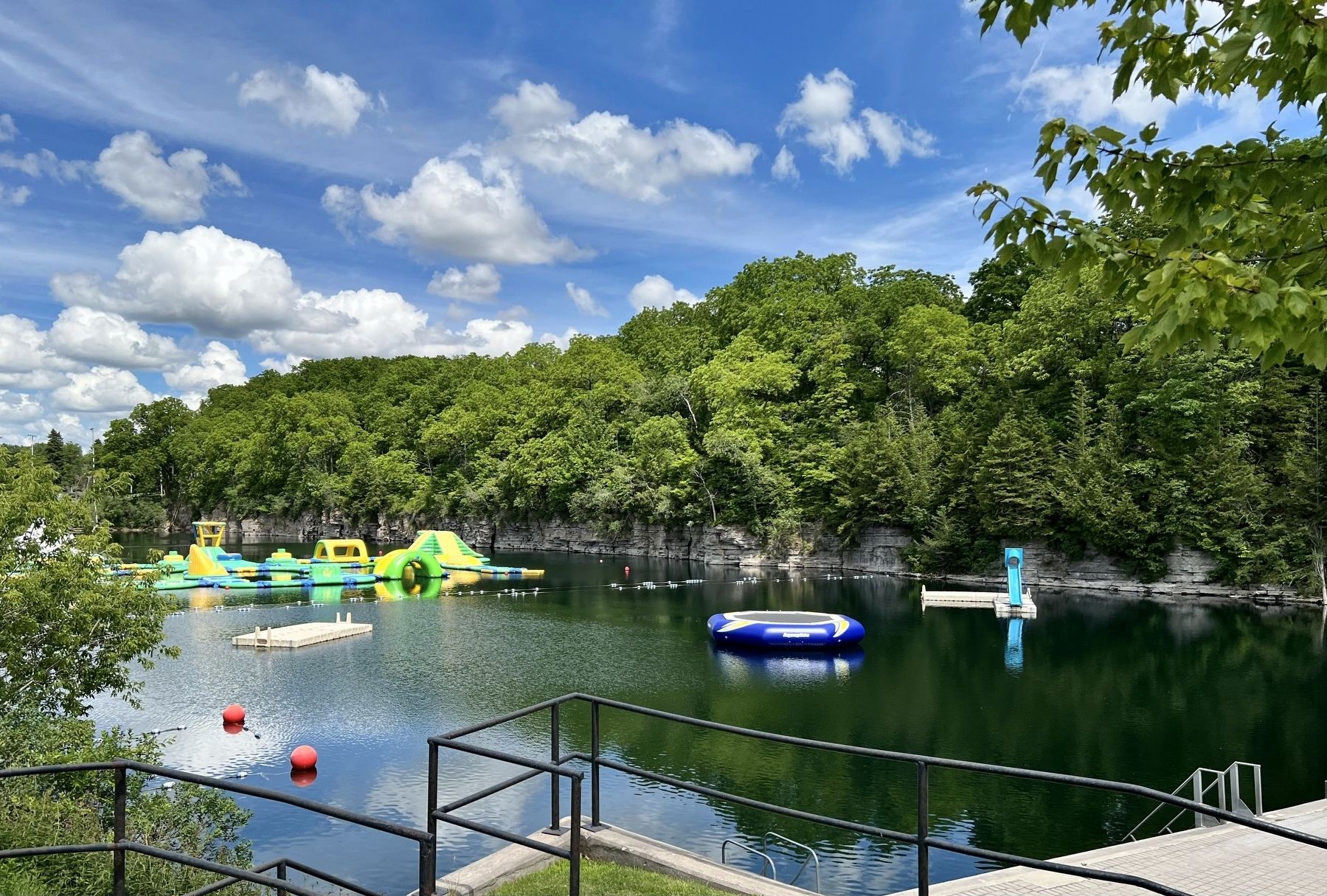
Photographed by Tim Boyd, June 21, 2026
3. The St. Marys Quarry in 2026
Throughout the 1930s and into the early 1940s, the two quarries remained private property, still owned - although abandoned - by Dufferin Construction. However, a growing number of local residents realized that this area had great recreational potential. With some intervention from the St. Marys Cement Company in 1945 the Town of St. Marys was able to acquire the two water-filled quarries and approximately 50 acres of adjacent land. But the transformation into a swimming area was not immediate. Considerable work was required to develop a safe and attractive site.
The east quarry was chosen as more suitable. On three sides, it was surrounded by high limestone walls as it is today. The south end, however, had a more gradual slope but even so, swimmers were accustomed to clambering over uneven ground and rocky ledges to reach the water. There was no grassy bank to spread out towels for sunbathing. Change facilities, washrooms, diving boards, buoy line and rafts were not yet in existence.
The town gave a newly formed Recreation Committee enough money to hire a lifeguard and to make some basic improvements. However, much of the work to create an attractive area was done by volunteers. The Fletcher family deserves great credit. Don, a World War II veteran studying physical education at Western University, had pushed for this development since the end of the war. He worked as the only lifeguard in the early years. His grandfather, George Fletcher, a carpenter, constructed the first quarry booth and change huts. Doug Fletcher was booth attendant. The two brothers also did maintenance and took turns sleeping in the booth at night to guard the facility.
The Rotary Club was active from the start, working with the Recreation Committee to lead the project. They cleared brush and removed small trees. The hillside was graded and seeded to create an inviting slope. A concrete deck made water access safer. Rafts and diving boards were installed. A buoy line marked the supervised swimming area but in early years, strong swimmers enjoyed challenging themselves by going the entire quarry length. The "quarry test" for less experienced swimmers became mandatory. Swimming lessons and lifesaving instruction developed into an important part of the summer for many local youngsters.
Quarry swimming has been enhanced in a number of ways since it first became a municipal swimming area. Some changes were easier to accept than others. In 1950 when the town decided to charge an entry fee to help allay costs, there was an outcry. People had always swum for free at the quarry. Now it was 25c per swim! Those were the days!
Erected 2018 by Heritage St. Marys.
Topics. This historical marker is listed in these topic lists: Industry & Commerce • Parks & Recreational Areas. A significant historical year for this entry is 1912.
Location. 43° 14.946′ N, 81° 8.951′ W. Marker is in Saint Marys, Ontario, in Perth County. It is on Water Street South 0.2 kilometers south of Washington Street, on the right when traveling north. Touch for map. Marker is at or near this postal address: 425 Water St S, Saint Marys ON N4X 1A1, Canada. Touch for directions.

Regionally, this marker is in the Huron-Perth-Waterloo-Wellington Area and in Southwestern Ontario. It is also in Central Canada. Globally, it is in North America, the Western Hemisphere, the Western World, and the Anglosphere. Historically, it finds itself in what was once a British colony, the Viceroyalty of New France, the Haudenosaunee (Iroquois) Confederacy, and Rupert’s Land.
Other nearby markers. At least 8 other markers are within walking distance of this marker: St. Marys Cement Plant (about 210 meters away, measured in a direct line); The Tracy House (approx. 0.9 kilometers away); Stonetown Insurance (approx. one kilometer away); The Armouries (approx. 1.2 kilometers away); St. Marys Opera House (approx. 1.2 kilometers away); Mill Wheel (approx. 1.2 kilometers away); Mill Race (approx. 1.2 kilometers away); The Hutton-MacPherson Block (approx. 1.2 kilometers away). Touch for a list and map of all markers in Saint Marys.
Credits. This page was last revised on June 23, 2026. It was originally submitted on June 23, 2026, by Tim Boyd of Hamilton, Ontario. This page has been viewed 9 times since then. Photos: 1, 2, 3. submitted on June 23, 2026, by Tim Boyd of Hamilton, Ontario. • Andrew Ruppenstein was the editor who published this page.
