Marker Logo
THE HISTORICAL
MARKER DATABASE
“Bite-Size Bits of Local, National, and Global History”
Town Point Park in Norfolk, Virginia — The American South (Mid-Atlantic)
 

Atlantic Intracoastal Waterway

— City of Norfolk —


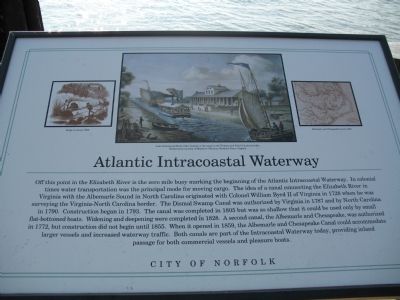
Atlantic Intracoastal Waterway Marker image. Click for full size.
Photographed by Laura Troy, November 4, 2007
1. Atlantic Intracoastal Waterway Marker
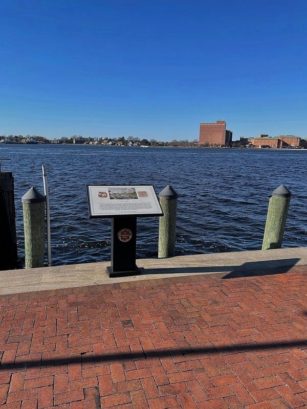
Inscription. Off this point in the Elizabeth River is the zero mile buoy marking the beginning of the Atlantic Intracoastal Waterway. In colonial times water transportation was the principal mode for moving cargo. The idea of a canal connecting the Elizabeth River in Virginia with the Albemarle Sound in North Carolina originated with Colonel William Byrd II of Virginia in 1728 when he was surveying the Virginia-North Carolina border. The Dismal Swamp Canal was authorized by Virginia in 1787 and by North Carolina in 1790. Construction began in 1793. The Canal was complete in 1805 but was so shallow that it could be used only by small flat bottomed boats. Widening and deepening were completed in 1828. A second canal, the Albemarle and Chesapeake, was authorized in 1772, but construction did not begin until 1855. When it opened in 1859, the Albemarle and Chesapeake Canal could accommodate larger vessels and increased waterway traffic. Both canals are part of the Intracoastal Waterway today, providing inland passage for both commercial vessels and pleasure boats.
 
Erected by City of Norfolk.
 
Topics and series. This historical
Paid Advertisement
Click or scan to see
this page online
marker is listed in this topic list: Waterways & Vessels. In addition, it is included in the Virginia, Norfolk Heritage Cannonball Trail series list. A significant historical year for this entry is 1728.
 
Location. 36° 50.744′ N, 76° 17.713′ W. Marker is in Norfolk, Virginia. It is in Town Point Park. It can be reached from the intersection of Waterside Drive and Boush Avenue. This marker is located in Town Point Park. Touch for map. Marker is at or near this postal address: 1 Waterside Dr, Norfolk VA 23510, United States of America. Touch for directions.

Regionally, this marker is in Virginia’s Hampton Roads, specifically in Coastal Virginia, and in the Hampton Roads Metropolitan Area. It is also in the American South, specifically in the Upper South, in the Tidewater, and on the Eastern Seaboard. Globally, it is in the North Atlantic Region, North America, the Western Hemisphere, the Western World, and the Anglosphere. Historically, it finds itself in what was once the territory of the Mississippian Culture, one of the original Thirteen Colonies, one of the Confederate States of America, and the Antebellum South.

Other nearby markers. At
Atlantic Intracoastal Waterway Marker image. Click for full size.
Photographed by Brandon D Cross, January 18, 2022
2. Atlantic Intracoastal Waterway Marker
least 8 other markers are within walking distance of this marker: The First Battle of Ironclad Ships, 1862 (within shouting distance of this marker); Armed Forces Memorial (within shouting distance of this marker); Downtown Waterfront Revitalization (about 300 feet away, measured in a direct line); a different marker also named Armed Forces Memorial (about 300 feet away); Half Moone Fort, 1673 (about 300 feet away); Surveying the Land & Sea (about 400 feet away); Navy Escort Carriers Based in Norfolk (about 400 feet away); The Cedar (about 500 feet away). Touch for a list and map of all markers in Norfolk.
 
More about this marker. This marker is part of the Norfolk Heritage Cannonball Trail.
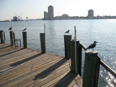
 
View from marker image. Click for full size.
Photographed by Laura Troy, November 4, 2007
3. View from marker
 
 
Credits. This page was last revised on June 24, 2026. It was originally submitted on November 11, 2007, by Laura Troy of Burke, Virginia. This page has been viewed 2,386 times since then and 30 times this year. Last updated on June 23, 2026, by Evan Dwyer of Richmond, Virginia. Photos:   1. submitted on November 11, 2007, by Laura Troy of Burke, Virginia.   2. submitted on January 18, 2022, by Brandon D Cross of Flagler Beach, Florida.   3. submitted on November 11, 2007, by Laura Troy of Burke, Virginia. • Devry Becker Jones was the editor who published this page.

m=303771

CeraNet Cloud Computing sponsors the Historical Marker Database.
This website earns income from purchases you make after using our links to Amazon.com. We appreciate your support.
Paid Advertisement
Jul. 27, 2026