Downtown in Norfolk, Virginia — The American South (Mid-Atlantic)
The First Battle of Ironclad Ships, 1862
| — | City of Norfolk | — |
Photographed by Laura Troy, November 4, 2007
1. The First Battle of Ironclad Ships, 1862 Marker
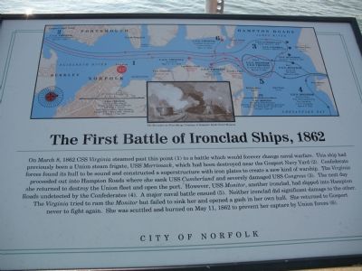
On March 8, 1862 CSS Virginia steamed past this point (1) to a battle which would forever change naval warfare. This ship had previously been a Union steam frigate, USS Merrimack, which had been destroyed near the Gosport Navy Yard (2). Confederate forces found its hull to be sound and constructed a superstructure with iron plates to create a new kind of warship. The Virginia proceeded out into Hampton Roads where she sank USS Cumberland and severely damaged USS Congress (3). The next day she returned to destroy the Union fleet and open the port. However, USS Monitor, another ironclad, had slipped into Hampton Roads undetected by the Confederates (4). A major naval battle ensued (5). Neither ironclad did significant damage to the other. The Virginia tried to ram the Monitor but failed to sink her and opened a gash in her own hull. She returned to Gosport never to fight again. She was scuttled and burned on May 11, 1862 to prevent her capture by Union forces (6).
Erected by City of Norfolk.
Topics and series. This historical marker is listed in this topic list: War, US Civil. In addition, it is included in
this page online
Location. 36° 50.757′ N, 76° 17.726′ W. Marker is in Norfolk, Virginia. It is in Downtown. It is on Waterside Drive south of Boush Avenue, on the right when traveling south. This marker sits in Town Point Park. Touch for map. Marker is at or near this postal address: 1 Waterside Dr, Norfolk VA 23510, United States of America. Touch for directions.

Regionally, this marker is in Virginia’s Hampton Roads, specifically in Coastal Virginia, and in the Hampton Roads Metropolitan Area. It is also in the American South, specifically in the Upper South, in the Tidewater, and on the Eastern Seaboard. Globally, it is in the North Atlantic Region, North America, the Western Hemisphere, the Western World, and the Anglosphere. Historically, it finds itself in what was once the territory of the Mississippian Culture, one of the original Thirteen Colonies, one of the Confederate States of America, and the Antebellum South.
Other nearby markers. At least 8 other markers are within walking distance of this marker: Atlantic Intracoastal Waterway
Photographed by Brandon D Cross, January 18, 2022
2. The First Battle of Ironclad Ships, 1862 Marker
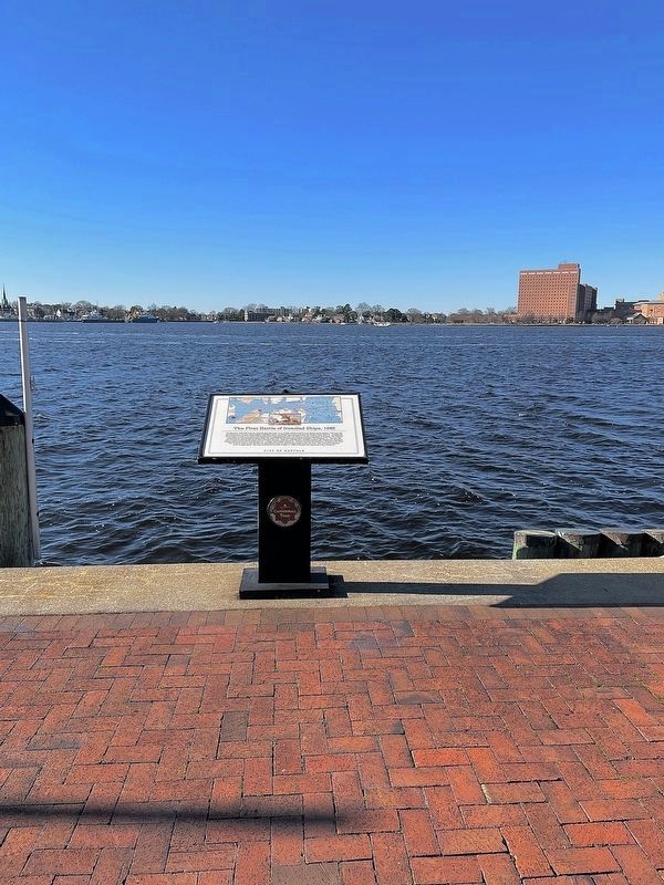
More about this marker. This marker is part of the Norfolk Heritage Cannonball Trail.
Photographed by Julian Oliver Davidson, 1886
3. The Encounter at Short Range
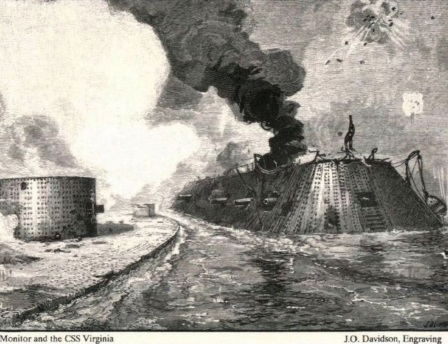
This is the same engraving as used on the marker.
Credits. This page was last revised on June 24, 2026. It was originally submitted on November 11, 2007, by Laura Troy of Burke, Virginia. This page has been viewed 3,008 times since then and 35 times this year. Last updated on June 23, 2026, by Evan Dwyer of Richmond, Virginia. Photos: 1. submitted on November 11, 2007, by Laura Troy of Burke, Virginia. 2. submitted on January 18, 2022, by Brandon D Cross of Flagler Beach, Florida. 3. submitted on October 7, 2015. • Devry Becker Jones was the editor who published this page.
