
Ridgeway in Fort Erie in Niagara Region, Ontario — Central Canada (North America)
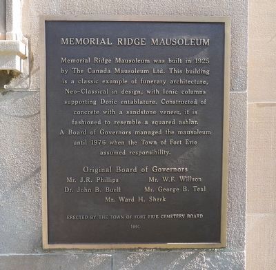
Memorial Ridge Mausoleum
Photographed by Kevin Westell, June 23, 2026
1. Memorial Ridge Mausoleum - Marker
Original Board of Governors
Mr. J.R. Phillips
Dr. John B. Buell
Mr. W.F. Willson
Mr. George B. Teal
Mr. Ward H. Sherk
Erected 1991 by Town of Fort Erie Cemetery Board.
Topics. This historical marker is listed in these topic lists: Architecture • Cemeteries & Burial Sites. A significant historical year for this entry is 1925.
Location. 42° 54.24′ N, 79° 2.352′ W. Marker is in Fort Erie, Ontario, in Niagara Region. It is in Ridgeway. It is on Garrison Road, on the right when traveling west. Touch for map. Marker is at or near this postal address: 3320 Garrison Rd, Fort Erie ON L0S 1N0, Canada. Touch for directions.

Regionally, this marker is on Ontario’s Golden Horseshoe and in Niagara
this page online
Other nearby markers. At least 8 other markers are within walking distance of this marker: Dr. Edmund John Zavitz 1895-1968 (about 150 meters away, measured in a direct line); Farm Innovations (about 150 meters away); Irelands Farmers (about 180 meters away); One Farm Family’s Fight (about 180 meters away); In the Line of Fire (about 180 meters away); Berties Farmers (about 180 meters away); Buildings on the Battlefield (about 180 meters away); A Catalyst to Confederation (about 180 meters away). Touch for a list and map of all markers in Fort Erie.
Photographed by Kevin Westell, June 23, 2026
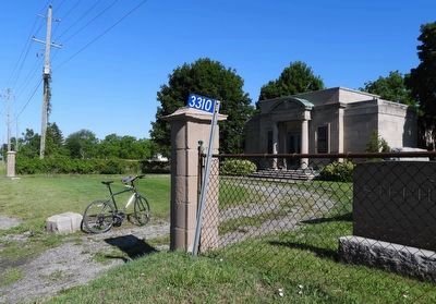
2. Memorial Ridge Mausoleum - Marker in context
Photo faces north-west. Marker (right, obscured by fence) is on the front of the mausoleum building.
Photographed by Kevin Westell, June 23, 2026
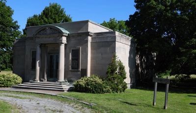
3. Memorial Ridge Mausoleum
Credits. This page was last revised on June 25, 2026. It was originally submitted on June 24, 2026, by Kevin Westell of St. Catharines, Ontario. This page has been viewed 11 times since then. Photos: 1, 2, 3. submitted on June 24, 2026, by Kevin Westell of St. Catharines, Ontario.
