De Cocksdorp in Texel, North Holland, Netherlands — Northwestern Europe
De Gemeente school
⎯⎯⎯
The Municipal School
Photographed by Andrew Ruppenstein, June 1, 2026
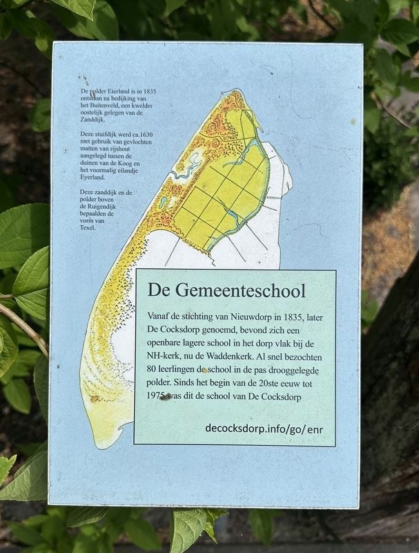
1. De Gemeente school / The Municipal School Marker
Note that: 1) The small text in the upper left is repeated on all 12+ similar markers in De Cocksdorp as it is, effectively, the origin story of the area, and 2) the URL provided on the marker seemingly does not work.

Vanaf de stichting van Nieuwdorp in 1835, later De Cocksdorp genoemd, bevond zich een openbare lagere school in het dorp vlak bij de NH-kerk, nu de Waddenkerk. Al snel bezochten 80 leerlingen de school in de pas drooggelegde polder. Sinds het begin van de 20ste eeuw tot 1975 vas dit de school van De Cocksdorp
De polder Eierland is in 1835 ontstaan na bedijking van het Buitenveld, een kwelder oostelijk gelegen van de Zanddijk.
Deze stuifdijk werd ca. 1630 met gebruik van gevlochten matten van rijshout aangelegd tussen de duinen van de Koog en het voormalig eilandje Eyerland.
Deze zanddijk en de polder boven de Ruigendijk bepaalden de vorm van Texel.
The Municipal School
From the founding of Nieuwdorp in 1835—later renamed De Cocksdorp—there was a public primary school in the village, located close to the Dutch Reformed church (now the Waddenkerk). Before long, 80 pupils were attending the school in the newly reclaimed polder. From the early 20th century until 1975, this served as the school for De Cocksdorp.
The Eierland polder was created in 1835 following the embankment of the Buitenveld, a salt marsh situated east of the Zanddijk.
This drift-sand dike was constructed around 1630—using woven brushwood mats—between the dunes of De Koog and the former small island of Eyerland.
This sand dike and the polder north of the Ruigendijk determined the shape of Texel.
Topics.
this page online
Location. 53° 9.324′ N, 4° 52.242′ E. Marker is in De Cocksdorp, Noord-Holland (North Holland), in Texel. It is on Kikkertstraat, on the right when traveling north. Touch for map. Marker is at or near this postal address: Kikkertstraat 6, De Cocksdorp, Noord-Holland 1795 AD, Netherlands. Touch for directions.

Regionally, this marker is on the German Wadden Sea. Globally, it is in Europe, the European Union, Atlantic Europe, the Benelux Low Countries, the Schengen Area, Western Europe, and the Western World. Historically, it finds itself in what was once the Holy Roman Empire.
Other nearby markers. At least 8 other markers are within walking distance of this marker: Zanddijk (here, next to this marker); De Niuewe Aanleg (within shouting distance of this marker); Vuurtoren / Lighthouse (within shouting distance of this marker); De Cocksdorp (within shouting distance of this marker); Molenbos (about 90 meters away, measured in a direct line); RK kerk / Roman Catholic Church (about 90
Photographed by Andrew Ruppenstein, June 1, 2026
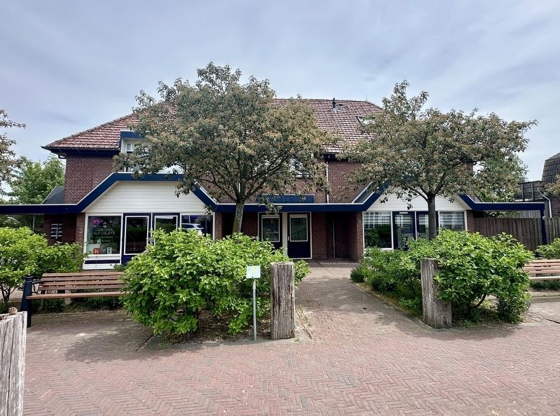
2. De Gemeente school / The Municipal School Marker - wide view
Credits. This page was last revised on June 24, 2026. It was originally submitted on June 24, 2026, by Andrew Ruppenstein of Lamorinda, California. This page has been viewed 12 times since then. Photos: 1, 2. submitted on June 24, 2026, by Andrew Ruppenstein of Lamorinda, California.
