Milford Mine Memorial Park near Wolford in Crow Wing County, Minnesota — The American Midwest (Upper Plains)
Soo Line Railroad Hauls Cuyuna Ore
Photographed by McGhiever, June 27, 2025
1. Soo Line Railroad Hauls Cuyuna Ore Marker
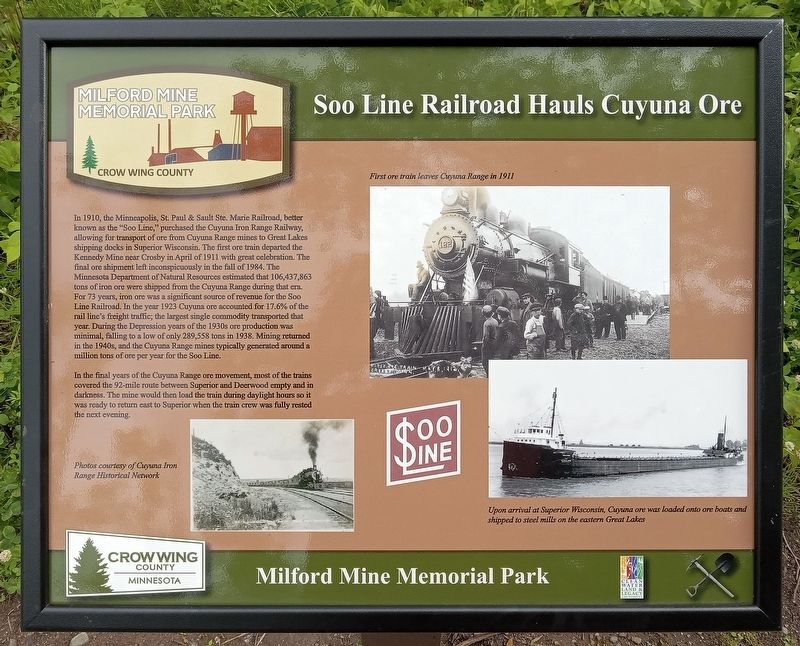
In 1910, the Minneapolis, St. Paul & Sault Ste. Marie Railroad, better known as the "Soo Line," purchased the Cuyuna Iron Range Railway, allowing for transport of ore from Cuyuna Range mines to Great Lakes shipping docks in Superior Wisconsin. The first ore train departed the Kennedy Mine near Crosby in April of 1911 with great celebration. The final ore shipment left inconspicuously in the fall of 1984. The Minnesota Department of Natural Resources estimated that 106,437,863 tons of iron ore were shipped from the Cuyuna Range during that era. For 73 years, iron ore was a significant source of revenue for the Soo Line Railroad. In the year 1923 Cuyuna ore accounted for 17.6% of the rail line's freight traffic; the largest single commodity transported that year. During the Depression years of the 1930s ore production was minimal, falling to a low of only 289,558 tons in 1938. Mining returned in the 1940s, and the Cuyuna Range mines typically generated around a million tons of ore per year for the Soo Line.
In the final years of the Cuyuna Range ore movement, most of the trains covered the 92-mile route between Superior
this page online
Photos courtesy of Cuyuna Iron Range Historical Network
First ore train leaves Cuyuna Range in 1911
Upon arrival at Superior Wisconsin, Cuyuna Ore was loaded onto ore boats and shipped to steel mills on the eastern Great Lakes
Erected by Crow Wing County.
Topics. This historical marker is listed in these topic lists: Industry & Commerce • Railroads & Streetcars • Waterways & Vessels. A significant historical year for this entry is 1910.
Location. 46° 32.09′ N, 93° 58.463′ W. Marker is near Wolford, Minnesota, in Crow Wing County. It is in Milford Mine Memorial Park. It can be reached from Milford Lake Drive. Touch for map. Marker is in this post office area: Crosby MN 56441, United States of America. Touch for directions.

Regionally, this marker is in the Northland. It is also in the American Midwest, in the Corn Belt, and in the Great River Road Region. Globally, it is in North America, the Great North Woods, the Western
Photographed by McGhiever, June 27, 2025
2. Soo Line Railroad Hauls Cuyuna Ore Marker
Other nearby markers. At least 8 other markers are within walking distance of this marker: Barrow Pits for Rail Grade & Road Construction (within shouting distance of this marker); Storage Facility (within shouting distance of this marker); Boarding House (within shouting distance of this marker); Mud Run, Launder & Dikes (about 300 feet away, measured in a direct line); Example of Timberwork Along the Main Shaft (about 500 feet away); Mine Shaft Entrance (about 500 feet away); Milford Miners (about 500 feet away); The Mine Shaft (about 500 feet away). Touch for a list and map of all markers in Wolford.
Credits. This page was last revised on July 13, 2026. It was originally submitted on June 24, 2026, by McGhiever of Minneapolis, Minnesota. This page has been viewed 20 times since then. Photos: 1, 2. submitted on June 24, 2026, by McGhiever of Minneapolis, Minnesota.
