Rivers Township in St. Charles in St. Charles County, Missouri — The American Midwest (Upper Plains)
Emmaus Homes Cemetery
Photographed by Jason Voigt, June 24, 2026
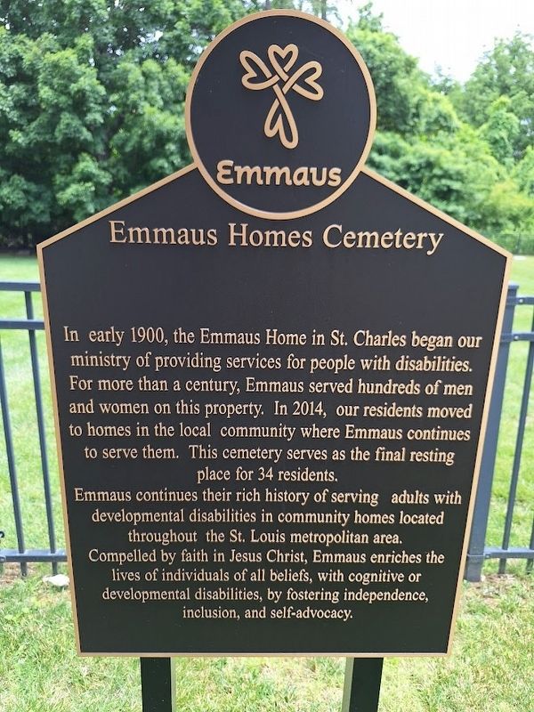
1. Emmaus Homes Cemetery Marker
In early 1900, the Emmaus Home in St. Charles began our ministry of providing services for people with disabilities. For more than a century, Emmaus served hundreds of men and women on this property. In 2014, our residents moved to homes in the local community where Emmaus continues to serve them. This cemetery serves as the final resting place for 34 residents.
Emmaus continues their rich history of serving adults with developmental disabilities in community homes located throughout the St. Louis metropolitan area. Compelled by faith in Jesus Christ, Emmaus enriches the lives of individuals of all beliefs, with cognitive or developmental disabilities, by fostering independence, inclusion, and self-advocacy.
Erected by Emmaus Homes.
Topics. This historical marker is listed in these topic lists: Cemeteries & Burial Sites • Religion & Religious Structures. A significant historical year for this entry is 1900.
Location. 38° 48.287′ N, 90° 29.054′ W. Marker is in St. Charles, Missouri, in St. Charles County. It is in Rivers Township. It is on De La Croix Avenue west of North Duchesne Drive, on the right when traveling
this page online

Regionally, this marker is in the Missouri River Corridor and in Greater St. Louis. It is also in the American Midwest, in the Lewis & Clark Corridor, in the Corn Belt, and in the Great River Road Region. Globally, it is in North America, the Western Hemisphere, the Western World, and the Anglosphere. Historically, it finds itself in what was once the territory of the Mississippian Culture, the Louisiana Purchase, and the Antebellum South.
Other nearby markers. At least 8 other markers are within walking distance of this marker: A different marker also named Emmaus Homes Cemetery (approx. ¼ mile away); In Memory of Louis Blanchette (approx. 0.3 miles away); In Memory of Jean Baptiste Point duSable (approx. 0.3 miles away); Welcome to Ben Rau Memorial Garden (approx. 0.4 miles away); Veterans Memorial (approx. 0.4 miles away); Historic Frenchtown (approx. 0.8 miles away); Bales Wetland (approx. 0.8 miles away); What Happens When Wetlands Are Lost? (approx. 0.8
Photographed by Jason Voigt, June 24, 2026
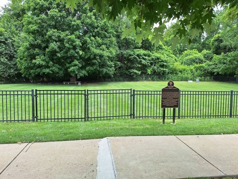
2. Emmaus Homes Cemetery Marker
Regarding Emmaus Homes Cemetery. This is known as the New Emmaus Cemetery. The old Emmaus Cemetery, which has a marker with mostly identical text, is nearby.
Also see . . . Emmaus Homes (official website). (Submitted on June 24, 2026, by Jason Voigt of Glen Carbon, Illinois.)
Credits. This page was last revised on June 24, 2026. It was originally submitted on June 24, 2026, by Jason Voigt of Glen Carbon, Illinois. This page has been viewed 7 times since then. Photos: 1, 2. submitted on June 24, 2026, by Jason Voigt of Glen Carbon, Illinois.
