Near Charlestown in Clark County, Indiana — The American Midwest (Great Lakes)
Reclaimed by Nature
Once a resort, now a nature preserve

Photographed by Tom Bosse, June 13, 2026
1. Reclaimed by Nature Marker
All that remains
Building foundations, stone walkways, and the concrete swimming pool are all that remain of Rose Island Amusement Park. The natural succession from resort to field and forest, as well as the forces of the mighty Ohio River, will be evident as you explore Rose Island.
From boom to bust, Rose Island has returned to a natural state.
Rose Island flourished during the 1920s and 30s, providing city dwellers as escape from oppressive heat and sooty coal-burning stoves. After the Great Depression of 1929, attendance declined. The Floor of 1937 sealed the park’s fate. Rose Island Amusement Park never reopened and slowly returned to its natural state.
Did you know?
The Great Flood of 1937 covered part of Rose Island with 10 feet of water. Look for markers throughout the site to see the estimated flood level.
[Captions:]
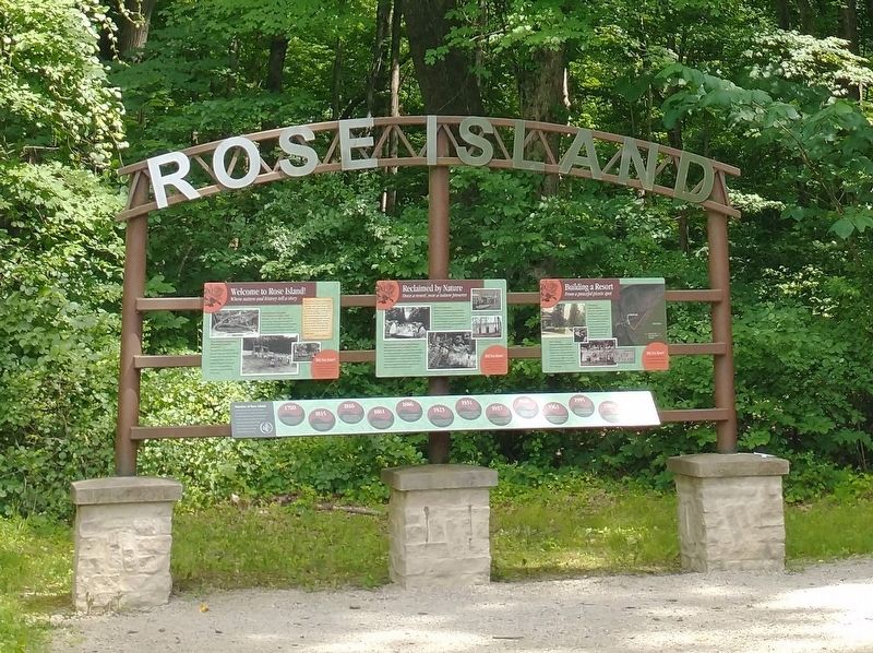
The Flood of 1937 left one million people homeless and many Louisville businesses under water. The bases of the Rose Island welcome sign still remain but very little else exists from the original structures.
Erected by Indiana Department of Natural Resources.
Topics and series.
this page online
Location. 38° 25.574′ N, 85° 37.302′ W. Marker is near Charlestown, Indiana, in Clark County. It is on Trail #7 east of State Park Drive, in the median. Marker is located on Trail #7 in Charlestown State Park. Touch for map. Marker is at or near this postal address: 3000 State Pk Dr, Charlestown IN 47111, United States of America. Touch for directions.

Regionally, this marker is in Southern Indiana. It is also in the American Midwest, in the Ohio River Valley, and in the Corn Belt. Globally, it is in North America, the Western Hemisphere, the Western World, and the Anglosphere. Historically, it finds itself in what was once the territory of the Mississippian Culture and also the Northwest Territory.
Other nearby markers. At least 8 other markers are within walking distance of this marker: Building a Resort (here, next to this marker); Timeline of Rose Island (here, next to this marker); Welcome to Rose Island!
Photographed by Tom Bosse, June 13, 2026
2. Reclaimed by Nature Marker
Marker is in the middle.

Photographed by Tom Bosse, June 13, 2026
3. Reclaimed by Nature Marker

Photographed by Tom Bosse, June 13, 2026
4. Reclaimed by Nature Marker

Photographed by Tom Bosse, June 13, 2026
5. Concrete Swimming Pool at Rose Island

Photographed by Tom Bosse, June 13, 2026
6. The Bases of the Rose Island Welcome Sign.
Credits. This page was last revised on July 1, 2026. It was originally submitted on June 24, 2026, by Tom Bosse of Jefferson City, Tennessee. This page has been viewed 17 times since then. Photos: 1, 2, 3, 4, 5, 6. submitted on June 24, 2026, by Tom Bosse of Jefferson City, Tennessee. • Devry Becker Jones was the editor who published this page.
