East Providence in Providence County, Rhode Island — The American Northeast (New England)
Green Jacket Shoal
The Largest Ship Graveyard in Rhode Island
| — | Bold Point Park | — |
Photographed by G.W.Bartlett, June 24, 2026
1. Green Jacket Shoal Marker
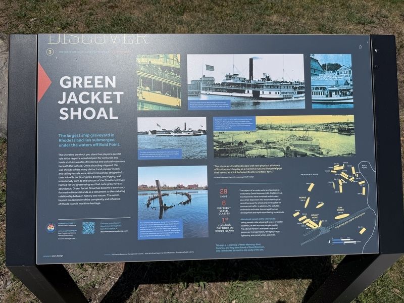
The largest ship graveyard in Rhode Island lies submerged under the waters off Bold Point.
The shoreline on which you stand has played a pivotal role in the region's industrial past for centuries and holds a hidden wealth of historical and cultural resources beneath the surface. Once a bustling shipyard, this was the site where many distinct and popular steam and sailing vessels were decommissioned, stripped of their valuable parts, engines, boilers, and rigging, and intentionally sunk to the bottom of the Providence River. Named for the green eel-grass that once grew here in abundance, Green Jacket Shoal has become a sanctuary for marine life and stands as a testament to the enduring relationship between history and nature. The water beyond is a reminder of the complexity and influence of Rhode Island's maritime heritage.
"This site is a cultural landscape with rare physical evidence of Providence's heyday as a maritime hub and industrial port that served as a link between Boston and New York." -- David Robinson, Marine Archaeologist (URI-GSO)
29 Ships -- 6 Different Vessel Classes -- 1st Floating Dry Dock in Rhode Island
The
this page online
Abandoned vessels at the site include: sailing vessels, side-wheel and screw-propeller steamers, as well as scow-barges used in Providence Harbor's maritime cargo and passenger transportation, dredging, cargo lightering and construction activities.
This sign is in memory of Peter Manning, diver, historian and long-time friend of David Robinson, who contributed so much to the study of this site.
( photo captions )
— No caption
— The side-wheel steamer Mount Hope was a fixture on Rhode Island waters, providing passenger service between Providence, Newport and Block Island from 1888 until 1934
— No caption
— The side-wheel steamer Bay Queen brought passengers to and from waterside dining halls and amusement parks on Narragansett Bay from 1865 until 1902.
— Bold Point was
Photographed by G.W.Bartlett, June 24, 2026
2. Green Jacket Shoal Marker
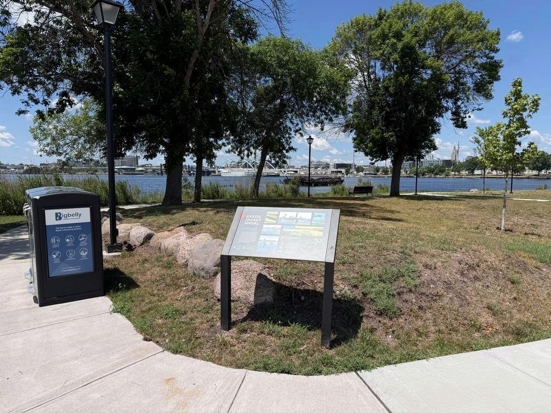
Bold Point Park overlooking the shoal. At he far left is Rhode Island Hospital. In the right distance is the City of Providence downtown skyline.
— The remains of the schooner-barge Remus (above) and of 28 other vessels abandoned on Green Jacket Shoal—along with wharf and floating dry dock pier remains that can be seen rising from the waters here—are ever-present reminders of the cultural, financial, technological, commercial, industrial, and maritime significance of this area during the late 1800s and early 1900s
Erected by City of East Providence.
Topics. This historical marker is listed in these topic lists: Industry & Commerce • Waterways & Vessels.
Location. 41° 48.944′ N, 71° 23.504′ W. Marker is in East Providence, Rhode Island, in Providence County. It is at the intersection of Waterfront Drive and Pier Road, on the right when traveling west on Waterfront Drive. Touch for map. Marker is in this post office area: East Providence RI 02914, United States of America. Touch for directions.

Regionally,
Photographed by G.W.Bartlett, June 24, 2026
3. Green Jacket Shoal
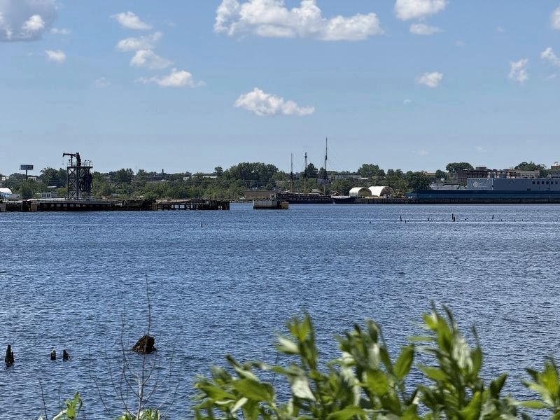
Vegetation and shipwreck remains are in the foreground. A classic three-masted schooner is docked at a pier on the west side of the Providence River.
Other nearby markers. At least 8 other markers are within walking distance of this marker: Tockwotton and the Indiamen / Sails to Rails 1835: Providence's First Train Station (about 600 feet away, measured in a direct line); Fox Point: The 19th Century Port of Providence / Shipping Expands Around the Point (approx. 0.2 miles away); Bridging the Seekonk (approx. 0.2 miles away); Roger Williams Landing 1636 (approx. ¼ mile away); Welcome to India Point Park / Welcome to Fox Point (approx. ¼ mile away); Veterans Memorial Parkway (approx. ¼ mile away); Four Cannon Fort (approx. ¼ mile away); Fox Point Cape Verdean Community (approx. ¼ mile away). Touch for a list and map of all markers in East Providence.
Also see . . .
1. Green Jacket Shoal (Wikipedia). (Submitted on June 30, 2026, by Michael Herrick of Southbury, Connecticut.)
2. Bold Point (Wikipedia).
Photographed by G.W.Bartlett, July 2, 2026
4. Green Jacket Shoal

Photographed by G.W.Bartlett, July 11, 2026
5. Green Jacket Shoal Marker
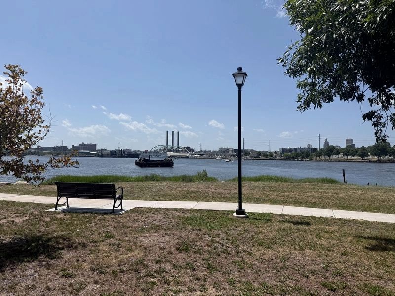
View of marker looking southwest as the ship “Nor Easter” is guided off a loading pier by tug boats to avoid the shoal.
Photographed by G.W.Bartlett, July 11, 2026
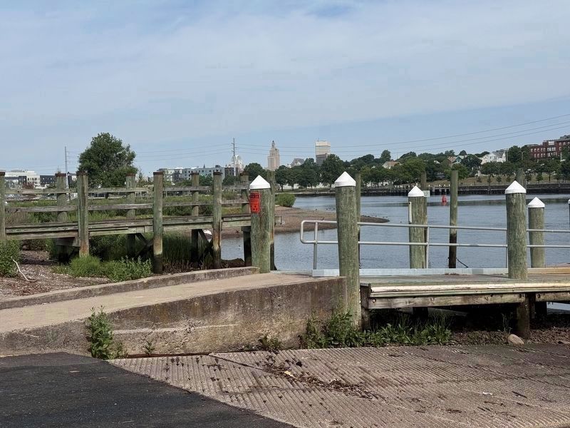
6. Bold Point Park Boat Launch
There is a public boat launch into the Seekonk River from the Bold Point Park at Green Jacket Shoal for trailered boats.
Credits. This page was last revised on July 25, 2026. It was originally submitted on June 25, 2026, by G.W.Bartlett of Hingham, Massachusetts. This page has been viewed 34 times since then. Photos: 1, 2, 3. submitted on June 25, 2026, by G.W.Bartlett of Hingham, Massachusetts. 4. submitted on July 2, 2026, by G.W.Bartlett of Hingham, Massachusetts. 5, 6. submitted on July 11, 2026, by G.W.Bartlett of Hingham, Massachusetts. • Michael Herrick was the editor who published this page.
