
National Museum of Transportations near Kirkwood in St. Louis County, Missouri — The American Midwest (Upper Plains)
First Through Train Over the Wabash
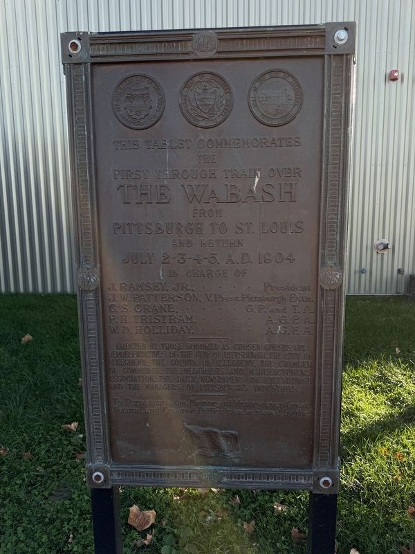
Photographed by Garrett Koch, November 14, 2025
1. First Through Train Over the Wabash Marker
the
first through train over
the Wabash
from
Pittsburgh to St. Louis
and return
July 2-3-4-5, A.D. 1904
In charge of
J. Ramsey, Jr., . . . . President
J. W. Patterson, V.Prest.Pittsburgh Extn.
C. S. Crane . . . . G. P. and T. A.
F. H. Tristam, . . . . A.G.P.A.
W. D. Holliday, . . . . A.G.F.A.
Erected by those honored as guests, viz: Representatives of the City of Pittsburgh, the City of Allegheny, the County of Allegheny, the Chamber of Commerce, the Merchants and Manufacturers' Association, the daily newspapers of Pittsburgh and the managers of Pittsburgh's industries.
To perpetuate the memory of victory over great natural and created difficulties achieved by the
Erected by Representatives of the City of Pittsburgh, the City of Allegheny, the County of Allegheny, the Chamber of Commerce, the Merchants and Manufacturers' Association, the daily newspapers of Pittsburgh and the managers of Pittsburgh's industries.
Topics. This historical marker is listed in these topic lists: Railroads & Streetcars • Waterways & Vessels. A significant historical date for this entry is July 2, 1904.
Location. 38° 34.386′ N,
this page online

Regionally, this marker is in Greater St. Louis. It is also in the American Midwest, in the Lewis & Clark Corridor, in the Corn Belt, and in the Great River Road Region. Globally, it is in North America, the Western Hemisphere, the Western World, and the Anglosphere. Historically, it finds itself in what was once the Viceroyalty of New France, the territory of the Mississippian Culture, the Louisiana Purchase, and the Antebellum South.
Other nearby markers. At least 8 other markers are within walking distance of this marker: Wabash #2847 (a few steps from this marker); Museum of Transportation - A Layout of the Land (a few steps from this marker); Who Is Owney The Dog? (within shouting distance of this marker); The National Museum of Transportation: Our History (within shouting distance of this marker); St. Joe Mining Corporation Ore Train #5441 (about 300 feet away, measured in a direct line); St. Joe Minerals Corporation Shovel (about 300 feet away); F/A-18 E/F Super Hornet (about 300 feet away); F/A-18 E1 Super Hornet (about 300 feet away). Touch for a list and map of all markers in Kirkwood.
Credits. This page was last revised on June 29, 2026. It was originally submitted on December 2, 2025, by Garrett Koch of Saint Louis, Missouri. This page has been viewed 53 times since then and 27 times this year. Last updated on June 26, 2026, by Garrett Koch of Saint Louis, Missouri. Photo 1. submitted on December 2, 2025, by Garrett Koch of Saint Louis, Missouri. • Devry Becker Jones was the editor who published this page.
