Olympia in Thurston County, Washington — The American West (Northwest)
She-Nah-Nam
Medicine Creek Treaty
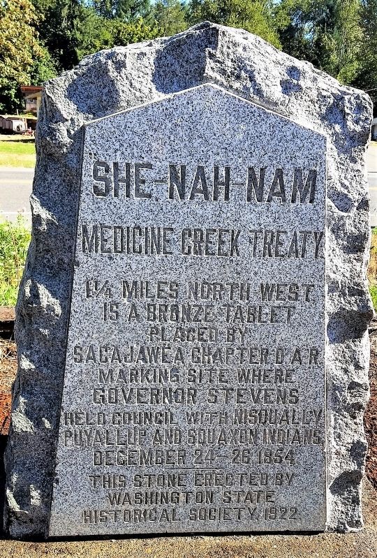
Photographed by Shirley A Stirling, September 2, 2017
1. SHE-NAH-NAM Marker
1¼ miles north-west is a bronze tablet placed by Sacajawea Chapter D.A.R. marking site where Governor Stevens held council with Nisqually, Puyallup and Squaxon Indians, December 24-26, 1854.
Erected 1922 by Washington State Historical Society.
Topics. This historical marker is listed in this topic list: Indigenous Peoples and Communities. A significant historical date for this entry is December 24, 1854.
Location. 47° 3.217′ N, 122° 42.365′ W. Marker is in Olympia, Washington, in Thurston County. It is at the intersection of Old Pacific Highway SE and 7th Avenue SE on Old Pacific Highway SE. Along Old Pacific Highway SE near its intersection with 7th Ave. S.E. in the Nisqually Valley area, Olympia, Thurston County, WA. It is on the grounds of Nisqually Valley Grocery and Union 76 Gas Station. Touch for map. Marker is at or near this postal address: 11020 7th Ave SE, Olympia WA 98513, United States of America. Touch for directions.

Regionally, this marker is in the Puget Sound Region and in Greater Seattle. It is also on the American Pacific Coast, in the Pacific Northwest, and in the Lewis & Clark Corridor. Globally, it is in North America, in the Inside Passage, on the Ring of Fire, in the Pacific Rim, in the Western Hemisphere, in the Western World, and in the Anglosphere.
Other nearby markers. At least 8 other markers are within 5 miles of this marker, measured as the crow flies: Global War on Terrorism Memorial (approx. 4 miles away); Ross Memorial (approx. 4 miles away); Chloe Aurelia Clark (Wilson) (approx. 4.3 miles away); Jackson Family/Goose Pond History (approx. 4½ miles away); Going Native with Kinnikinnick (approx. 4½ miles away); Lacey Women's Club (approx. 4.9 miles away); Gallagher House (approx. 4.9 miles away); Fort Eaton (approx. 4.9 miles away). Touch for a list and map of all markers
this page online
Another marker is no longer nearby. Site of the Medicine Creek Treaty (was approx. 1.6 miles away but has been permanently removed).
More about this marker. Restored September 2, 2017
Regarding She-Nah-Nam. This marker describes another Medicine Creek Treaty marker which was originally 1 1/4 miles away. That marker was placed on the Treaty tree, placed there by the Sacajawea Chapter of the Daughters of the American Revolution.
Also see . . . Treaty of Medicine Creek (Wikipedia).
The Treaty of Medicine Creek was an 1854 treaty between the United States, and nine tribes and bands of Indians, occupying the lands lying around the head of Puget Sound, Washington, and the adjacent inlets. The tribes listed on the Treaty of Medicine Creek are as follows: Nisqually, Puyallup, Steilacoom, Squawskin (Squaxin Island), S'Homamish, Stehchass, T'Peeksin, Squi-aitl, and Sa-heh-wamish". The treaty was signed on December 26, 1854, by Isaac I. Stevens, governor and superintendent of Indian Affairs of the territory at the time of the signing, along with the chiefs, head-men and delegates of the stated tribes.(Submitted on September 6, 2017.)For the purpose of the treaty, these representatives who signed the treaty were stated to have been, "regarded as one nation, on behalf of said tribes and bands, and duly authorized by them."Photographed by Linda McClendon2. She-Nah-Nam Marker

Credits. This page was last revised on June 29, 2026. It was originally submitted on September 3, 2017, by Shirley A Stirling of Lacey, Washington. This page has been viewed 1,389 times since then and 61 times this year. Last updated on June 27, 2026, by Carolyn Sanders of Plano, Texas. Photos: 1. submitted on September 3, 2017, by Shirley A Stirling of Lacey, Washington. 2. submitted on August 1, 2024, by Shirley A Stirling of Lacey, Washington. • Devry Becker Jones was the editor who published this page.
