Saint Marys in Perth County, Ontario — Central Canada (North America)
The Historic Banks of Trout Creek
Historic St. Marys
Photographed by Tim Boyd, June 21, 2026
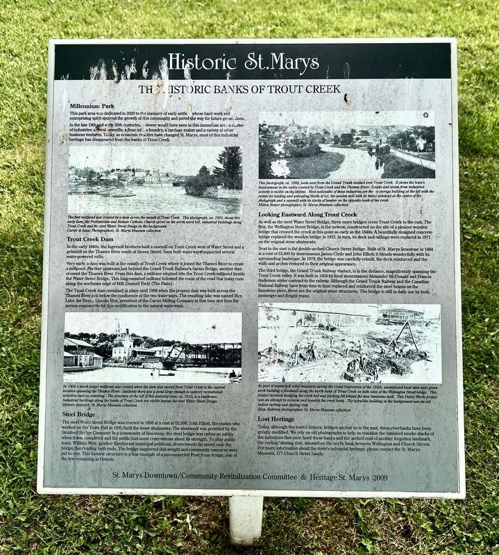
1. The Historic Banks of Trout Creek Marker
This park area was dedicated in 2000 to the memory of early settlers whose hard work and enterprising spirit spurred the growth of this community and paved the way for future generations.
In the late 19th and early 20th centuries, a viewer would have seen in this immediate are a cluster of industries: several sawmills, a flour mill, a foundry, a carriage maker and a variety of other business ventures. Today, as economic realities have changed St. Marys, most of this industrial heritage has disappeared from the banks of Trout Creek.
Trout Creek Dam
In the early 1840s, the Ingersoll brothers built a sawmill on Trout Creek west of Water Street and a gristmill on the Thames River south of Queen Street. Soon both waterways supported several water-powered mills.
Very early, a dam was built at the mouth of Trout Creek where it joined the Thames River to create a millpond. Further upstream just beyond the Grand Trunk Railway's Sarnia Bridge, another dam crossed the Thames River. From this dam, a millrace emptied into the Trout Creek millpond beside the Water Street Bridge. This long-vanished millrace
this page online
The Trout Creek dam remained in place until 1908 when the present dam was built across the Thames River just below the confluence of the two waterways. The resulting lake was named Rice Lake, for Henry Lincoln Rice, president of the Carter Milling Company at that time and thus the person responsible for this modification to the natural waterways.
Steel Bridge
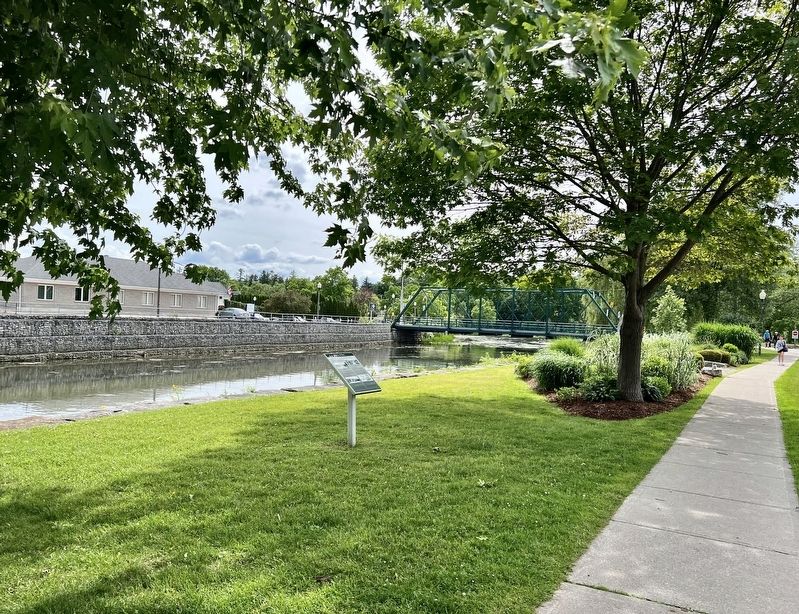
The steel Water Street Bridge was erected in 1898 at a cost of $2,000. John Elliott, the mason who worked on the Town Hall in 1891, built the stone abutments. The steelwork was provided by the Stratford Bridge Company. In a community of limestone, the steel bridge was rather an oddity when it was completed and the public had some reservations about its strength. To allay public fears, William Weir, a rather flamboyant municipal politician, drove twenty fat steers onto the bridge, barricading both ends. The bridge supported this weight and community concerns were put to rest. This historic structure is a fine example of a pin-connected Pratt truss bridge, one of the
Photographed by Tim Boyd, June 21, 2026
2. The Historic Banks of Trout Creek Marker
Looking Eastward Along Trout Creek
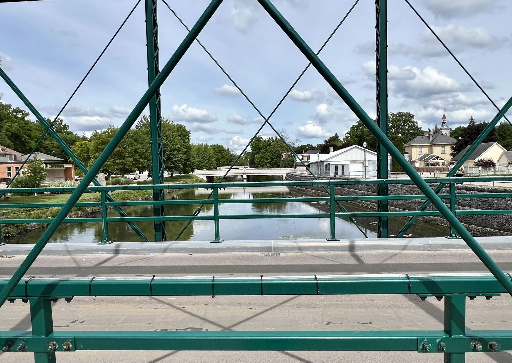
As well as the steel Water Street Bridge, three more bridges cross Trout Creek to the east. The first, the Wellington Street Bridge, is the newest, constructed on the site of a pioneer wooden bridge that crossed the creek at this point as early as the 1840s. A beautifully designed concrete bridge replaced the wooden bridge in 1912. In turn, its deck and railings were replaced in 1971 on the original stone abutments.
Next to the east is the double arched Church Street Bridge. Built of St. Marys limestone in 1884 at a cost of $3,800 by stonemasons James Clyde and John Elliott, it blends wonderfully with its surrounding landscape. In 1979, the bridge was carefully rebuilt, the deck reinforced and the walls and arches restored to their original appearance.
The third bridge, the Grand Trunk Railway viaduct, is in the distance, magnificently spanning the Trout Creek valley. It was built in 1858 by local stonemasons Alexander McDonald and Francis Anderson under contract to the railway. Although the Grand Trunk Railway and the Canadian National Railway have from time to
Photographed by Tim Boyd, June 21, 2026
3. Trout Creek in 2026
From the Water Street Bridge, showing the Wellington Street and Church Street Bridges in the background
Lost Heritage
Today, although the town's historic bridges anchor us to the past, these riverbanks have been greatly modified. We rely on old photographs to help us visualize the vanished smoke stacks of the industries that once lined these banks and the arched roof of another forgotten landmark, the curling/skating rink, situated on the north bank between Wellington and Church Streets. For more information about the town's industrial heritage, please contact the St. Marys Museum, 177 Church Street South.
Erected 2009 by Heritage St. Marys.
Topics. This historical marker is listed in these topic lists: Bridges & Viaducts • Industry & Commerce • Waterways & Vessels. A significant historical year for this entry is 2000.
Location. 43° 15.649′ N, 81° 8.576′ W. Marker is in Saint Marys, Ontario, in Perth County. It is at the intersection of Parkview Drive and Wellington Street North, on the left when traveling west on Parkview Drive. Touch for map. Marker is at or near this postal address: 1961 Parkview Drive, Saint Marys ON N4X 1A9, Canada. Touch for directions.

Regionally, this marker is in the Huron-Perth-Waterloo-Wellington Area and in Southwestern Ontario. It is also in Central Canada. Globally, it is in North America, the Western Hemisphere, the Western World, and the Anglosphere. Historically, it finds itself in what was once a British colony, the Viceroyalty of New France, the Haudenosaunee (Iroquois) Confederacy, and Rupert’s Land.
Other nearby markers. At least 8 other markers are within walking distance of this marker: Water Street Bridge (within shouting distance of this marker); John McDonald Block (about 150 meters away, measured in a direct line); The Church Street Bridge (about 150 meters away); Andrews Jeweller (about 150 meters away); The Hutton-MacPherson Block (about 180 meters away); The A. Workman Building (about 180 meters away); Robert Eaton Building (about 180 meters away); Mill Race (about 180 meters away). Touch for a list and map of all markers in Saint Marys.
Credits. This page was last revised on June 27, 2026. It was originally submitted on June 27, 2026, by Tim Boyd of Hamilton, Ontario. This page has been viewed 12 times since then. Photos: 1, 2, 3. submitted on June 27, 2026, by Tim Boyd of Hamilton, Ontario. • Andrew Ruppenstein was the editor who published this page.
