Florence in Lauderdale County, Alabama — The American South (East South Central)
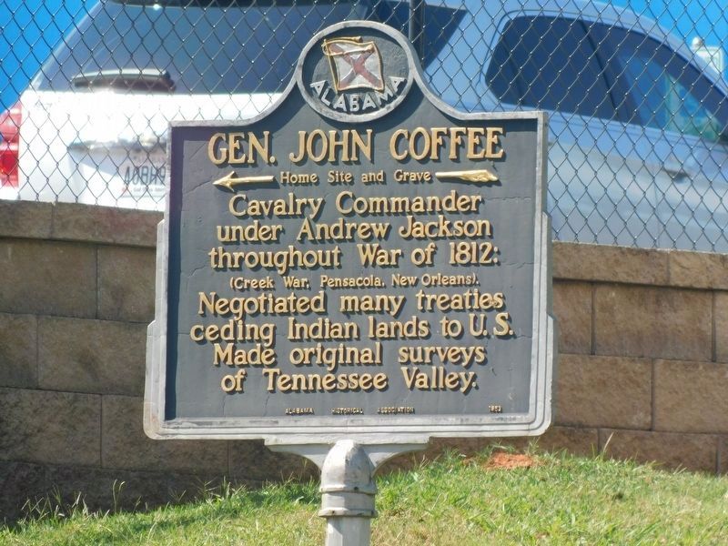
General John Coffee
Home Site and Grave
Photographed by Jimmy Emerson, September 6, 2026
1. General John Coffee Marker
Cavalry Commander under Andrew Jackson throughout War of 1812:
(Creek War, Pensacola, New Orleans).
Negotiated many treaties ceding Indian lands to U.S. Made original surveys of Tennessee Valley.
Erected by Alabama Historical Association.
Topics and series. This historical marker is listed in these topic lists: Indigenous Peoples and Communities • Settlements & Settlers • War of 1812. In addition, it is included in the Alabama Historical Association, and the Former U.S. Presidents: #07 Andrew Jackson series lists. A significant historical year for this entry is 1812.
Location. 34° 50.457′ N, 87° 41.295′ W. Marker is in Florence, Alabama, in Lauderdale County. It is on Cloverdale Road (Alabama Route 157) north of Cox Creek Parkway ( Route 133). Just off N. Cox Creek Pkwy head East past CVS Pharmacy on left. The Coffee home burn down but family cemetery is still there and is on private property. Touch for map. Marker is in this post office area: Florence AL 35630, United States of America. Touch for directions.

Regionally, this marker is in North Alabama and in the Shoals. It is also in the American
this page online
Other nearby markers. At least 8 other markers are within 2 miles of this marker, measured as the crow flies: John Coffee: 1772-1833 (approx. 0.2 miles away); Hickory Hill Plantation Slave Cemetery (approx. ¼ mile away); Florence's Early Water Tower 1890 (approx. 1.1 miles away); Governor Hugh McVay Home Site and Cemetery (approx. 1.6 miles away); Ante-Bellum Cotton Mills 1840 (approx. 1.6 miles away); Larimore Home (approx. 1.7 miles away); Homer Givens (approx. 1.7 miles away); North Wood United Methodist Church (approx. 1.7 miles away). Touch for a list and map of all markers in Florence.
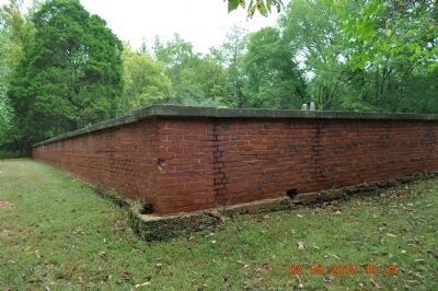
Regarding General John Coffee. Cemetery Wall
The cemetery is completely surrounded with a brick wall about 4 or 5 ft tall with a set of steps on the inside of
Photographed by Sandra Hughes, June 23, 2009
2. General John Coffee Marker
Also see . . . Findagrave John Coffee. General John R Coffee son of Captain Joshua and Elizabeth (Graves) Coffee married Mary Donalson, 3 Oct 1809 in Davidson Co., TN. (Submitted on September 3, 2010, by Sandra Hughes Tidwell of Killen, Alabama, USA.)
Photographed by Sandra Hughes, September 8, 2010
3. General John Coffee Cemetery
Photographed by Sandra Hughes, September 8, 2010
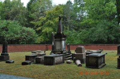
4. General John Coffee Marker (the tall one)
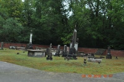
Photographed by Sandra Hughes, September 8, 2010
5. General John Coffee Cemetery showing the inside steps
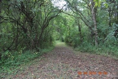
Photographed by Sandra Hughes, September 8, 2010
6. Path leading to Cemetery
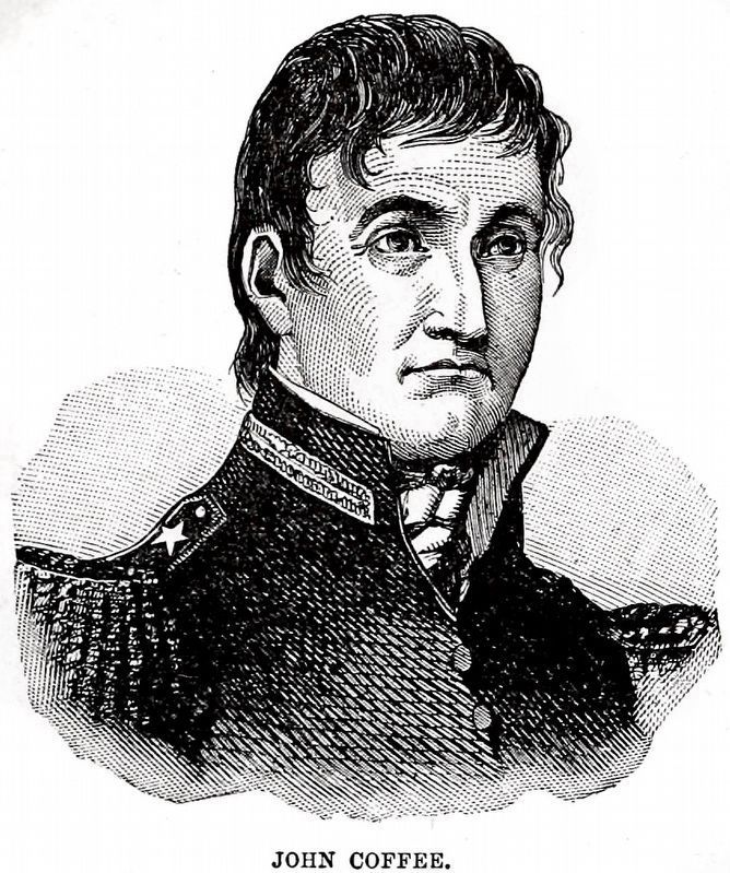
Internet Archive
7. John Coffee
From Harper's Encyclopædia of United States History from 458 A.D. to 1905 by Benson John Lossing and Woodrow Wilson 1905, Vol. 2, page 230.
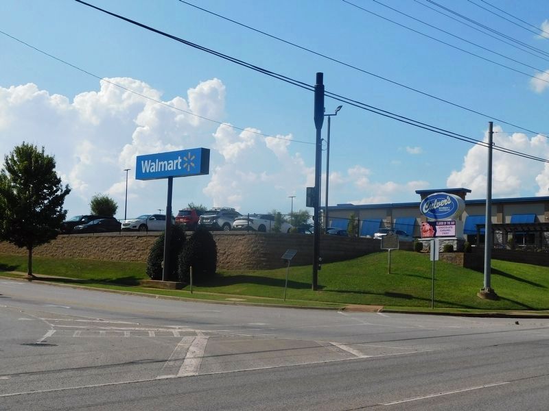
Photographed by Jimmy Emerson, September 6, 2026
8. General John Coffee Marker
Credits. This page was last revised on September 12, 2026. It was originally submitted on September 3, 2010, by Sandra Hughes Tidwell of Killen, Alabama, USA. This page has been viewed 2,579 times since then and 105 times this year. Last updated on June 28, 2026, by Rebecca Lew of Oak Ridge, Tennessee. Photos: 1. submitted on September 8, 2026, by Jimmy Emerson of Dalton, Georgia. 2. submitted on September 3, 2010, by Sandra Hughes Tidwell of Killen, Alabama, USA. 3, 4, 5, 6. submitted on September 8, 2010, by Sandra Hughes Tidwell of Killen, Alabama, USA. 7. submitted on January 24, 2024, by Allen C. Browne of Silver Spring, Maryland. 8. submitted on September 8, 2026, by Jimmy Emerson of Dalton, Georgia. • Devry Becker Jones was the editor who published this page.
