Gilbertown in Choctaw County, Alabama — The American South (East South Central)
Indian Trail Crossing

Photographed by Jimmy Emerson, Aug 2019
1. Indian Trail Crossing Marker
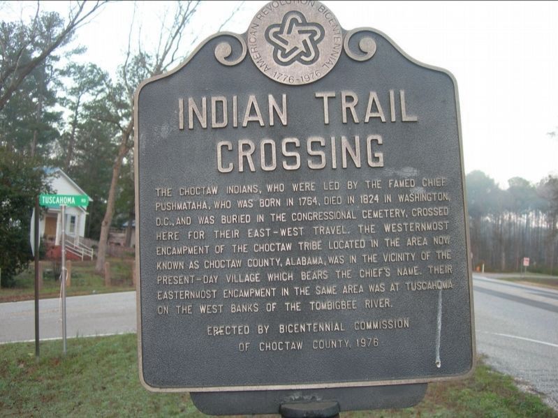
The Choctaw Indians, who were led by the famed Chief Pushmataha, who was born in 1764, died in 1824 in Washington, D.C., and was buried in the Congressional Cemetery, crossed here for their east-west travel. The westernmost encampment of the Choctaw Tribe located in the area now known as Choctaw County, Alabama, was in the vicinity of the present-day village which bears the Chief's name. Their easternmost encampment in the same area was at Tuscahoma on the west banks of the Tombigbee River.
Erected 1976 by Bicentennial Commission of Choctaw County.
Topics and series. This historical marker is listed in this topic list: Indigenous Peoples and Communities. In addition, it is included in the The Spirit of ’76, America’s Bicentennial Celebration series list. A significant historical year for this entry is 1764.
Location. 31° 52.758′ N, 88° 19.367′ W. Marker is in Gilbertown, Alabama, in Choctaw County. It is at the intersection of Melvin Road and High Street, on the right when traveling west on Melvin Road. As of 2019, the marker was located inside the Choctaw County Museum. Touch for map. Marker is at or near this postal
this page online

Regionally, this marker is in the American South, specifically in the Deep South, and in the Black Belt. Globally, it is in North America, a Gulf of Mexico state, the Western Hemisphere, the Western World, and the Anglosphere. Historically, it finds itself in what was once New Spain, the territory of the Mississippian Culture, one of the Confederate States of America, and the Antebellum South.
Other nearby markers. At least 8 other markers are within 18 miles of this marker, measured as the crow flies: First Oil Well in Alabama (here, next to this marker); Sims Cemetery (approx. 1.2 miles away); First Oil Well In Alabama (approx. 1.8 miles away); Silas Elementary School (approx. 7.7 miles away); Little Place Cemetery / Mt. Pleasant Baptist Church Womack Hill Community (approx. 8½ miles away); Springhill Missionary Baptist Church Cemetery (approx. 11.6 miles away); West Bend (approx. 11.9 miles away); Dyess Bridge (approx. 17.2 miles away in Mississippi). Touch for a list and map of all markers in Gilbertown.
Photographed by Jimmy Emerson, 2006
2. Indian Trail Crossing Marker
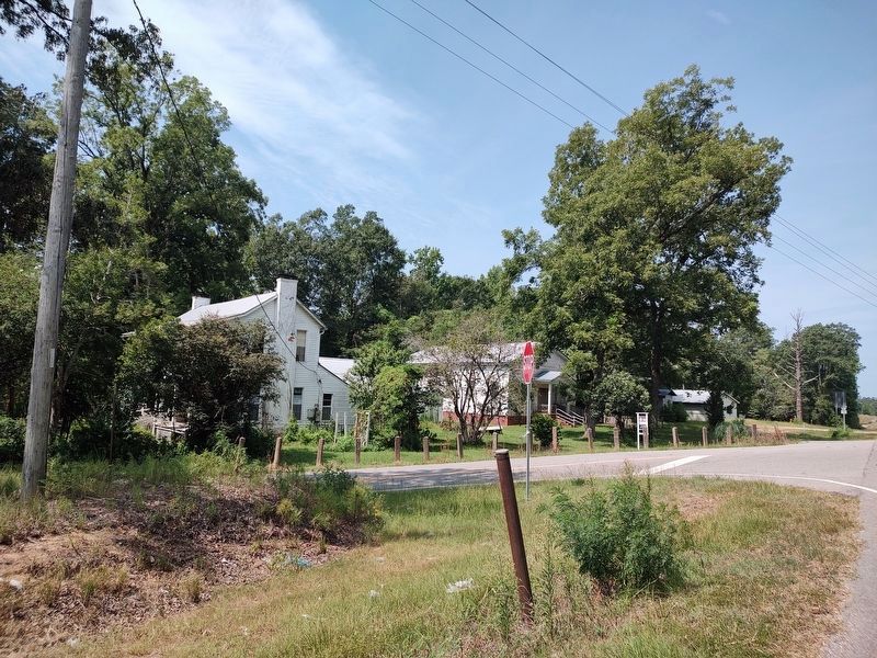
Original location of marker on AL Hwy 10 and Tuscahoma Road in the Mt Sterling community.
Photographed by Jimmy Emerson, July 29, 2026
3. Indian Trail Crossing Marker Post
Where the marker originally was located at the junction of Tuscahoma Road and AL 10 in Mt Sterling Alabama.
Credits. This page was last revised on August 4, 2026. It was originally submitted on October 12, 2025. This page has been viewed 152 times since then and 87 times this year. Last updated on June 28, 2026. Photos: 1, 2. submitted on October 12, 2025, by Jimmy Emerson of Dalton, Georgia. 3. submitted on July 30, 2026, by Jimmy Emerson of Dalton, Georgia. • Devry Becker Jones was the editor who published this page.
