Near London in Kimble County, Texas — The American South (West South Central)
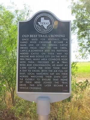
Old Beef Trail Crossing
Photographed by Richard Denney, May 16, 2012
1. Old Beef Trail Crossing Marker
Erected 1997 by Texas Historical Commission. (Marker Number 3637.)
Topics. This historical marker is listed in these topic lists: Animals • Roads & Vehicles. A significant historical year for this entry is 1867.
Location. 30° 35.217′ N, 99° 35.828′ W. Marker is near London, Texas, in Kimble County. It is at the intersection of Ranch to Market Road 385 and Ranch to Market Road 331, on the left when traveling south on Route 385. Located just south of the Llano River crossing. Touch for map. Marker is at or near this postal address: Ranch Rd 385, London TX 76854,
this page online

Regionally, this marker is in the Hill Country. Globally, it is in North America, a Gulf of Mexico state, the Western Hemisphere, the Western World, and the Anglosphere. Historically, it finds itself in what was once New Spain, the Republic of Texas, and one of the Confederate States of America.
Other nearby markers. At least 8 other markers are within 11 miles of this marker, measured as the crow flies: Reichenau Gap (approx. 4.6 miles away); Teacup Mountain (approx. 5.8 miles away); London Post Office (approx. 6.2 miles away); London Town Square (approx. 6.4 miles away); Cloud Point (approx. 8.8 miles away); Miller-Browning Colony (approx. 8.8 miles away); The Oliver Pecan (approx. 10.3 miles away); Little Mexico (approx. 11 miles away). Touch for a list and map of all markers in London.
Photographed by Richard Denney, May 16, 2012
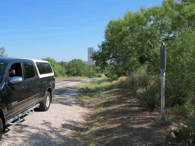
2. Old Beef Trail Crossing Marker
Looking north, marker is to the right, with the Llano River in the distance.
Photographed by Richard Denney, May 16, 2012
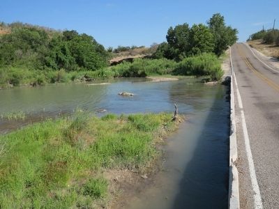
3. Old Beef Trail Crossing of the Llano River
Photographed by Richard Denney, May 16, 2012
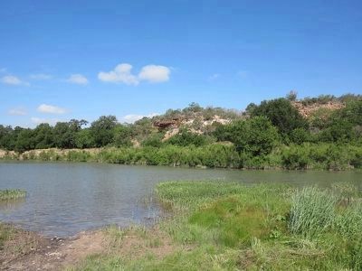
4. Old Beef Trail Crossing on the Llano
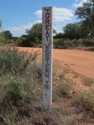
Photographed by Richard Denney, May 16, 2012
5. Western Cattle Trail Marker
The "Old Beef Trail Crossing" is part of the Great Western Cattle Trail. Markers such as this one are used to mark the route(s) of the Great Western Cattle Trail in Texas. This marker is on Ranch Road 385, about 15 miles south of the Old Beef Trail Crossing of the Llano River, at the intersection of County Road 430 (lat/long 30.467168, -99.399622).
Credits. This page was last revised on June 30, 2026. It was originally submitted on November 23, 2015, by Richard Denney of Austin, Texas. This page has been viewed 1,287 times since then and 82 times this year. Last updated on June 29, 2026, by Joe Lotz of Flower Mound, Texas. Photos: 1, 2, 3, 4, 5. submitted on November 23, 2015, by Richard Denney of Austin, Texas. • James Hulse was the editor who published this page.
