
Lynnwood in Rockingham County, Virginia — The American South (Mid-Atlantic)
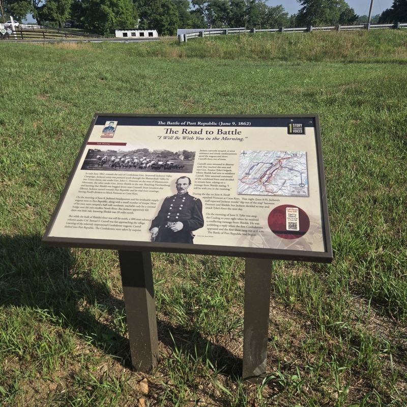
The Road to Battle
"I Will Be With You in the Morning."
| — | The Battle of Port Republic (June 9, 1862) | — |
Photographed by Mike McKeown, July 3, 2026
1. The Road to Battle Marker
On the moming of June 8, Jackson's headquarters and his invaluable supply wagons were in Port Republic, along with a small number of troops. Most of his men were camped a half mile northeast, reachable only by a covered bridge over the rain-swollen North River. But Jackson apparently felt there was little risk, knowing Shields was 20 miles north.
But while the bulk of Shields's force was still far north, a 400-man advance column under Col. Samuel S. Carroll was fast approaching the village. Learning of the relatively unprotected Confederate wagons, Carroll dashed into Port Republic. The Confederates were
this page online
Jackson narrowly escaped, as stout resistance and timely reinforcements saved the wagons and drove Carroll's force out of town.
Carroll's men retreated in disarray until they reached this area and met Gen. Erastus Tyler's brigade, whom Shields had sent to reinforce Carroll. Tyler assumed command of the combined force and decided to remain here, relying on a message from Shields stating "I will be with you in the morning."
During the day on June 8, Ewell repulsed Fremont at Cross Keys. That night (June 8-9), Jackson's staff expected Jackson would slip out of the trap" between Fremont and Shields, but Jackson decided to stay and attack Tyler's force the next day. On the morning of June 9, Tyler was atop the Coaling to your right when he received a conflicting message from Shields. He was scribbling a reply when the first Confederates appeared and the first shots rang out at 6 a.m. The Battle of Port Republic had begun.
(caption) Union Gen. James Shields
Erected 2026 by Shenandoah Valley Battlefields Foundation.
Topics. This historical marker is listed in this topic list: War, US Civil. A significant historical date for this entry is June 9, 1862.
Location. 38° 18.09′ N,

Photographed by Bradley Owen, August 29, 2026
2. The Road to Battle Marker
Marker is on the right.

Regionally, this marker is in Virginia’s Shenandoah Valley. It is also in the American South and specifically in the Upper South. Globally, it is in North America, the Western Hemisphere, the Western World, and the Anglosphere. Historically, it finds itself in what was once the territory of the Mississippian Culture, one of the original Thirteen Colonies, one of the Confederate States of America, and the Antebellum South.
Other nearby markers. At least 8 other markers are within walking distance of this marker: Explore. Learn. Remember. (here, next to this marker); Port Republic Battlefield / Visiting the Battlefields / The Battlefields Today (a few steps from this marker); The Coaling (within shouting distance of this marker); Port Republic Battlefield

Library of Congress
3. Samuel S. Carroll
Another marker is no longer nearby. Port Republic (was within shouting distance of this marker but has been replaced with another marker now near it).
Also see . . .
1. Shenandoah Battlefields Foundation. (Submitted on July 3, 2026, by Mike McKeown of Baltimore, Maryland.)
2. Port Republic (American Battlefield Trust). (Submitted on July 3, 2026, by Mike McKeown of Baltimore, Maryland.)
Credits. This page was last revised on August 31, 2026. It was originally submitted on July 3, 2026, by Mike McKeown of Baltimore, Maryland. This page has been viewed 25 times since then. Photos: 1. submitted on July 3, 2026, by Mike McKeown of Baltimore, Maryland. 2. submitted on August 31, 2026, by Bradley Owen of Morgantown, West Virginia. 3. submitted on July 3, 2026, by Mike McKeown of Baltimore, Maryland. • Bernard Fisher was the editor who published this page.
