Fort Myer in Arlington in Arlington County, Virginia — The American South (Mid-Atlantic)
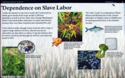
Dependence on Slave Labor
Arlington House, The Robert E. Lee Memorial
| — | National Park Service, U.S. Department of the Interior | — |
Photographed by Allen C. Browne, November 29, 2013
1. Dependence of Slave Labor Marker
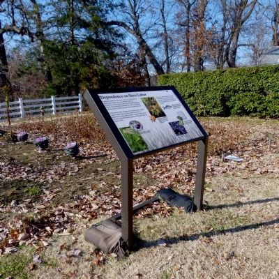
Unlike the planters in the lower south, the Custis and Lee family grew mostly food crops on this 1,100 acre plantation as well as at two other sites. George Washington Park Custis limited the cultivation of cotton and tobacco because they were labor intensive and exhausted the soil.
Custis did not make enough money from his other crops to support large numbers of slaves, thus he was not as dependent on slave labor as others. It was his intent to free his slaves, which he did through his will five years after his death in 1857.
The other Custis-Lee plantations, White House, and Romancoke in the central tidewater of Virginia (almost 10,000 acres in total) generated most of the families' income.
Erected by National Park Service, U.S. Department of the Interior.
Topics and series. This historical marker is listed in these topic lists: African Americans • Agriculture. In addition, it is included in the National Cemeteries series list. A significant historical year for this entry is 1857.
Location. Marker has been permanently removed. It was located near 38° 52.893′ N, 77° 4.373′ W. Marker was in Arlington, Virginia,
this page online
We have been informed that this marker is no longer there and will not be replaced. This page is an archival view of what was.
Regionally, this marker was in the Washington Metropolitan Area and in Northern Virginia. It was also in the American South, specifically in the Upper South, in the Mid-Atlantic, and on the Eastern Seaboard. Globally, it was in the North Atlantic Region, North America, the Western Hemisphere, the Western World, and the Anglosphere. Historically, it found itself in what was once the territory of the Mississippian Culture, one of the original Thirteen Colonies, one of the Confederate States of America, and the Antebellum South.

Other nearby markers. At least 8 other markers are within walking distance of this location: Growing Season (a few steps from this marker);
Photographed by Allen C. Browne, November 29, 2013
2. Dependence of Slave Labor Marker
Other markers no longer nearby. Kitchen Garden (was a few steps from this marker but has been replaced with another marker now near it); A Garden Sustains (was a few steps from this marker but has been permanently removed); Arlington Estate, 1860 (was within shouting distance of this marker but has been permanently removed); Selina Gray (was within shouting distance of this marker but has been replaced with another marker now near it); Guardian of a Nation's Heritage (was within shouting distance of this marker but has been permanently removed).
Also see . . . Arlington House, The Robert E. Lee Memorial. National Park Service (Submitted on December 1, 2013.)
Photographed by J. Makali Bruton, March 15, 2016
3. Dependence on Slave Labor Marker
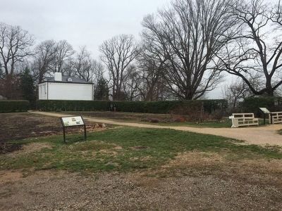
The marker is on the left, with the "A Garden Sustains" marker on the right, both just north of Arlington House.
Photographed by Allen C. Browne, November 29, 2013
4. Tobacco Leaf Platter
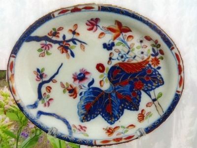
A tobacco leaf china set passed down through the family.Close-up of photo on marker
Photographed by Allen C. Browne, November 29, 2013
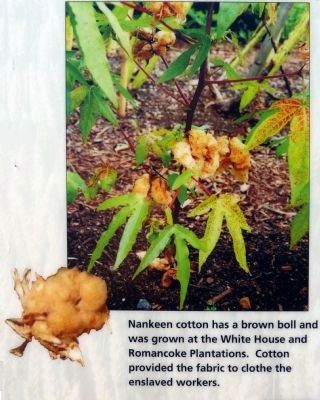
5. Nankeen Cotton
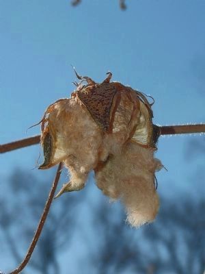
Nankeen cotton has a brown boll and was grown at the White House and Romancoke Plantations. Cotton provided the fabric to clothe the enslaved workers.Close-up of photos on marker
Photographed by Allen C. Browne, November 29, 2013
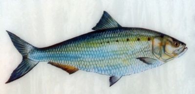
6. American Shad - Alosa sapidissima
Wheat and corn were the primary money crops. Timber, brandy, and butter provided additional income along with the Potomac and Pamunkey River fisheries.Close-up of picture on marker
Photographed by Allen C. Browne, November 29, 2013
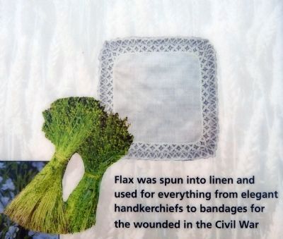
7. Flax
Flax was spun into linen and used for everything from elegant handkerchiefs to bandages for the wounded in the Civil War.Close-up of photos on marker
Photographed by Allen C. Browne, November 29, 2013
8. Brown Boll of Nankeen Cotton
Credits. This page was last revised on July 7, 2026. It was originally submitted on November 30, 2013, by Allen C. Browne of Silver Spring, Maryland. This page has been viewed 760 times since then and 35 times this year. Last updated on July 3, 2026, by Evan Dwyer of Richmond, Virginia. Photos: 1, 2. submitted on November 30, 2013, by Allen C. Browne of Silver Spring, Maryland. 3. submitted on March 16, 2016, by J. Makali Bruton of Washington, District of Columbia. 4, 5, 6, 7, 8. submitted on November 30, 2013, by Allen C. Browne of Silver Spring, Maryland. • Devry Becker Jones was the editor who published this page.
