De Cocksdorp in Texel, North Holland, Netherlands — Northwestern Europe
De Russenoorlog op Texel
⎯⎯⎯
The Russian War on Texel
⎯⎯⎯
Der Russenkrieg auf Texel
| — | Liberation Route Europe | — |

Photographed by Andrew Ruppenstein, June 1, 2026
1. De Russenoorlog op Texel / The Russian War on Texel / Der Russenkrieg auf Texel Marker

In de nacht van 5 op 6 april 1945 gebeurt wat de Texelaars tot dan toe bespaard is gebleven. Een bloedige strijd breekt uit en verscheurt het eiland. De Russen, sinds februari als soldaten van het Duitse leger gestationeerd op het eiland, zijn aan het muiten geslagen. De Duitsers slaan ongenadig hard terug en veranderen het eiland in een gruwelijk slagveld. Ook op en rond vliegveld. De familie Bakker bevindt zich op een steenworp afstand...
De kustlijn van het Waddengebied was onderdeel van de Atlantikwall, de Duitse verdedigingslinie langs de West-Europese kust. De algehele capitulatie van het Duitse leger was op 5 mei 1945 een feit, maar het Waddengebied was daarmee nog niet bevrijd. Van 5 april tot 20 mei woedde er op Texel een hevige strijd tussen de Georgische opstandelingen en Duitse bezetting. Pas op 11 juni 1945 vertrokken de laatste Duitse soldaten van Schiermonnikoog en was heel Nederland bevrijd. Tijdens de Liberation Route hoort u hun belevenissen. De geschiedenis van deze plek kunt u gratis downloaden vanaf www.liberationroute.com, scan de
this page online
The morning of April 6, 1945 sees events the inhabitants of the isle of Texel had been spared until then: the island is torn apart by bloody combat. The Russians, who had been stationed on the island as soldiers in the German army, start a mutiny. The Germans retaliate without mercy en turn the island into a horrific battlefield. Also on and around the airfield. The Bakker family lives only a stone's throw away.
The Wadden Sea coastline was part of the Atlantic Wall, the German line of defense along the West European coast. The general capitulation of the German army was a fact on May 5, 1945, but the Wadden Sea area was not yet liberated. From April 5th to May 20th, a fierce battle raged on Texel between Georgian insurgents and the German occupation. Only on June 11, 1945 did the last German soldiers leave Schiermonnikoog and then the whole of the Netherlands was liberated. During the Liberation Route, you will hear their experiences. The history of this location can be downloaded for free from www.liberationroute.com
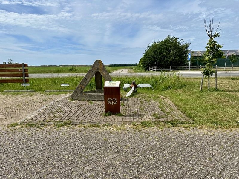
Photographed by Andrew Ruppenstein, June 1, 2026
2. The Russian War on Texel Marker - wide view
Am Morgen des 6. April 1945 geschah, was den Einwohnern von Texel bis dahin erspart geblieben war. Ein blutiger Kampf zerreißt die Insel. Die Russen, die seit Februar als Soldaten der deutschen Armee auf der Insel stationierten sind, versuchen zu meutern. Die Deutschen schlagen gnadenlos zurück und verwandeln die Insel in ein grausames Schlachtfeld. So auch auf und rund um den Flughafen herum. Die Familie Bakker befindet sich nur einen Katzensprung entfernt...
Die allgemeine Kapitulation der deutschen Armee war eine Tatsache am 5. Mai 1945, aber das Wattenmeergebiet wurde noch nicht befreit. Vom 5. April bis 20. Mai tobte ein heftiger Kampf zwischen den georgischen Rebellen und der deutschen Besatzung auf Texel. Erst am 11. Juni 1945 verließen die letzten deutschen Soldaten Schiermonnikoog und dann wurden die gesamten Niederlande befreit. Auf der Liberation Route können Sie sich ihre Erlebnisse anhören. Die Geschichte dieses Ortes steht auf der Website www.liberationroute.com kostenlos zum Download bereit.
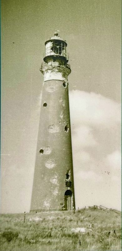
1945
3. Marker photo: the Texel Lighthouse after the battle
Erected 2019 by Stichting Liberation Route Europe. (Marker Number 664.)
Topics. This historical marker is listed in these topic lists: Notable Events • War, World II. A significant historical date for this entry is April 6, 1945.
Location. 53° 7.083′ N, 4° 49.609′ E. Marker is in De Cocksdorp, Noord-Holland (North Holland), in Texel. It is on Postweg, on the left when traveling south. The marker is located on the grounds of the Luchtvaart- en Oorlogsmuseum Texel (“Aviation & War Museum Texel”), by the parking lot. Touch for map. Marker is at or near this postal address: Postweg 124, De Cocksdorp, Noord-Holland 1795 JS, Netherlands. Touch for directions.

Regionally, this marker is on the German Wadden Sea. Globally, it is in Europe, the European Union, Atlantic Europe, the Benelux Low Countries, the Schengen Area, Western Europe, and the Western World. Historically, it finds itself in what was once the Holy Roman Empire.
Other nearby markers. At least 8 other markers are within 6 kilometers of this marker, measured as the crow flies: “Rose O’Day” (a few steps from this marker); De Atlantikwall / Der Atlantikwall / The Atlanticwall (within shouting distance of this marker); RK kerk / Roman Catholic Church (approx. 5 kilometers away); Molenbos (approx. 5 kilometers away); De Cocksdorp (approx. 5 kilometers away); Vuurtoren / Lighthouse (approx. 5 kilometers away); De Niuewe Aanleg (approx. 5 kilometers away); Zanddijk (approx. 5.1 kilometers away). Touch for a list and map of all markers in De Cocksdorp.
Also see . . .
1. Georgian uprising on Texel (Wikipedia). Overview:
The Georgian uprising on Texel (Dutch: Opstand der Georgiërs) (5 April 1945 – 20 May 1945) was an insurrection by the 882nd Infantry Battalion Königin Tamara (Queen Tamar or Tamara) of the Georgian Legion of the German Army stationed on the German-occupied Dutch island of Texel…. The battalion was made up of 800 Georgians and 400 Germans, with mainly German officers. It was one of the last battles in the European theater.(Submitted on July 5, 2026.)
2. The Georgian Uprising (VVV Texel). Excerpt:
…As the German defeat became apparent, the army command was forced to put troops into action formed of prisoners of war from the Eastern Front. The 822nd Georgian infantry battalion, which arrived on Texel on 6 February 1945, was among these troops. It consisted of 800 Georgians and 400 Germans.(Submitted on July 5, 2026.)
To escape the terrible conditions of their captivity, many Georgians saw themselves more or less forced to serve in the German army. Others opted to do so voluntarily, in the hope of ousting communism in their home country. When it looked like the Germans were going to lose the war, many Georgians feared for their lives: the Soviets considered all soldiers, voluntary or otherwise, as traitors to their country.
They were due to leave on 6 April to fight the allied forces in the East Netherlands. The only chance the Georgians had to rehabilitate themselves for their service in the German army was an uprising. On 6 April at 01:00, the uprising kicked off, led by Georgian commander Shalva Loladze. By early morning, 450 Germans had already been killed, most in their sleep. At first, the uprising went smoothly.
However, the Georgians failed to get a hold on the North and South batteries. The Germans were quick to send reinforcements to the island to quash the Georgian uprising. It took five weeks of heavy fighting before the Germans were able to subdue the Georgians.
The battle claimed the lives of 565 Georgians, 120 Texel people and about 800 Germans. Texel properties were left heavily damaged. Although Germany had already surrendered unconditionally on 5 May, the war on Texel would continue until 20 May. Consequently, the Georgian Uprising is also referred to as ‘Europe’s last battlefield’.
3. De Russenoorlog (Liberation Route Europe, in Dutch (and English and German)). The QR code on top of the marker leads to this page (with buttons also leading to English and German versions), offering a bit more information. (Submitted on July 5, 2026.)
Credits. This page was last revised on July 5, 2026. It was originally submitted on July 4, 2026, by Andrew Ruppenstein of Lamorinda, California. This page has been viewed 15 times since then. Photos: 1. submitted on July 4, 2026, by Andrew Ruppenstein of Lamorinda, California. 2. submitted on July 5, 2026, by Andrew Ruppenstein of Lamorinda, California. 3. submitted on July 4, 2026, by Andrew Ruppenstein of Lamorinda, California.
