Guildford in Surrey, England, United Kingdom — Northwestern Europe (the British Isles)
Friary Square
Photographed by Ray Gurganus, April 13, 2026
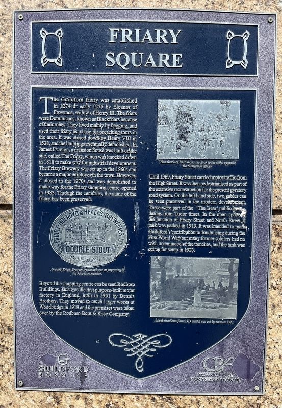
1. Friary Square Marker
Beyond the shopping centre can be seen Rodboro Buildings. This was the first purpose-built motor factory in England, built in 1901 by Dennis Brothers. They moved to much larger works at Woodbridge in 1919 and the premises were taken over by the Rodboro Boot & Shoe Company.
Until 1969, Friary Street carried motor traffic from the High Street. It was then pedestrianised
this page online
Topics. This historical marker is listed in these topic lists: Industry & Commerce • Roads & Vehicles. A significant historical year for this entry is 1274.
Location. 51° 14.171′ N, 0° 34.577′ W. Marker is in Guildford, England, in Surrey. It is at the intersection of North Street and Friary Street, on the left when traveling east on North Street. Touch for map. Marker is in this post office area: Guildford, England GU1 3EG, United Kingdom. Touch for directions.

Regionally, this marker is in the Greater South East. Globally, it is on the Atlantic Ocean, in the North Atlantic Region, in Europe, in Atlantic Europe, on one of the British Isles, in the Western World, and in the Anglosphere. Historically, it finds itself in what was once the Roman Empire.
Other nearby markers. At least 8 other markers are within walking distance of this marker: The Town Bridge (about 150 meters away, measured in a direct line); The Stranglers (about 150 meters away); The Star Inn History (about 150 meters away); Medieval Synagogue (about 180 meters away); St. Mary's Church (about 180 meters away); Quarry Street/Rosemary Alley (approx. 0.3 kilometers away); Tunsgate Arch (approx. 0.3 kilometers away); Guildhall (approx. 0.3 kilometers away). Touch for a list and map of all markers in Guildford.
Credits. This page was last revised on July 5, 2026. It was originally submitted on July 4, 2026, by Ray Gurganus of Washington, District of Columbia. This page has been viewed 13 times since then. Photo 1. submitted on July 4, 2026, by Ray Gurganus of Washington, District of Columbia. • Andrew Ruppenstein was the editor who published this page.
