Near Eveleth in Saint Louis County, Minnesota — The American Midwest (Upper Plains)
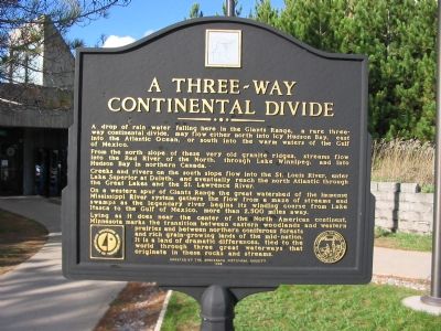
A Three-Way Continental Divide
From the north slope of these very old granite ridges, streams flow into the Red River of the North, through Lake Winnipeg, and into Hudson Bay in northern Canada.
Creeks and rivers on the south slope flow into the St. Louis River, enter Lake Superior at Duluth, and eventually reach the north Atlantic through the Great Lakes and the St. Lawrence River.
On a western spur of Giants Range the great watershed of the immense Mississippi River system gathers the flow from a maze of streams and swamps as the legendary river begins its winding course from Lake Itasca to the Gulf of Mexico, more than 2,500 miles away.
Lying as it does near the center of the North American continent, Minnesota marks the transition between eastern woodlands and western prairies and between northern coniferous forests and rich grain-growing lands of the mid-nation. It is a land of dramatic differences, tied to the world through three great waterways that originate in these rocks and streams.
Erected by the Minnesota Historical Society.
Topics and series. This historical marker is listed in this topic list: Natural Features. In addition, it is included in the Minnesota Historical Society series list.
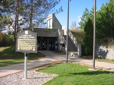
Location. 47° 19.191′ N, 92° 28.213′ W. Marker is near Eveleth, Minnesota, in Saint Louis County. Marker can be reached from U.S. 53 at milepost 50, on the right when traveling north. Marker is 9 miles south of Eveleth at the Anchor Lake Rest Area off of Anchor Lake Road. The rest area can be reached from both directions on U.S. 53. Touch for map. Marker is in this post office area: Eveleth MN 55734, United States of America. Touch for directions.
Other nearby markers. At least 2 other markers are within 11 miles of this marker, measured as the crow flies. Paul Wellstone Memorial and Historic Site (approx. 5.8 miles away); John Mariucci (approx. 10.8 miles away).
Credits. This page was last revised on June 16, 2016. It was originally submitted on October 19, 2007, by Keith L of Wisconsin Rapids, Wisconsin. This page has been viewed 5,555 times since then and 141 times this year. Photos: 1, 2, 3. submitted on October 19, 2007, by Keith L of Wisconsin Rapids, Wisconsin. • J. J. Prats was the editor who published this page.


