Merchants Quay in Dublin in County Dublin, Leinster, Ireland — Mid-East (and Dublin)
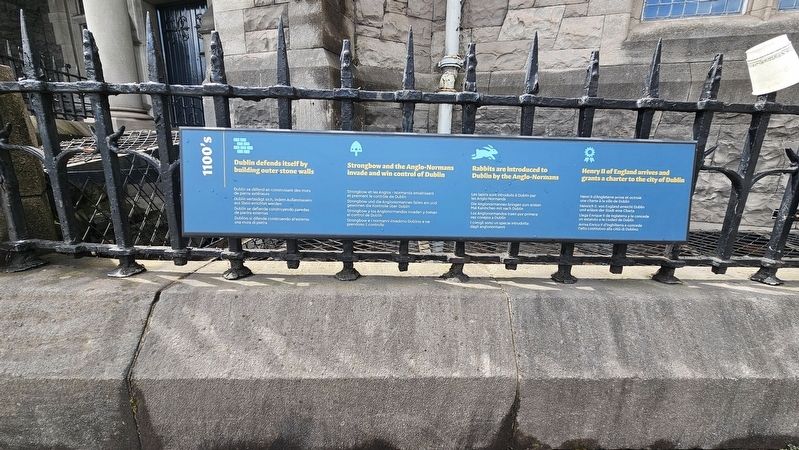
1100's
Photographed by Ian Lefkowitz, May 17, 2026
1. 1100's Marker
 1100’s
Dublin Defends Itself by Building Outer Stone Walls
Dublin se défend en construisant des murs de pierre extérieurs
Dublin verteidigt sich, indem Außenmauern aus Stein errichtet werden
Dublín se defiende construyendo paredes de piedra externas
Dublino si difende costruendo all’esterno una mura di pietra
Strongbow and the Anglo-Normans Invade and Win Control of Dublin
Strongbow et les Anglo-Normands envahissent et prennent le contrôle de Dublin
Strongbow und die Anglonormannen fallen ein und gewinnen die Kontrolle über Dublin
Strongbow y los Anglonormandos invaden y toman el control de Dublín
Strongbow e i Normanni invadono Dublino e ne prendono il controllo
Rabbits Are Introduced to Dublin by the Anglo-Normans
Les lapins sont introduits à Dublin par les Anglo-Normands
Die Anglonormannen bringen zum ersten Mal Kaninchen mit nach Dublin
Los Anglonormandos traen por primera vez conejos a Dublín
I conigli sono un specie introdotta dagli Anglonormanni
Henry II of England Arrives and Grants a Charter to the City of Dublin
Henri
this page online
Heinrich II. von England erreicht Dublin und erlässt der Stadt eine Charta
Llega Enrique II de Inglaterra y le concede un estatuto a la ciudad de Dublín
Arriva Enrico II d’Inghilterra e concede l’atto costitutivo alla città di Dublino
Erected by Dublinia.
Topics. This historical marker is listed in these topic lists: Animals • Forts and Castles • Wars, Non-US.
Location. 53° 20.59′ N, 6° 16.312′ W. Marker is in Dublin, Leinster, in County Dublin. It is in Merchants Quay. It is at the intersection of Winetavern Street and High Street, on the left when traveling north on Winetavern Street. Touch for map. Marker is at or near this postal address: 3 Winetavern Street, Dublin, Leinster, Ireland. Touch for directions.

Regionally, this marker is in the Ancient East. Globally, it is on the Atlantic Ocean, in the North Atlantic Region, in Europe, on the Island of Ireland, on the Celtic Fringe, in the European Union, in Atlantic Europe, on one of the British Isles, in the Western
Photographed by Ian Lefkowitz, May 17, 2026
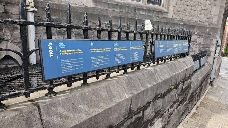
2. Dublinia Timeline
The 1100s to 1300s section is south of the bridge leading to Dublinia.
Other nearby markers. At least 8 other markers are within walking distance of this marker: 1200's (here, next to this marker); 1300's (here, next to this marker); 1400’s (a few steps from this marker); 1500's (a few steps from this marker); 1600's (a few steps from this marker); Christ Church Cathedral Dublin Around 1370 (within shouting distance of this marker); Christ Church Cathedral / Ardeaglais Theampall Chríost (about 120 meters away, measured in a direct line); Chris Reid Oral History Artwork Project (about 120 meters away). Touch for a list and map of all markers in Dublin.
Credits. This page was last revised on July 19, 2026. It was originally submitted on July 5, 2026, by Ian Lefkowitz of New York, New York. This page has been viewed 17 times since then. Photos: 1, 2. submitted on July 5, 2026, by Ian Lefkowitz of New York, New York. • Andrew Ruppenstein was the editor who published this page.
