Maryborough in Portlaoise in County Laois, Leinster, Ireland — Mid-East (and Dublin)
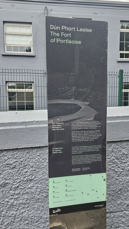
Dún Phort Laoise
⎯⎯⎯
The Fort of Portlaoise
Photographed by Ian Lefkowitz, May 17, 2026
1. Dún Phort Laoise / The Fort of Portlaoise Marker

Dún Túdarach, chun clann Ghaelach a chur faoi chois
Ba iad fórsaí Túdaracha Shasana a thóg Sean-Dún Phort Laoise sna blianta 1547–48 chun cur faoi chois chríocha Ghaelacha chlann Uí Mhórdha agus Uí Chonchúir. Bhí sé ar an gcéad phlandáil in Éirinn, rud ba thús le forleathnu coilíneach na dTúdarach.
Throid na clanna áitiúla go fíochmhar agus d’ionsaigh siad an Dún go minic. Sa bhliain 1607, chuir na Sasanaigh a smacht i bhfeidhm trí laioch a chur ar na teaghlaigh áitiúla i gceannas, a athionnadh i gContae Chiarraí. D’fhás Port Laoise thart ar an Seandún. Tá 75% de bhallaí bunaidh an Dúin ina gcuid de na struchtúir uirbeacha a fheiceann tú inniu.
A Tudor Fort to supress Gaelic clans
The Old Fort of Portlaoise was built by English Tudor forces in 1547–48 to supress the Gaelic Irish territories of the O’More and O’Connor clans. It was the first plantation in Ireland and marked the start of Tudor colonial expansion.
The local clans fought fiercely and attacked the Fort many times. In 1607, the English exerted their control by forcing the leading families to resettle in County Kerry. The town of Portlaoise grew around the Old Fort. 75% of the original Fort walls are incorporated into the urban structures you can see today.
(Captions)
Radharc ar an Seandún sa 16ú haois, bunaithe ar léarscáileanna stairiúla — 16th century view of the Old Fort, based on historic maps
Topics. This historical marker is listed in these topic lists: Forts and Castles • Wars, Non-US. A significant historical year for this entry is 1548.
Location. 53° 2.104′ N, 7° 17.958′ W. Marker is in Portlaoise, Leinster, in County Laois. It is in Maryborough. It is on Railway Street south of Millbrook, on the right when traveling north. Touch for map. Marker is at or near this postal address: 3 Railway St, Portlaoise, Leinster,
this page online

Regionally, it is on the Atlantic Ocean, in the North Atlantic Region, in Europe, on the Island of Ireland, on the Celtic Fringe, in the European Union, in Atlantic Europe, on one of the British Isles, in the Western World, and in the Anglosphere.
Other nearby markers. At least 8 other markers are within walking distance of this marker: Portlaoise Vocational School (a few steps from this marker); Old St Peter’s Church (a few steps from this marker); Colonel James Fitzmaurice (within shouting distance of this marker); Old County Gaol (within shouting distance of this marker); St. Mary’s C.B.S. (about 90 meters away, measured in a direct line); Portlaoise Courthouse (about 120 meters away); Odlums’ Mills (about 120 meters away); Fort of Maryborough (about 120 meters away). Touch for a list and map of all markers in Portlaoise.
Photographed by Ian Lefkowitz, May 17, 2026
2. Dún Phort Laoise / The Fort of Portlaoise Marker
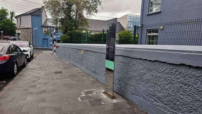
The marker is located on Railway Street. The map in the marker is incorrectly indicating that the marker has been placed on Church Avenue. A second marker with the same title has been placed at that location, indicating that these two markers have been accidentally swapped.
Photographed by Ian Lefkowitz, May 17, 2026
3. Dún Phort Laoise / The Fort of Portlaoise Marker
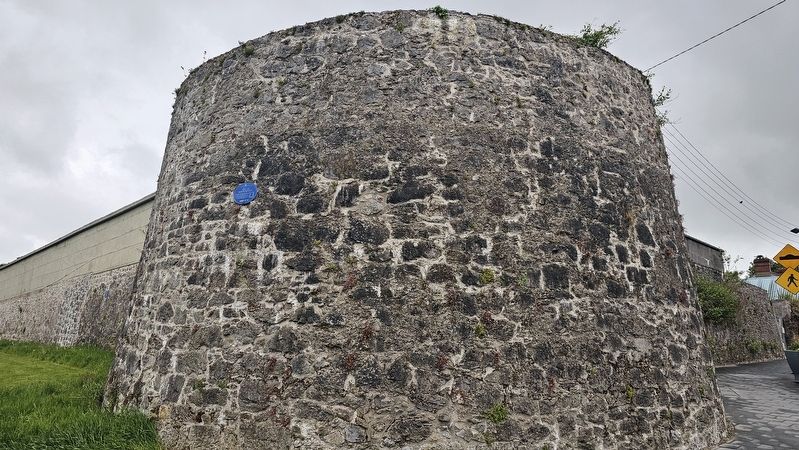
The nearby Fort of Portlaoise.
Credits. This page was last revised on July 7, 2026. It was originally submitted on July 6, 2026, by Ian Lefkowitz of New York, New York. This page has been viewed 12 times since then. Photos: 1, 2, 3. submitted on July 6, 2026, by Ian Lefkowitz of New York, New York. • Andrew Ruppenstein was the editor who published this page.
