Maryborough in Portlaoise in County Laois, Leinster, Ireland — Mid-East (and Dublin)
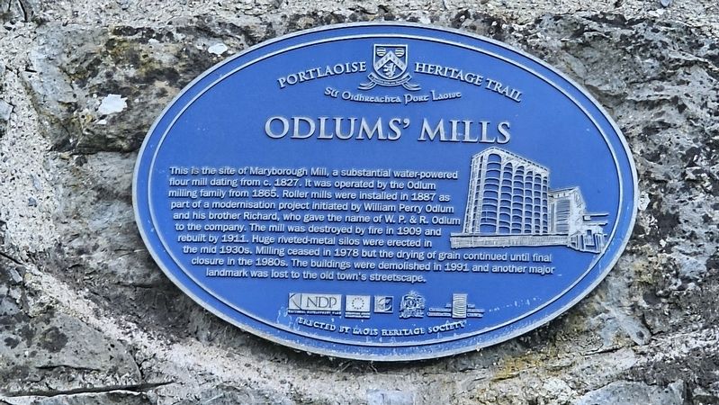
Odlums’ Mills
| — | Portlaoise Heritage Trail / Slí Oidhreachta Port Laoise | — |
Photographed by Ian Lefkowitz, May 17, 2026
1. Odlums’ Mills Marker
Erected by Laois Heritage Society.
Topics. This historical marker is listed in these topic lists: Agriculture • Industry & Commerce. A significant historical year for this entry is 1827.
Location. 53° 2.139′ N, 7° 17.862′ W. Marker is in Portlaoise, Leinster, in County Laois. It is in Maryborough. It is at the intersection of Church Avenue and Millbrook, on the right when traveling south on Church Avenue. Touch for map. Marker is at or near this postal address: 7/8 Church Avenue,
this page online

Regionally, it is on the Atlantic Ocean, in the North Atlantic Region, in Europe, on the Island of Ireland, on the Celtic Fringe, in the European Union, in Atlantic Europe, on one of the British Isles, in the Western World, and in the Anglosphere.
Other nearby markers. At least 8 other markers are within walking distance of this marker: Cuidíonn siúinéir Sasanach leis an Dún a thógáil / An English Carpenter Helps to Build the Fort (a few steps from this marker); Fort of Maryborough (a few steps from this marker); Cláirseoir ag seinm do thaoisigh na háite / A Harper Performs for the Local Chieftains (within shouting distance of this marker); Fitzmaurice Place (within shouting distance of this marker); Tá trodaire Gaelach timpeall an Dun / A Gaelic Fighter Surrounds the Fort (within shouting distance of this marker); Tá Cailín Óg ina Cónaí Taobh Amuigh den Dún / A Young Girl Lives Outside the Fort (within shouting distance of this marker); Eitilt (within shouting distance of this marker); SS Peter and Paul Church (within shouting distance of this marker). Touch for a list and map
Photographed by Ian Lefkowitz, May 17, 2026
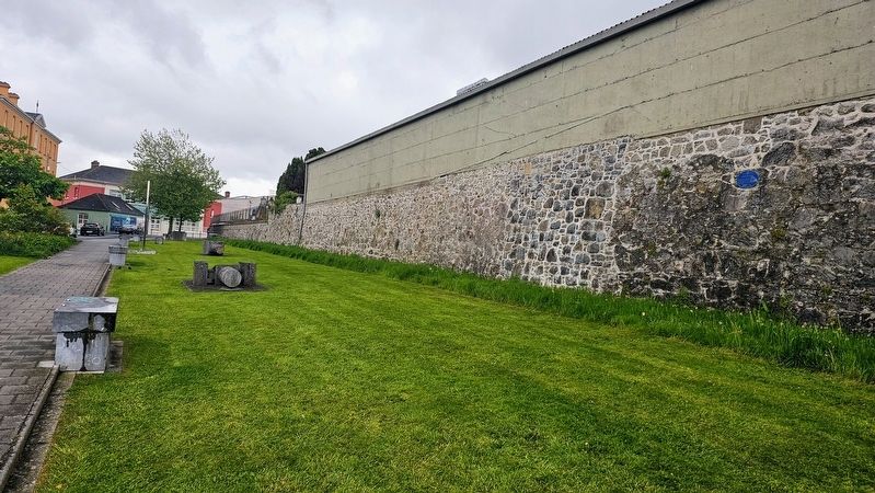
2. Odlums’ Mills Marker
The former site of the mill is also near the former Fort of Portlaoise.
Also see . . . Odlums Group (Wikipedia).
A flour mill operated by William Odlum, one of three Odlum brothers, in Maryborough (now Portlaoise) began operation in 1845. Odlum was succeeded by his two sons, William P. and Richard Odlum, and the company became known as W.P. & R. Odlum.(Submitted on July 6, 2026, by Ian Lefkowitz of New York, New York.)
Credits. This page was last revised on July 7, 2026. It was originally submitted on July 6, 2026, by Ian Lefkowitz of New York, New York. This page has been viewed 12 times since then. Photos: 1, 2. submitted on July 6, 2026, by Ian Lefkowitz of New York, New York. • Andrew Ruppenstein was the editor who published this page.
