Stilwell in Adair County, Oklahoma — The American South (West South Central)
The End of the Journey
Stilwell and the Trail of Tears
| — | Trail of Tears National Historic Trail | — |
Photographed by Marc Hayot, July 5, 2026
1. The End of the Journey Marker
The End of the Journey
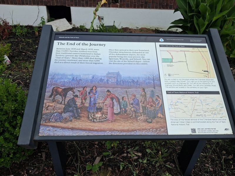
Between June 1838 and March 1839, more than 15,000 Cherokee trekked west from their traditional eastern homeland to Indian Territory (present-day Oklahoma) over the “Trail of Tears.” More than 1,000 died during the journey westward, and more than 4,000 died as a direct result of their forced migration. Once they arrived in their new homeland, Cherokee detachments disbanded at one of five disbandment depots, the most popular being sites near present-day Spavinaw, Westville, and Stilwell. You can visit the site of the Stilwell depot follow the directions provided on this exhibit.
Visit a Site on the Trail of Tears
You are invited to visit the place where the Cherokee disbanded here in present-day Stilwell. Turn right out of the parking lot and proceed north on Highway 59. Turn left at the intersection of Highway 59 and Back Jack Street. Turn left onto Cemetery Road. The exhibits are located in the cemetery on your right.
Trail of Tears National Historic Trail
The story of the forced removal of the Cherokee Nation and other American Indian tribes is commemorated along the Trail of Tears
this page online
Erected 2004 by Trail of Tears National Association National Park Service.
Topics and series. This historical marker is listed in these topic lists: Indigenous Peoples and Communities • Settlements & Settlers. In addition, it is included in the Trail of Tears series list. A significant historical year for this entry is 1839.
Location. 35° 48.831′ N, 94° 37.558′ W. Marker is in Stilwell, Oklahoma, in Adair County. It is on US 59 (Highway 1), on the right when traveling north. The marker is centrally located outside of the KCS Depot in Stilwell. Touch for map. Marker is at or near this postal address: 1 US-59, Stilwell OK 74960, United States of America. Touch for directions.

Regionally, this marker is in the Cherokee Nation and in Northeast Oklahoma—Green Country. It is also in the American South, specifically in the Ozarks, on the prairies, and on the Southern Plains. Globally, it is in North America, the Western Hemisphere, the Western World, and the Anglosphere. Historically, it finds itself in what was once the territory of the Mississippian Culture and also the Louisiana Purchase.
Other nearby markers. At least 7 other markers are within 10 miles of this marker, measured as the crow flies: KCS Railway Depot (a few steps from this marker); a different marker also named End of the Journey (approx. 1.1 miles away); Almost The End Of The Cherokee's Sad Journey Westward (approx. 7.4 miles away in Arkansas); R. L. Leach Grocery Store (approx. 8.7 miles away in Arkansas); Hermannsburg-Dutch Mills (approx. 8.7 miles away in Arkansas); Bethlehem Methodist-Episcopal Church South (approx. 10.1 miles away in Arkansas); Bethlehem Cemetery (approx. 10.1 miles away in Arkansas).
More about this marker. This is one of two End of the Journey markers in Stilwell. This marker is more of a direction finder for the main End of the Journey marker at Stilwell Cemetery.
Credits. This page was last revised on July 19, 2026. It was originally submitted on July 6, 2026, by Marc Hayot of Siloam Springs, Arkansas. This page has been viewed 20 times since then. Photo 1. submitted on July 6, 2026, by Marc Hayot of Siloam Springs, Arkansas. • Andrew Ruppenstein was the editor who published this page.
