
Pulaski in Pulaski County, Virginia — The American South (Mid-Atlantic)
Calfree Training School

Pulaski Graded School, later renamed Calfee Training School, was built in 1894. The building, which served Black students eventually through grade 11, burned in 1938. with help from Thurgood Marshall and the NAACP, faculty members Chauncey Harmon and Willis Gravely petitioned the school board in 1939 for equal facilities and teacher pay. Calfee was rebuilt as an elementary school using Public Works Administration funds, and Black high school students were sent away to Christiansburg Industrial Institute. In Corbin v. County School Board (1949), a federal court ruled that Pulaski's Black high school students were unlawfully denied equal educational opportunities. Schools were desegregated in 1966.
Erected 2023 by Department of Historic Resources. (Marker Number KE-7.)
Topics and series. This historical marker is listed in these topic lists: African Americans • Civil Rights • Education. In addition, it is included in the Virginia Department of Historic Resources (DHR) series list. A significant historical year for this entry is 1894.
Location. 37° 2.88′ N, 80° 47.188′ W. Marker is in Pulaski, Virginia, in Pulaski
this page online

Regionally, this marker is in Southwest Virginia, in the Blue Ridge Highlands, and in the New River Gorge. It is also in the American South, specifically in the Upper South, in Appalachia, and specifically in Southern Appalachia. Globally, it is in North America, the Western Hemisphere, the Western World, and the Anglosphere. Historically, it finds itself in what was once the territory of the Mississippian Culture, one of the original Thirteen Colonies, one of the Confederate States of America, and the Antebellum South.
Other nearby markers. At least 8 other markers are within walking distance of this marker: Thomas Jefferson Wallner (approx. ¼ mile away); Pulaski County War Memorial (approx. 0.3 miles away); Pulaski Veterans Memorial (approx. 0.3 miles away); Pulaski County Courthouse (approx. 0.3 miles away); Lest We Forget (approx. 0.3 miles away); Thorton Lemmon Massie (approx. 0.3 miles
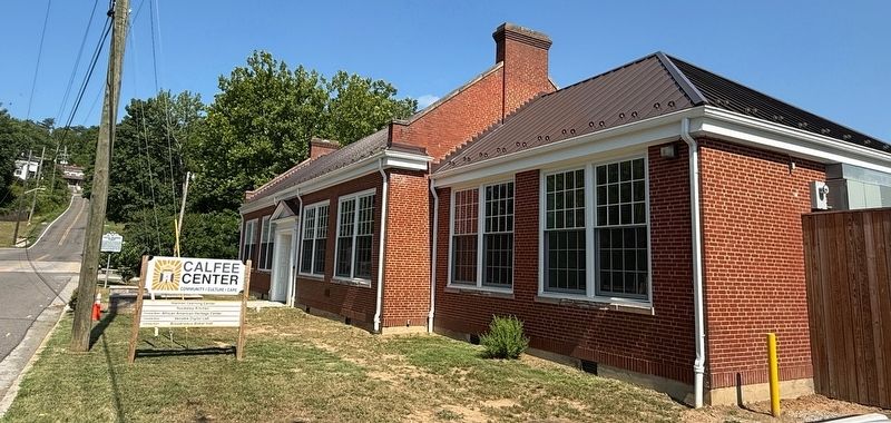
Photographed by Devry Becker Jones (CC0), July 4, 2026
2. Calfree Training School Building, now the Calfee Center
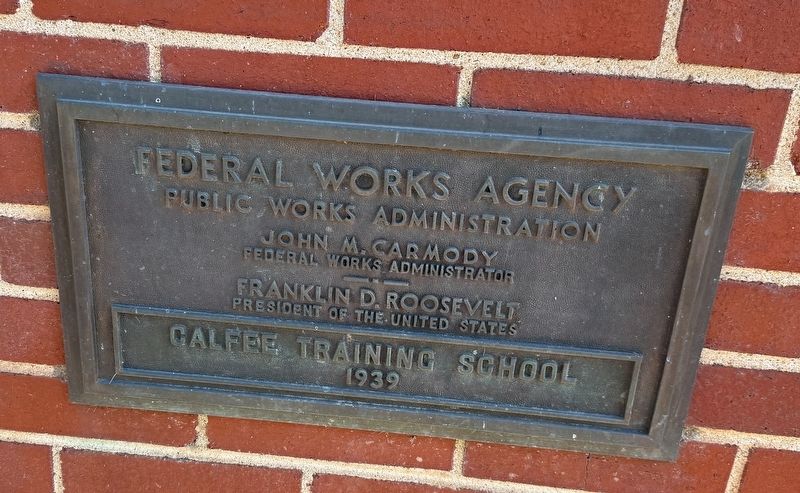
Photographed by Devry Becker Jones (CC0), July 4, 2026
3. Public Works Administration plaque on the building
Credits. This page was last revised on July 6, 2026. It was originally submitted on July 6, 2026, by Devry Becker Jones of Washington, District of Columbia. This page has been viewed 10 times since then. Photos: 1, 2, 3. submitted on July 6, 2026, by Devry Becker Jones of Washington, District of Columbia.
