The McKinley-Darragh Story
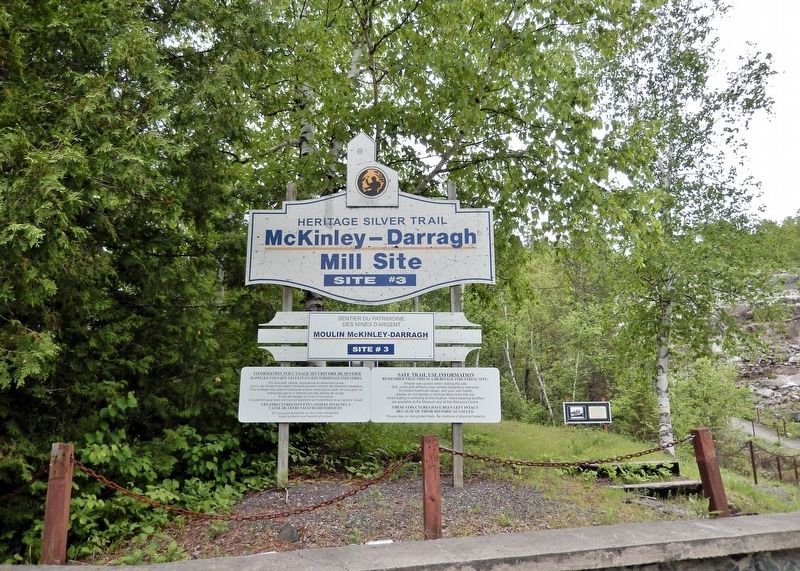
| — | Heritage Silver Trail Site #3 | — |

James McKinley and Ernest Darragh worked for the Temiskaming and Northern Ontario Railway. While collecting timber in August 1903, they found “glittering rock” on the south shore of Cobalt Lake 200 m northeast of this location. The rock assayed 4000 ounces of silver/ton and led to the development of the McKinley-Darragh mine which consisted of 5 shafts and 24 km of underground workings. The mine produced over 20 million ounces of silver in the first sixteen years of operation, The company's mill, the first to be built in the Cobalt camp, was erected in 1907 to process silver ore from their mines. The adjoining photograph shows the mill as it was in 1916. It had an initial capacity of 15 tons of ore/day and by 1913, could process 225 tons/day. The mill was permanently closed in August 1927 and burned to the ground in April of the following year. The foundations before you are all that remains of the McKinley-Darragh legacy.
Erected by Cobalt Historical Society.
Topics. This historical marker is listed in these topic lists: Industry & Commerce • Settlements & Settlers. A significant historical month for this entry is August 1903.
Location. 47° 23.282′ N,
this page online

Regionally, this marker is in Northeastern Ontario and specifically in Northern Ontario. It is also in Central Canada. Globally, it is in North America, the Great North Woods, the Western Hemisphere, the Western World, and the Anglosphere. Historically, it finds itself in what was once a British colony, the Viceroyalty of New France, the Haudenosaunee (Iroquois) Confederacy, and Rupert’s Land.
Other nearby markers. At least 8 other markers are within walking distance of this marker: Tri-town Trolleys (here, next to this marker); Cobalt Lake Mine (approx. 0.3 kilometers away); Tunnel to Riches (approx. 0.4 kilometers away); Townsite #1 Shaft / Le puits n°1 de la mine Townsite (approx. half a kilometer

Also see . . .
1. McKinley-Darragh Mill Site (Cobalt Historical Society).
Excerpt: This is an important site as this is where silver was first discovered. The mill was named for James McKinley and Ernest Darragh who found silver on this claim in August of 1903. It was the first mill to operate in the summer of 1907.(Submitted on July 8, 2026, by Cosmos Mariner of Cape Canaveral, Florida.)It was a typical “gravity mill” built on a hillside so that crushed ore would flow downward by gravity as it passed through the plant. Crushed first by a line of pounding stamps, the pulverized ore then went to jigs, ball mills, and gravity tables.
The ore came from eight shafts on the property and from the Savage Claim at Cart Lake by means of an aerial tramway. The mill ceased operations in 1927 having recovered more than 13 million ounces of silver.
The Nipissing Central Railway, a streetcar service
between Cobalt, Haileybury, and New Liskeard passed right beside the mill. This privately owned railway provided economical and comfortable service in the area until it closed in the 1930s.Photographed by Cosmos Mariner, June 2, 20223. The McKinley-Darragh Story Marker

2. Cobalt: The Silver Rush That Changed a Forest Town.
Excerpt: In the summer of 1903, two railway workers named James McKinley and Ernest Darragh were helping build a train line through the forest. One day, they noticed pink stains on a rock near a small lake. They broke off pieces of the rock and did an old prospector trick—they bit the metal. It was soft. That meant it might be silver! They sent the rock to a lab in Montreal. The results were incredible: the rock was packed with silver.(Submitted on July 8, 2026, by Cosmos Mariner of Cape Canaveral, Florida.)A geologist named Willett Green Miller came to check out the discovery. He knew that silver in the area often appeared with another metal called cobalt, which was used to make blue paint. He put up a sign at the train stop and called the place Cobalt. The name stuck.
McKinley and Darragh began digging for silver using simple tools like shovels, picks, and wheelbarrows.
They found even more silver close to the surface. Soon, word spread. Miners and investors rushed in from all over the world. New mines opened, and Cobalt grew incredibly fast. By 1909, the town had up to 12,000 people.Photographed by Cosmos Mariner, June 2, 20224. The McKinley-Darragh Mill SiteTurn here from Coleman Road to access the site and historical marker.

Credits. This page was last revised on July 8, 2026. It was originally submitted on July 6, 2026, by Cosmos Mariner of Cape Canaveral, Florida. This page has been viewed 17 times since then. Photos: 1, 2, 3, 4, 5. submitted on July 8, 2026, by Cosmos Mariner of Cape Canaveral, Florida.
