Calion in Union County, Arkansas — The American South (West South Central)
Hernando de Soto

Photographed by Jimmy Emerson, July 5, 2026
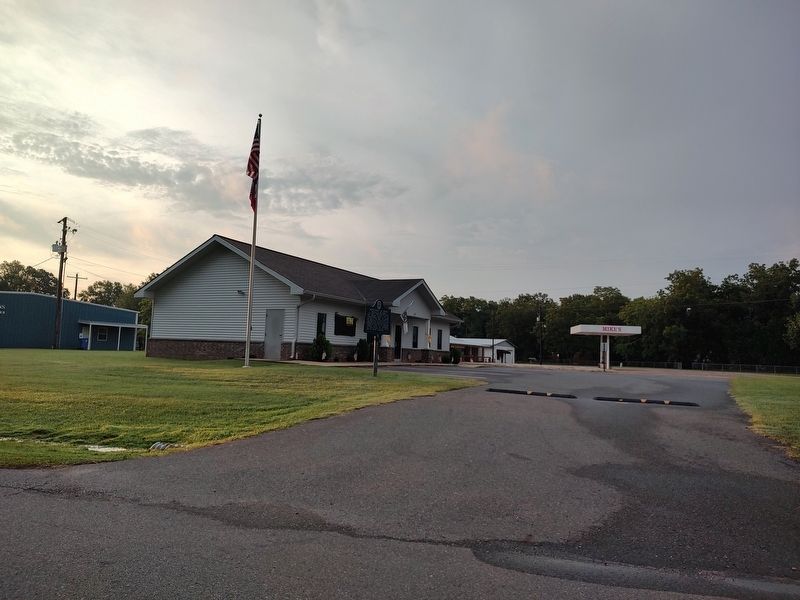
1. Hernando de Soto Marker
Hernando de Soto
Wintered on this Ridge
November, 1541 - March 6, 1542
The Spanish Explorer with his Conquistadores used the slough, now part of the lake, to enter the Ouachita River to visit the Indians along the banks. Here Juan Ortiz, the interpreter died; the first Christian religious service was celebrated; and Juan Guzman was left behind with his Indian sweetheart.
Erected 1965 by Arkansas Society - Colonial Dames of the 17th Century.
Topics and series. This historical marker is listed in these topic lists: Exploration • Waterways & Vessels. In addition, it is included in the The Colonial Dames XVII Century, National Society series list. A significant historical year for this entry is 1541.
Location. 33° 19.794′ N, 92° 32.555′ W. Marker is in Calion, Arkansas, in Union County. It is on North Hoover Street. Touch for map. Marker is at or near this postal address: 133 N Hoover St, Calion AR 71724, United States of America. Touch for directions.

Regionally, this marker is in the Gulf Coastal Plain and in Timberlands. It is also in the American South, specifically in the Upper South, and in the
this page online
Other nearby markers. At least 8 other markers are within 11 miles of this marker, measured as the crow flies: O.L. Bodenhamer Memorial Park (approx. 10.3 miles away); Union County Second Courthouse (approx. 10.7 miles away); The Gunfight on El Dorado's Courthouse Square, Oct. 9, 1902 (approx. 10.7 miles away); The Gunfight on the Square (approx. 10.7 miles away); First Union County Courthouse (approx. 10.7 miles away); For Service in Iraq and Afghanistan (approx. 10.7 miles away); El Dorado Masonic Temple (approx. 10.7 miles away); Oil in Arkansas — The Wildcatters (approx. 10.8 miles away).
Also see . . . Hernando de Soto (1500?–1542) (Encyclopedia of Arkansas). Excerpt:
In May 1539, de Soto set out from Cuba with about 600 men, plus horses, pigs, and equipment. His contract with the king required him to explore the region(Submitted on July 8, 2026.)and establish settlements and forts. After landing on the southwest coast of Florida, the crew traveled through the Southeast before crossing the Mississippi River into what is now Arkansas on June 28, 1541 (June 18 on the Julian calendar, which was used at that time).Photographed by Jimmy Emerson, July 5, 20262. Hernando de Soto MarkerLocated in front of city hall
The explorers were the first Europeans to set foot in Arkansas.…
Credits. This page was last revised on July 8, 2026. It was originally submitted on July 7, 2026, by Jimmy Emerson of Dalton, Georgia. This page has been viewed 54 times since then. Photos: 1, 2. submitted on July 7, 2026, by Jimmy Emerson of Dalton, Georgia. • Andrew Ruppenstein was the editor who published this page.
