Jefferson in Jackson County, Georgia — The American South (South Atlantic)
Preacher Riley's Place
Shields-Ethridge Heritage Farm
Photographed by Cosmos Mariner, October 8, 2021
1. Preacher Riley's Place Marker
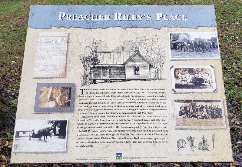
The chimney marks the site of Preacher Riley's Place. This was one of fourteen or fifteen tenant homes on the farm in the 1930s and '40s. It was probably the largest tenant house. Clearly, Riley who despite his nickname was not a preacher enjoyed a special status among the tenants. The L-shaped building had four rooms and a front porch looking out onto a small swept yard. Grouped around the house site there are several outbuildings including a garage, a chicken house, a small barn, plus a well and a privy. Between his house and the gin Riley kept a large vegetable garden — this area is used for plowing demonstrations each Mule Day.
There were both black and white tenants on the farm, but most were African American. Tenant holdings were generally between 15 and 30 acres, probably insufficient to support a family but tenants also worked as wage hands for Mr. Ira. Joyce Ethridge remembered that in the 1940s hands were paid 75 cents for a day's work.
In 2004, Preacher Riley's Place was partially restored with funding provided from a Georgia Heritage Grant through the Georgia Department of Natural Resources/Historic Preservation
this page online
[photo captions]
• Tenant’s accounts in cotton gin ledger, 1903.
• Mr. Ira and farm hands at the cotton gin, n.d.
• Got Shields and Scott Ethridge in a horse-drawn buggy, n.d.
• Farm hands with mules pictured behind the wheat house.
• Black tenants cooking barbeque, 1924.
• Tenants with Ethridge family and friends, 1946.
• Primary crops harvested at Shields-Ethridge Farm were cotton, corn, tobacco, and wheat.
Erected by Shields-Ethridge Heritage Farm; and Appalachian Regional Commission.
Topics. This historical marker is listed in these topic lists: African Americans • Agriculture • Architecture • Settlements & Settlers.
Location. 34° 3.817′ N, 83° 35.329′ W. Marker is in Jefferson, Georgia, in Jackson County. It can be reached from Johnson Mill Road just west of Ethridge Road, on the left when traveling west. Touch for map. Marker is at or near this postal address: 2355 Ethridge Road, Jefferson GA 30549,
Photographed by Cosmos Mariner, October 8, 2021
2. Preacher Riley's Place Marker
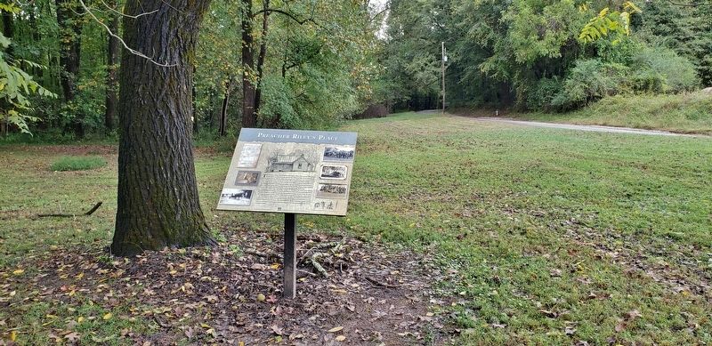
Looking west; Johnson Mill Road continues west in the right background.

Regionally, this marker is in the Piedmont. It is also in the American South and specifically in the Deep South. Globally, it is in North America, the Western Hemisphere, the Western World, and the Anglosphere. Historically, it finds itself in what was once the territory of the Mississippian Culture, one of the original Thirteen Colonies, one of the Confederate States of America, and the Antebellum South.
Other nearby markers. At least 8 other markers are within walking distance of this marker: Cotton Gin (within shouting distance of this marker); Gin Office (within shouting distance of this marker); Seed House (within shouting distance of this marker); Tractor Shed (within shouting distance of this marker); Teacher's House (within shouting distance of this marker); Milking Barn (about 300 feet away, measured in a direct line); Gristmill (about 300 feet away); Blacksmith's Shop and Carpenter's Shop (about 300 feet away). Touch for a list and map of all markers in Jefferson.
Also see . . . Preacher Riley’s Place (Shields-Ethridge Farm). (Submitted on July 7, 2026, by Cosmos Mariner of Cape Canaveral, Florida.)

Photographed by Cosmos Mariner, October 8, 2021
3. Preacher Riley's Place Ruins
Brick chimney and foundation piers are all that remain today.

Photographed by Cosmos Mariner, October 8, 2021
4. Preacher Riley's Place & Outbuildings
Preacher Riley's Place is on the right and the outbuildings are on the left.

Photographed by Cosmos Mariner, October 8, 2021
5. Preacher Riley's Place: Garage
Credits. This page was last revised on July 7, 2026. It was originally submitted on July 7, 2026, by Cosmos Mariner of Cape Canaveral, Florida. This page has been viewed 18 times since then. Photos: 1, 2, 3, 4, 5. submitted on July 7, 2026, by Cosmos Mariner of Cape Canaveral, Florida.
