
Norton, Virginia — The American South (Mid-Atlantic)
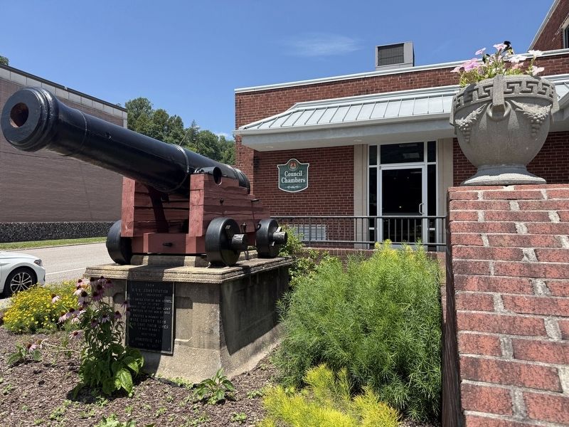
From U.S.S. Constitution
"Old Ironsides"

Built in 1797
Winner of the first and last sea battles of the War of 1812
Erected in memory of Wise County boys who gave their lives in World War I
Dedicated Armistice Day
Nov. 11, 1933
Erected by City of Norton.
Topics. This memorial is listed in these topic lists: War of 1812 • War, World I • Waterways & Vessels. A significant historical year for this entry is 1797.
Location. 36° 56.119′ N, 82° 37.727′ W. Memorial is in Norton, Virginia. It is at the intersection of Virginia Avenue Northwest and 7th Street Northwest, on the right when traveling west on Virginia Avenue Northwest. Touch for map. Memorial is at or near this postal address: 618 Virginia Ave NW, Norton VA 24273, United States of America. Touch for directions.

Regionally, this memorial is in Southwest Virginia. It is also in the American South, specifically in the Upper South, in Appalachia, and specifically in Southern Appalachia. Globally, it is in North America, the Western Hemisphere, the Western World, and the Anglosphere. Historically, it finds itself in what was once the territory of
this page online
Other nearby markers. At least 8 other markers are within 3 miles of this marker, measured as the crow flies: Armed Forces Memorial (about 500 feet away, measured in a direct line); The Hotel Norton (about 600 feet away); Wise County Virginia Chamber of Commerce (about 700 feet away); Norton (about 700 feet away); First Integrated Little League Baseball Teams in Virginia (approx. 0.4 miles away); Resolution Declaring a Sasquatch / Bigfoot Sanctuary (approx. 1.1 miles away); Norton / Coeburn (approx. 1.1 miles away); Benge’s Gap (approx. 2.7 miles away). Touch for a list and map of all markers in Norton.
Credits. This page was last revised on July 8, 2026. It was originally submitted on July 8, 2026, by Devry Becker Jones of Washington, District of Columbia. This page has been viewed 13 times since then. Photos: 1, 2. submitted on July 8, 2026, by Devry Becker Jones of Washington, District of Columbia.
