
Asbury in Bethlehem Township in Hunterdon County, New Jersey — The American Northeast (Mid-Atlantic)
Jersey Barriers
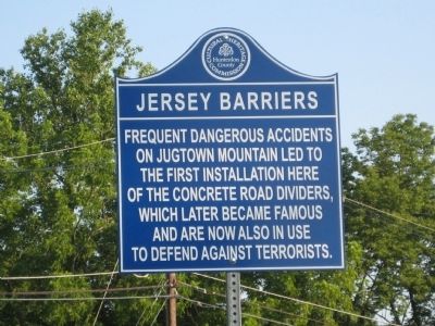
Photographed by Alan Edelson, July 28, 2009
1. Jersey Barriers Marker
Erected 2009 by Hunterdon County Cultural And Heritage Commission.
Topics and series. This historical marker is listed in this topic list: Roads & Vehicles. In addition, it is included in the New Jersey, Hunterdon County Cultural and Heritage Commission series list.
Location. Marker is missing. It was located near 40° 39.307′ N, 75° 1.288′ W. Marker was in Bethlehem Township, New Jersey, in Hunterdon County. It was in Asbury. It was at the intersection of New Jersey Route 173 at milepost 6.9 and Mine Road, on the right when traveling west on New Jersey Route 173. Touch for map. Marker was at or near this postal address: 1075 State Route 173, Asbury NJ 08802, United States of America. Touch for directions.

Regionally, this marker was in the New York City Metropolitan Area. It was also in the American Northeast and in the Mid-Atlantic. Globally, it was in North America,
this page online
Other nearby markers. At least 8 other markers are within 2 miles of this location, measured as the crow flies: Jugtown Mountain (within shouting distance of this marker); Hannah's Rock (approx. half a mile away); West Portal Methodist Church (approx. half a mile away); West Portal (approx. 0.8 miles away); Bethlehem Township Veterans Memorial (approx. 0.9 miles away); Bellewood Park (approx. 1.2 miles away); Tower Hill Farm (approx. 1.3 miles away); Pattenburg United Methodist Church (approx. 1.4 miles away).
Another marker is no longer nearby. Musconetcong (was within shouting distance of this marker but has been confirmed missing).
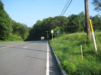
Photographed by Alan Edelson, July 28, 2009
2. Jersey Barriers Marker
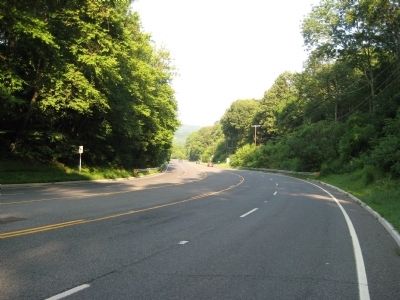
Photographed by Alan Edelson, July 28, 2009
3. Looking down "dangerous" Jugtown Mountain
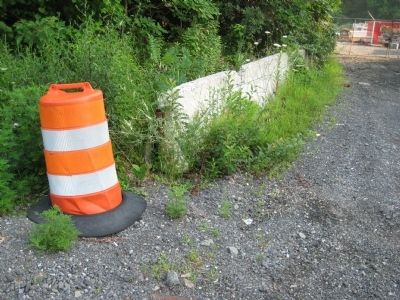
Photographed by Alan Edelson, July 28, 2009
4. Jersey Barriers
There are no longer any Jersey Barriers in use on Jugtown Mountain (Hwy 173), but these abandoned barriers were spotted on the side of the road. Perhaps remainders of the original barriers?
Shown here is a moveable Jersey barrier. The original Jersey barriers on Jugtown Mt. (rt 22) were permanent concrete barriers and shorter. The original barriers measured 19 inches high.
Shown here is a moveable Jersey barrier. The original Jersey barriers on Jugtown Mt. (rt 22) were permanent concrete barriers and shorter. The original barriers measured 19 inches high.
Credits. This page was last revised on July 8, 2026. It was originally submitted on July 28, 2009, by Alan Edelson of Union Twsp., New Jersey. This page has been viewed 3,231 times since then and 79 times this year. Last updated on July 8, 2026, by Josh Bloomer of Montpelier, Vermont. Photos: 1, 2, 3, 4. submitted on July 28, 2009, by Alan Edelson of Union Twsp., New Jersey. • Devry Becker Jones was the editor who published this page.
