Felixstowe in Suffolk, England, United Kingdom — Northwestern Europe (the British Isles)
Nautical Almanac
Photographed by Ray Gurganus, April 21, 2026
1. Nautical Almanac Marker
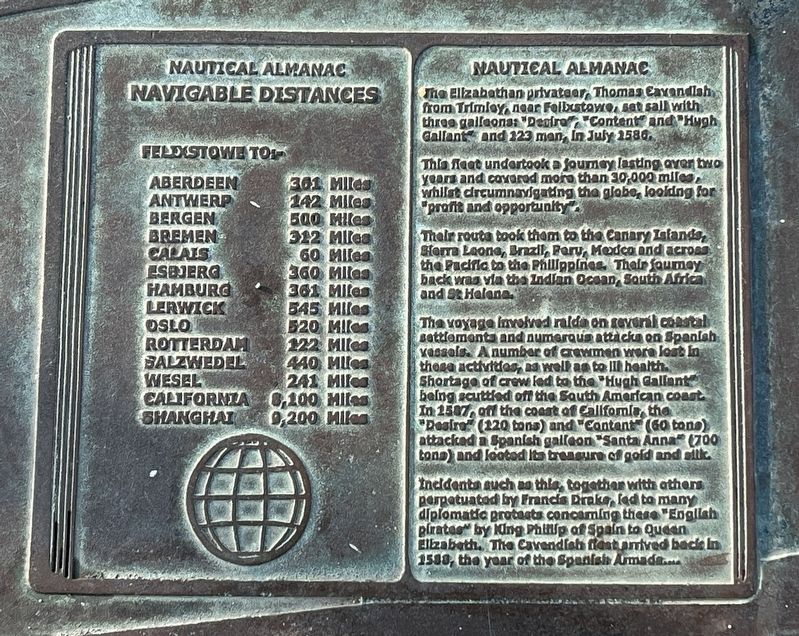
This fleet undertook a journey lasting over two years and covered more than 30,000 miles whilst circumnavigating the globe, looking for "profit and opportunity".
Their route took them to the Canary Islands, Sierra Leone, Brazil, Peru, Mexico and across the Pacific to the Philippines. Their journey back was via the Indian Ocean, South Africa and St Helena.
The voyage involved raids on several coastal settlements and numerous attacks on Spanish vessels. A number of crewmen were lost in these activities, as well as to ill health. Shortage of crew led to the "Hugh Gallant" being scuttled off the South American coast. In 1587 off the coast of California, the "Desire" (120 tons) and "Content (60 tons) attacked a Spanish galleon "Santa Anna" (700 tons) and looted its treasure of gold and silk.
Incidents such as this, together with others perpetuated by Francis Drake, led to many diplomatic protests concerning these "English pirates" by King Phillip
this page online
Topics. This historical marker is listed in these topic lists: Exploration • Waterways & Vessels. A significant historical year for this entry is 1580.
Location. 51° 57.587′ N, 1° 20.937′ E. Marker is in Felixstowe, England, in Suffolk. It is on Wolsey Gardens, on the left when traveling west. The marker is set in the pavement at a small lookout area facing the sea. Touch for map. Marker is at or near this postal address: 3 Wolsey Gardens, Felixstowe, England IP11 2AF, United Kingdom. Touch for directions.

Regionally, this marker is in East Anglia. Globally, it is on the Atlantic Ocean, in the North Atlantic Region, in Europe, in Atlantic Europe, on one of the British Isles, in the Western World, and in the Anglosphere. Historically, it finds itself in what was once the Roman Empire.
Other nearby markers. At least 8 other markers are within 18 kilometers of this marker, measured as the crow flies: Felixstowe Seafront Gardens (approx. 0.3 kilometers away); The Deben Valley (approx. 14.7 kilometers away); Thomas Seckford
Photographed by Ray Gurganus, April 21, 2026
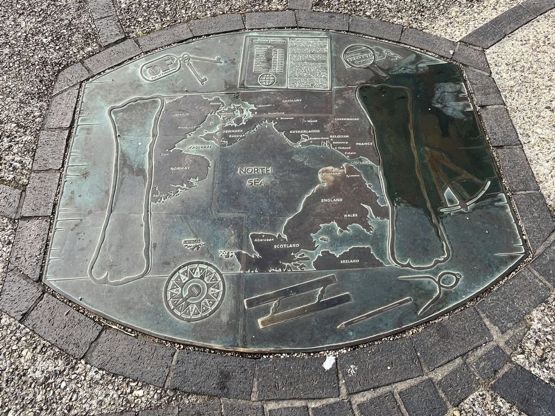
2. Nautical Almanac Marker
Also see . . . Thomas Cavendish (Wikipedia). Overview:
Sir Thomas Cavendish (1560 – May 1592) was an English explorer and privateer known as "The Navigator" because he was the first to deliberately attempt to emulate Sir Francis Drake, raiding Spanish towns and ships in the Pacific and then returning by circumnavigating the globe. Though Magellan-Elcano, Loaísa, Drake, and Loyola had all preceded him in circumnavigating the globe, Cavendish's own successful voyage, between 1586 and 1588, was the first deliberately planned circumnavigation. It made him rich from captured Spanish gold, silk, and treasure from the Pacific and the Philippines, with his richest prize being the 600-ton Manila galleon Santa Ana (also called Santa Anna). He was knighted by Queen Elizabeth I of England after his return. He later set out for a second raid and circumnavigation but was not as fortunate and died at sea in 1592, at the age of 31.(Submitted on July 9, 2026.)
Credits. This page was last revised on July 9, 2026. It was originally submitted on July 9, 2026, by Ray Gurganus of Washington, District of Columbia. This page has been viewed 9 times since then. Photos: 1, 2. submitted on July 9, 2026, by Ray Gurganus of Washington, District of Columbia. • Andrew Ruppenstein was the editor who published this page.
