Marker Logo
THE HISTORICAL
MARKER DATABASE
“Bite-Size Bits of Local, National, and Global History”
Fort Chiswell in Wythe County, Virginia — The American South (Mid-Atlantic)
 

Lead Mines


Lead Mines Marker image. Click for full size.
Photographed by Devry Becker Jones (CC0), July 4, 2026
1. Lead Mines Marker
Inscription. Col. John Chiswell is credited with discovering a lead deposit along the New River, about seven miles south of here, late in the 1750s. With partners he established mines and a smelting operation. Enslaved laborers were a vital part of the workforce. The mines, leased by Virginia during the Revolutionary War, supplied lead to the Continental army. Moses Austin, father of Stephen F. Austin, ran the mines during the 1790s, and the town of Austinville grew up nearby. The mines supplied the Confederacy and were destroyed by Union forces on 17 Dec. 1764. Rebuilt, they were again destroyed in April 1865. After the Civil War, zinc replaced lead as the primary resource extracted here.
 
Erected 2016 by Department of Historic Resources. (Marker Number K-39.)
 
Topics and series. This historical marker is listed in these topic lists: Industry & CommerceNatural ResourcesWar, US CivilWar, US Revolutionary. In addition, it is included in the Virginia Department of Historic Resources (DHR) series list. A significant historical month for this entry is April 1865.
 
Location. 36° 56.645′ N, 80° 56.843′ W. Marker is in Fort
Paid Advertisement
Click or scan to see
this page online
Chiswell, Virginia, in Wythe County. It is on Fort Chiswell Road (U.S. 52) south of Chapman Road (County Road F-042), on the right when traveling south. Touch for map. Marker is at or near this postal address: 118 Fort Chiswell Rd, Max Meadows VA 24360, United States of America. Touch for directions.

Regionally, this marker is in Southwest Virginia and in the Blue Ridge Highlands. It is also in the American South, specifically in the Upper South, in Appalachia, and specifically in Southern Appalachia. Globally, it is in North America, the Western Hemisphere, the Western World, and the Anglosphere. Historically, it finds itself in what was once the territory of the Mississippian Culture, one of the original Thirteen Colonies, one of the Confederate States of America, and the Antebellum South.

Other nearby markers. At least 8 other markers are within 7 miles of this marker, measured as the crow flies: Anchor and Hope Plantation (within shouting distance of this marker); Fort Chiswell (approx. 0.8 miles away); Wilderness Road (approx. 0.8 miles away); Fincastle County (approx. 4.7 miles away); Wythe County Poorhouse Farm
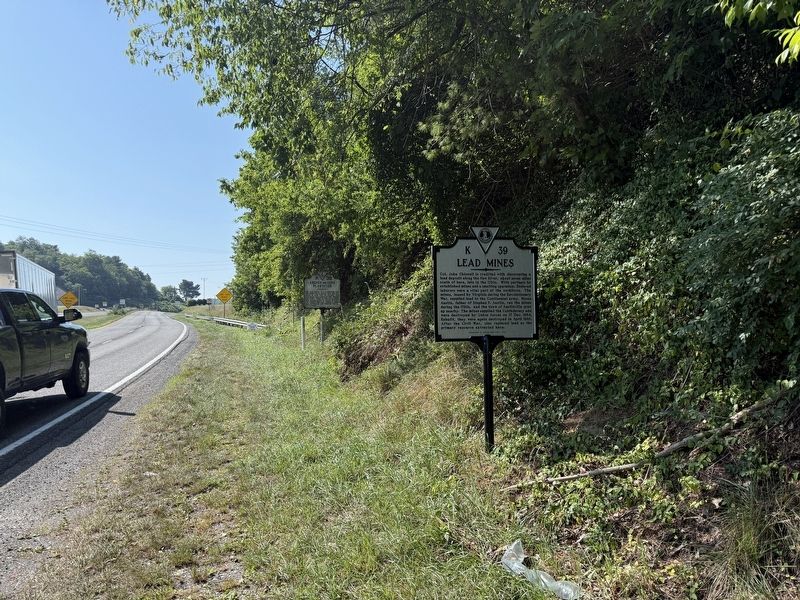
Lead Mines Marker image. Click for full size.
Photographed by Devry Becker Jones (CC0), July 4, 2026
2. Lead Mines Marker
(approx. 5.1 miles away); New River (approx. 6.1 miles away); To Mark The Site of The Lead Mines (approx. 6.1 miles away); Walter Crockett (approx. 6.2 miles away). Touch for a list and map of all markers in Fort Chiswell.
 
Another marker is no longer nearby. Lead Mines (was within shouting distance of this marker but has been replaced with another marker now near it).
 
 
Credits. This page was last revised on July 10, 2026. It was originally submitted on July 10, 2026, by Devry Becker Jones of Washington, District of Columbia. This page has been viewed 10 times since then. Photos:   1, 2. submitted on July 10, 2026, by Devry Becker Jones of Washington, District of Columbia.

m=305287

CeraNet Cloud Computing sponsors the Historical Marker Database.
This website earns income from purchases you make after using our links to Amazon.com. We appreciate your support.
Paid Advertisement
Jul. 20, 2026
