New Liskeard in Temiskaming Shores in Timiskaming District, Ontario — Central Canada (North America)
Northern Farm Country
⎯⎯⎯
Région agricole septentrionale

Photographed by Cosmos Mariner, June 2, 2022
1. Northern Farm Country / Région agricole septentrionale Marker

As with many northern Ontario towns, the Town of New Liskeard was shaped by geography and geology. In the wake of the glaciation era, some 10,000 years ago, rich deposits of clay and top soil settled on the north shore of Lake Temiskaming in what has become known as the Little Clay Belt. The geography of this agricultural landscape forms a large inverted triangle with its apex at the town of New Liskeard.
Despite its northern locale, the Little Clay Belt is a rich agricultural area producing excellent yields of grains and other crops, and supporting a large dairy and beef cattle industry. Thus, New Liskeard is ideally situated as the commercial and industrial hub for farming areas north of Lake Temiskaming. Haileybury, its neighbour to the south is the administrative centre for the region with a court house, jail and government offices, and nearby Cobalt has become a mining town since silver was discovered there in 1903.
[image captions]
• wheat, Ottawa River headwaters, holstein cow, rural New Liskeard, Wabi River.
À l'instar de bien d'autres
this page online
En dépit de sa situation septentrionale, la zone de Little Clay est une riche terre agricole produisant d'excellentes récoltes de céréales et d'autres cultures et soutenant une importante industrie laitière et d'élevage bovin. Par conséquent, New Liskeard est le noyau commercial et industriel des régions agricoles au nord du lac Temiskaming. Au sud, se trouve Haileybury, la ville voisine qui, en tant que centre administratif, est dotée d'un palais de justice, d'une prison et de bureaux du gouvernement. Tout près, Cobalt s'est transformé en une ville minière depuis la découverte d'argent en 1903.
[légendes d'images]
• blé
• réservoir d'amont sur la rivière des Outaouais
• vache de race Holstein
• la campagne de New Liskeard
• la rivière
Photographed by Cosmos Mariner, June 2, 2022
2. Northern Farm Country / Région agricole septentrionale Marker
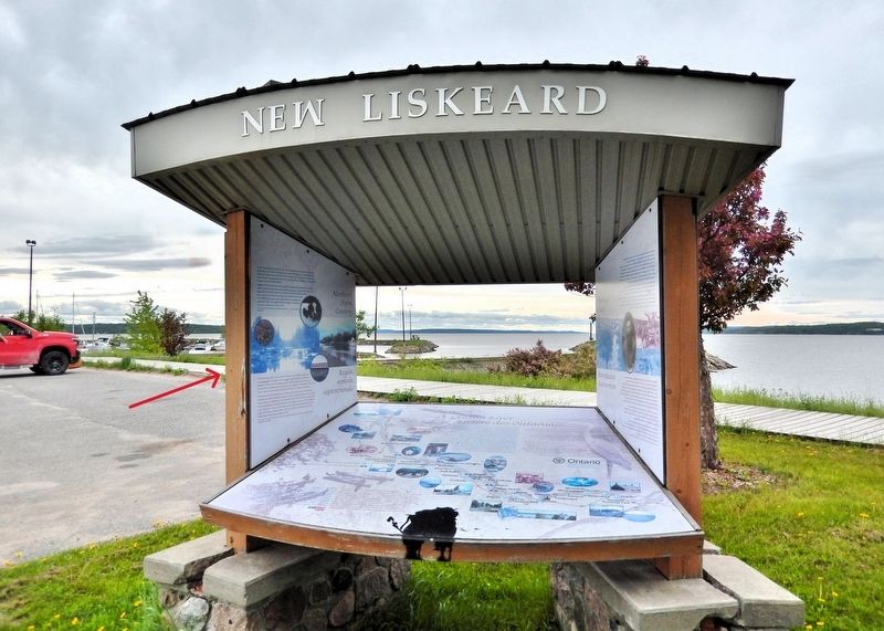
The marker is on the left side of this interpretive kiosk near the New Liskeard Waterfront Marina.
Topics. This historical marker is listed in these topic lists: Agriculture • Industry & Commerce. A significant historical year for this entry is 1903.
Location. 47° 30.377′ N, 79° 40.108′ W. Marker is in Temiskaming Shores, Ontario, in Timiskaming District. It is in New Liskeard. It is on Riverside Drive 0.2 kilometers east of May Street South, on the right when traveling east. The marker is beside the parking lot on the west side of the New Liskeard Waterfront Marina. Touch for map. Marker is at or near this postal address: 199 Riverside Drive, Temiskaming Shores ON P0J 1P0, Canada. Touch for directions.

Regionally, this marker is in Northeastern Ontario and specifically in Northern Ontario. It is also in Central Canada. Globally, it is in North America, the Great North Woods, the Western Hemisphere, the Western World, and the Anglosphere. Historically, it finds itself in what was once a British colony, the Viceroyalty of New France, the Haudenosaunee (Iroquois) Confederacy, and Rupert’s Land.
Other nearby markers. At least 8 other markers are within walking distance of this marker: Ottawa River / Rivière des Outaouais (here, next to this marker); Staking a Claim / Revendication d'un territoire (here, next to this marker); Lake Temiskaming (about 90 meters away, measured in a direct line); Founding of New Liskeard / Fondation de New Liskeard (about 210 meters away); The New Liskeard Public Library Building (approx. 0.4 kilometers away); New Liskeard Library / La bibliothèque de New Liskeard (approx. 0.4 kilometers away); World War I and World War II Memorial (approx. 0.4 kilometers away); This Park Dedicated to F/O Alfred Holmes D.F.C. (approx. 0.4 kilometers away). Touch for a list and map of all markers in Temiskaming Shores.
Also see . . . Clay Belt (Wikipedia).
Excerpt: The Clay Belt is a vast tract of fertile soil in Canada, stretching across Cochrane District in Ontario and Abitibi County in Quebec, covering 180,000 square km in total with 120,000 square km of that in Ontario. It is generally subdivided into the Great Clay Belt to the north running eastward from Kapuskasing, past Lake Abitibi and on to Amos, and the V-shaped Lesser Clay Belt to its south, running from Englehart down to the Wabi River to the northern tip of Lake Timiskaming, and long the eastern side of Timiskaming and back up to Rouyn-Noranda. The Clay Belt is the result of the draining of the Glacial Lake Ojibway around 8,200 BP, whose lakebed sediment forms the modern landform. The Clay Belt is surrounded by the Canadian Shield, forming an island of “southern flatlands” amid the hilly and rocky surroundings.(Submitted on July 11, 2026, by Cosmos Mariner of Cape Canaveral, Florida.)The area was first mapped by Dr. Robert Bell and his assistant Arthur Barlow in 1887, as part of a wider series of surveys in northern Ontario. In 1899, Barlow wrote a report on the geology and natural resources of the area, which suggested that the rich belt of clay that lay north of Lake Temiskaming was ideal for agricultural settlement. The area has rich clay soil, in contrast to the low fertility of the muskeg and exposed bedrock shield surrounding it. Moreover, the combination of its general fertility, flat topography, high water table and relative accessibility to an extensive network of roads for logging and mining make it suitable for some types of farming.
Credits. This page was last revised on July 11, 2026. It was originally submitted on July 10, 2026, by Cosmos Mariner of Cape Canaveral, Florida. This page has been viewed 7 times since then. Photos: 1, 2. submitted on July 10, 2026, by Cosmos Mariner of Cape Canaveral, Florida.
