
Near Put-in-Bay in Ottawa County, Ohio — The American Midwest (Great Lakes)
South Bass Island Light
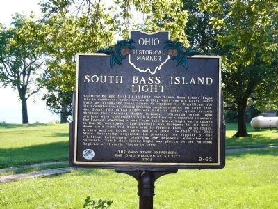
Photographed by Dale K. Benington, August 17, 2003
1. South Bass Island Light Marker
Erected 2002 by The Ohio State University and The Ohio Historical Society. (Marker Number 9-62.)
Topics and series. This historical marker is listed in these topic lists: Communications • Education • Landmarks • Waterways & Vessels.
this page online
Location. Marker is missing. It was located near 41° 37.733′ N, 82° 50.436′ W. Marker was near Put-in-Bay, Ohio, in Ottawa County. It was on Langram Road, on the left when traveling west. This historical marker is on the southwestern tip of South Bass Island, just east of the lighthouse. If you take the Miller Ferry boat service from Catawba Island to South Bass Island, once you arrive on the island, immediately proceed to the first street (Langram Road), turn left onto Langram and travel west for about 2 to 3 tenths of a mile and you will arrive at both the lighthouse and the historical marker. Touch for map. Marker was at or near this postal address: 2360 Langram Road, Put in Bay OH 43456, United States of America. Touch for directions.

Regionally, this marker was on the Lake Erie Shore and in the Toledo Metropolitan Area. It was also in the American Midwest and in the Corn Belt. Globally, it was in North America, on the Great Lakes, in the Western Hemisphere,
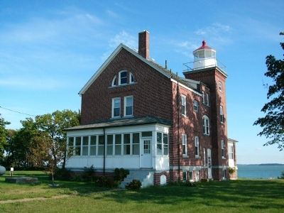
Photographed by Dale K. Benington, August 17, 2003
2. South Bass Island Light
View of backside of lighthouse looking southward, with a view of Lake Erie, just beyond the lighthouse.
Other nearby markers. At least 8 other markers are within 2 miles of this location, measured as the crow flies: Call to Duty Salute (approx. 0.4 miles away); a different marker also named Call to Duty Salute (approx. 1.1 miles away); Ohio Department of Natural Resources 75th Anniversary (approx. 1.9 miles away); The Doller House (approx. 2 miles away); Joseph (Jose) DeRivera St. Jurgo (approx. 2 miles away); Oelschlager's Dry Goods Store (approx. 2 miles away); Within This Enclosure (approx. 2 miles away); Joseph De Rivera St. Jurgo, 1813-1889 (approx. 2.1 miles away). Touch for a list and map of all markers in Put-in-Bay.
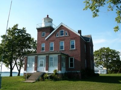
Photographed by Dale K. Benington, August 17, 2003
3. South Bass Island Light
View looking northward of the frontside of the lighthouse.
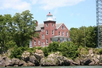
Photographed by Dale K. Benington, July 5, 2006
4. South Bass Island Light
View of the lighthouse as seen from a boat in the water sitting just offshore from the lighthouse.
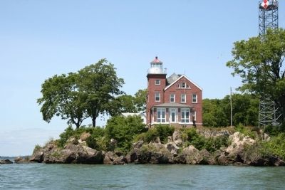
Photographed by Dale K. Benington, July 5, 2006
5. South Bass Island Light Marker
Another view of lighthouse, from the boat sitting in the waters of Lake Erie, just offshore from the lighthouse.
Credits. This page was last revised on July 13, 2026. It was originally submitted on March 1, 2010, by Dale K. Benington of Toledo, Ohio. This page has been viewed 1,013 times since then and 32 times this year. Last updated on July 11, 2026, by Craig Doda of Napoleon, Ohio. Photos: 1, 2, 3, 4, 5. submitted on March 1, 2010, by Dale K. Benington of Toledo, Ohio. • Devry Becker Jones was the editor who published this page.
