
Edgewood in Northeast Washington in Washington, District of Columbia — The American Northeast (Mid-Atlantic)
Grove Karl Gilbert
6-May-1843
| — | 1-May-1918 | — |
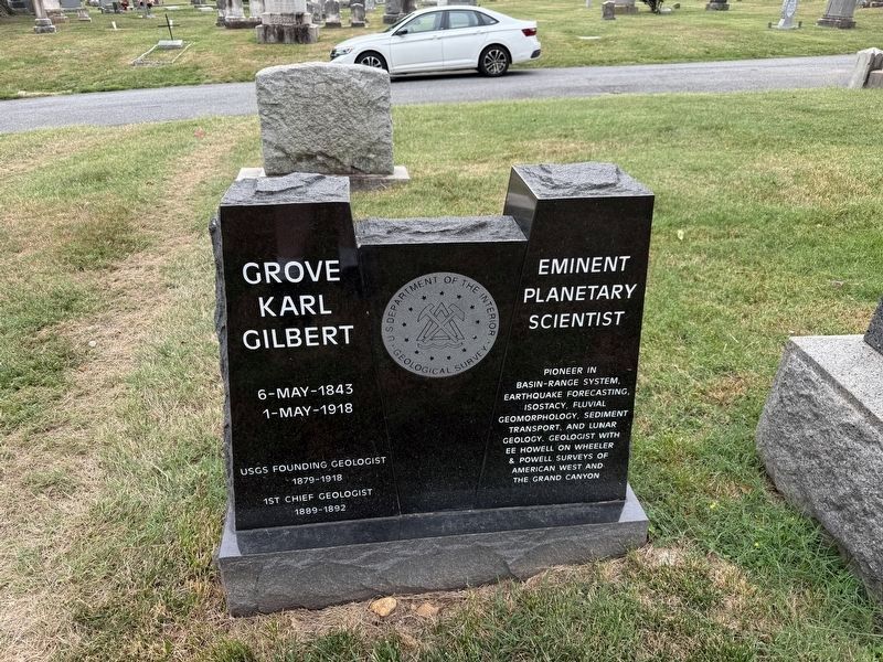
USGS Founding Geologist, 1879 - 1918 • 1st Chief Geologist, 1889 - 1892
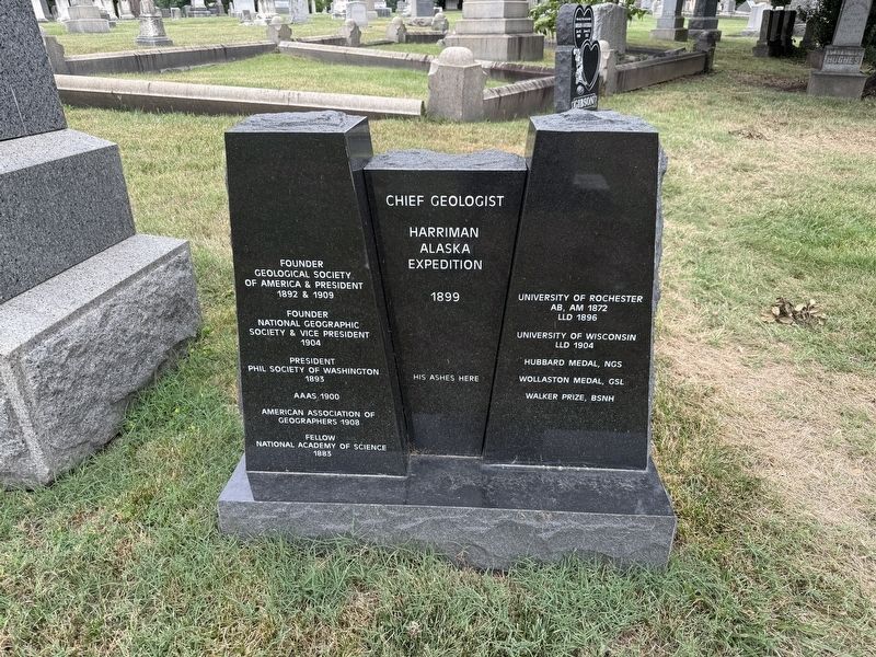
His ashes here
Founder,Geological Society of America & President, 1892 & 1909 • Founder, National Geographic Society & Vice President, 1904 • President, Phil Society of Washington, 1893 • AAAS 1900 • American Association of Geographers 1908 • Fellow, National Academy of Science, 1883
University of Rochester, AB, AM 1872, LLD 1896 • University of Wisconsin LLD 1904 • Hubbard Medal, NGS • Wollaston Medal, GSL • Walker Prize, BSNH
Erected by Geological Survey, U.S. Department of the Interior.
Topics. This historical marker is listed in these topic lists: Cemeteries & Burial Sites • Charity & Public Work • Exploration • Settlements & Settlers. A significant historical year for this entry is 1879.
Location. 38° 55.331′ N, 77° 0.332′ W.
this page online

Regionally, this marker is in the Washington Metropolitan Area. It is also in the American Northeast, in the Upper South, in the Mid-Atlantic, in the Tidewater, and in the Chesapeake Bay Region. Globally, it is in North America, the Western Hemisphere, the Western World, and the Anglosphere.
Other nearby markers. At least 8 other markers are within walking distance of this marker: The Glenwood Cemetery Chapel (within shouting distance of this marker); Prospect Hill Cemetery (approx. ¼ mile away); Filter Bed (approx. ¼ mile away); Central to the System / How It Worked (approx. ¼ mile away); Prospect Hill (approx. ¼ mile away); Sand Washer (approx. 0.3 miles away); Regulator House (approx. 0.3 miles away); Green Space / Sustaining the City
Credits. This page was last revised on July 24, 2026. It was originally submitted on July 11, 2026, by Devry Becker Jones of Washington, District of Columbia. This page has been viewed 19 times since then. Photos: 1, 2, 3. submitted on July 11, 2026, by Devry Becker Jones of Washington, District of Columbia.
