Maryborough in Portlaoise in County Laois, Leinster, Ireland — Mid-East (and Dublin)
Burial Ridge of Maryborough
| — | Portlaoise Heritage Trail / Slí Oidhreachta Port Laoise | — |
Photographed by Ian Lefkowitz, May 17, 2026
1. Burial Ridge of Maryborough Marker
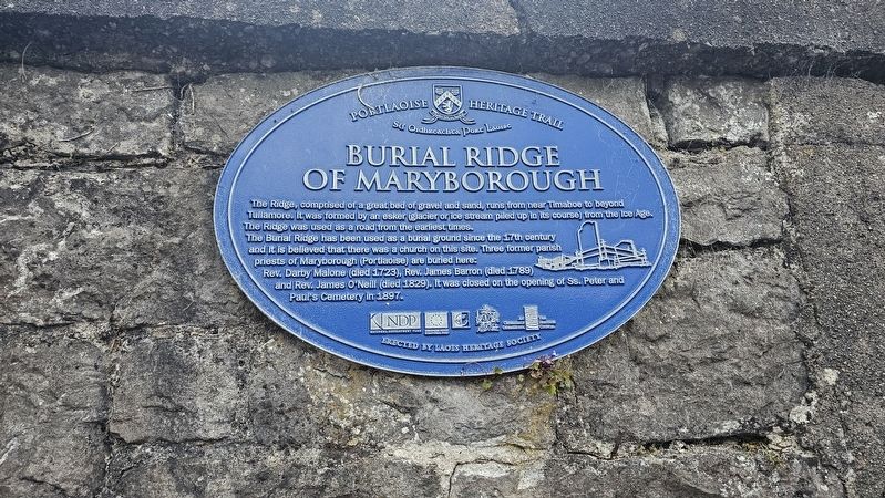
The Burial Ridge has been used as a burial ground since the 17th century and it is believed that there was a church on this site. Three former parish priests of Maryborough (Portlaoise) are buried here: Rev. Darby Malone (died 1723), Rev. James Barron (died 1789) and Rev. James O’Neill (died 1829). It was closed on the opening of Ss. Peter and Paul’s Cemetery in 1897.
Erected by Laois Heritage Society.
Topics. This historical marker is listed in these topic lists: Cemeteries & Burial Sites • Religion & Religious Structures.
Location. 53° 2.13′ N, 7° 17.627′ W. Marker is in Portlaoise, Leinster, in County Laois. It is in Maryborough. It is at the intersection of Dublin Road and Millview, on the left when traveling north on Dublin Road. Touch for map. Marker is at or near this postal address: 42 Dublin Rd, Portlaoise, Leinster
this page online

Regionally, it is on the Atlantic Ocean, in the North Atlantic Region, in Europe, on the Island of Ireland, on the Celtic Fringe, in the European Union, in Atlantic Europe, on one of the British Isles, in the Western World, and in the Anglosphere.
Other nearby markers. At least 8 other markers are within walking distance of this marker: Portleix House (within shouting distance of this marker); Bartholomew Mosse (about 180 meters away, measured in a direct line); World War I Centennial Plaque (about 180 meters away); 4th Battalion Leinster Regiment Memorial (about 180 meters away); Irish Veterans Memorial (about 210 meters away); Presentation Convent (about 210 meters away); Portlaoise United Nations Veterans Memorial (about 210 meters away); SS Peter and Paul Church (about 210 meters away). Touch for a list and map of all markers in Portlaoise.
Also see . . . The Ridge of Maryborough (Historic Graves).
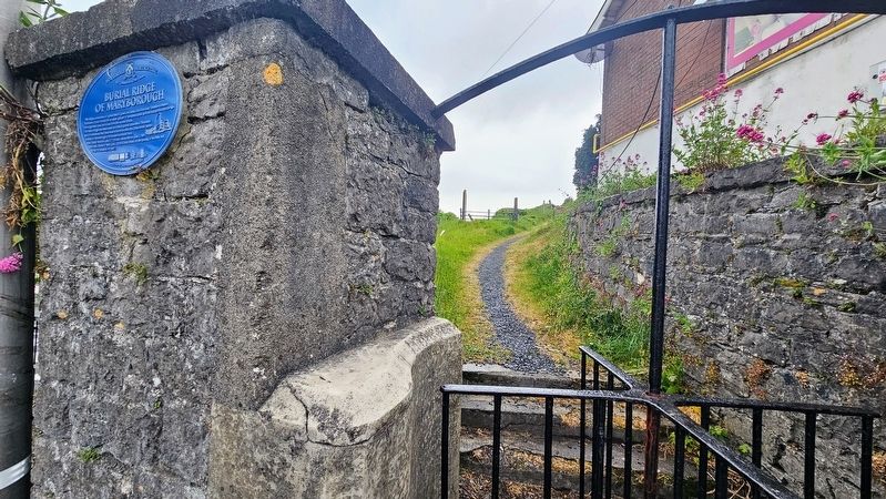
The graveyard is on a steep-sloped esker ridge in Portlaoise town (formerly Maryborough). Graveyard contains no upstanding structures. Local tradition of a church in(Submitted on July 11, 2026, by Ian Lefkowitz of New York, New York.)the vicinity but no visible trace exists.Photographed by Ian Lefkowitz, May 17, 20262. Burial Ridge of Maryborough MarkerThe marker is located next to the entrance to the burial ridge.

Photographed by Ian Lefkowitz, May 17, 2026
3. Burial Ridge of Maryborough
The ridge itself extends from a roundabout. Gravestones can be seen along the ridge.
Credits. This page was last revised on July 15, 2026. It was originally submitted on July 11, 2026, by Ian Lefkowitz of New York, New York. This page has been viewed 10 times since then. Photos: 1, 2, 3. submitted on July 11, 2026, by Ian Lefkowitz of New York, New York. • Andrew Ruppenstein was the editor who published this page.
