
Naval Station Norfolk , Virginia — The American South (Mid-Atlantic)
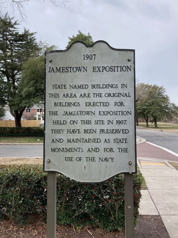
1907 Jamestown Exhibition
2024
1. 1907 Jamestown Exhibition Marker
Topics. This historical marker is listed in these topic lists: Architecture • Entertainment • Science & Medicine. A significant historical year for this entry is 1907.
Location. 36° 57.063′ N, 76° 19.018′ W. Marker is in Norfolk, Virginia. It is in Naval Station Norfolk. It is at the intersection of Dillingham Boulevard and Bacon Avenue, on the left when traveling west on Dillingham Boulevard. Marker is on board the Naval Station. A DoD identification card is required to access the base. Touch for map. Marker is at or near this postal address: 405 Dillingham Boulevard, Norfolk VA 23511, United States of America. Touch for directions.

Regionally, this marker is in Virginia’s Hampton Roads, specifically in Coastal Virginia, and in the Hampton Roads Metropolitan Area. It is also in the American South, specifically in the Upper South, in the Tidewater, and on the Eastern Seaboard. Globally, it
this page online
Other nearby markers. At least 8 other markers are within 2 miles of this marker, measured as the crow flies: Birthplace of Naval Aviation (approx. 0.3 miles away); USS Cole DDG 67 (approx. 0.3 miles away); Navy Mess Attendant School (approx. 0.3 miles away); USS Cole (DDG 67) Memorial (approx. 0.3 miles away); Virginia and Monitor (approx. 0.4 miles away); USS Iowa (approx. 0.4 miles away); We remember turret two ... (approx. 0.4 miles away); U.S. Submarine Veterans W.W. II Memorial (approx. 1.1 miles away). Touch for a list and map of all markers in Norfolk.
More about this marker. The house whose lawn includes this marker is the Delaware House, one of the houses built for the exposition - and one of nine "state" houses on "Admiral's Row" that remain in their original location. Another seven, the ones east of Farragut
2024
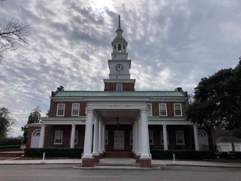
2. Pennsylvania House
Built by the state of Pennsylvania for the exposition, this house is a scaled down replica of Independence Hall in Philadelphia (though with a porch added - and the two wings enclosed - in the nearly 120 years since its construction). It is now used as a meeting hall, unlike the other houses from the expo which are largely used as officer housing. Pennsylvania House is two blocks east of the marker.
Regarding 1907 Jamestown Exhibition. The Jamestown Expo houses are one of the main points of historic interest included in the Naval Station Bus Tours (in which public visitors do not disembark on base, but are driven around on a Navy bus with a guide). The Jamestown Expo predated the naval station; in fact, the presence of the infrastructure put in place for the Expo was a contributing factor to the selection of Sewell's Point for the naval base in the early years of World War I. The Golf Course north of Admiral's Row, including Iowa Point, is all fill - originally, Dillingham Blvd would have fronted the harbor. The marine used by the MWR sailing center is the basin originally built for the exposition, which allowed visitors to walk on a pier out into the harbor. Much of the rip-rap along the shore is the remnants of destroyed portions of the Expo's shorefront features. Other remaining buildings from the Expo include the wings flanking Building N-26, the arts building to the immediate west (now the Gymnasium, N-24), the Walter Baker Company Chocolate
Photographed by Jamestown A&Y Co., circa 1907
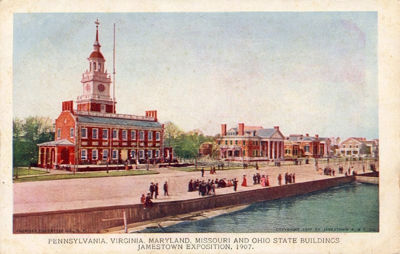
3. 1907 Jamestown Exposition Postcard
Featuring the Pennsylvania Building (before the porch was added, and with the wings open as originally built - much closer to the appearance of the Philadelphian original), with the Virginia, Maryland, and Missouri houses running into the distance from right to left. The Golf Course now occupies the point where this photo was taken. What became Dillingham Boulevard is the road in the foreground. Public Domain historic postcard.
Also see . . . Department of Historic Resources - Jamestown Exposition Buildings. This link includes the nomination form for National Register of Historic Places completed for listing the buildings referenced in the marker. (Submitted on July 11, 2026.)
Credits. This page was last revised on July 13, 2026. It was originally submitted on July 11, 2026. This page has been viewed 14 times since then. Photos: 1, 2, 3. submitted on July 11, 2026. • Bernard Fisher was the editor who published this page.
