Heiloo, North Holland, Netherlands — Northwestern Europe
Runxputte
⎯⎯⎯
The “Runx” Well
Photographed by Andrew Ruppenstein, May 31, 2026
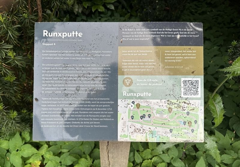
1. Runxputte / The “Runx” Well Marker

De Genadekapel en 't Putje vormen het hart van het Heiligdom. Bezoekers komen speciaal voor het heilzame water uit 't Putje. Z drinken het water en anderen nemen het water in een flesje mee naar huis.
De ontstaansgeschiedenis guat terug naar het jaar 1400. Toen voer ec schipper voor de kust van Egmond. Hij kwam in een zware storm terecht. De man verkeerde in doodsnood en hoorde een vrouwenstem die zei: 'Als ge mij gaat eren zal de wind gaan keren. De schipper deed een belofte. Hij zou eer kapel voor Moriu bouwen, als hij veilig aan land zou komen. Op hetzelfde moment werd een houten Mariabeeld gevonden op een akker. Het beeld keerde op miraculeuze wijze terug naar de vindplek. De gebeurtenis bereikte de schipper. Dit signaal van Mania was voor de schipper duidelijk en hij bouwde op deze pisk de kapel.
Tijdens de Tachtigjarige Oorlog, ofwel De Opstand van het protestantse Nederland tegen het katholieke Spanje (1568-1648), werd de oorspronkelijke kapei verwoest. In 1637 werd met de resten van de kapel de put gedicht. Tijdens het Hoogfeest Maria Onbevlekte Ontvangenis op 8 december 1713 kwam
this page online
(Bible verse and discussion on the right half of the marker not transcribed)
(English translation:)
The “Runx” Well
The Chapel of Grace and 't Putje (“the Well”) form the heart of the shrine. Visitors come specifically for the healing water from the well; some drink it on the spot, while others take it home in a bottle.
The story of its origin dates back to the year 1400. A skipper was sailing off the coast of Egmond when he was caught in a severe storm. Fearing for his life, he heard a woman's voice say: "If you honor me, the wind will turn." The skipper made a vow: he would build a chapel for Mary if he reached the shore safely. At that same moment, a wooden statue of Mary was discovered in a field. The statue miraculously returned to the spot where it had been found. News of this
Photographed by Andrew Ruppenstein, May 31, 2026
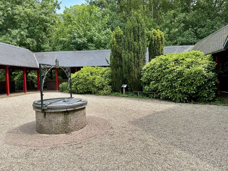
2. Runxputte / The “Runx” Well Marker - wide view
The well is visible here in the foreground on the left, with the marker visible in the middle distance by some shrubs.
During the Eighty Years' War — the revolt of the Protestant Netherlands against Catholic Spain (1568–1648) — the original chapel was destroyed. In 1637, the well was filled in using the chapel's ruins. On December 8, 1713 — the Solemnity of the Immaculate Conception — water gushed forcefully from the well. Cattle suffering from rinderpest that drank the water survived the disease. The miracle of the Runxputte drew massive crowds of people. In 1714, the States of Holland and West Friesland ordered the well to be filled in again. Despite the well being sealed, pilgrimages and devotion to Onze Lieve Vrouw ter Nood (“Our Lady in Need”) continued.
(Marker Number 8.)
Topics. This historical marker is listed in these topic lists: Man-Made Features • Religion & Religious Structures. A significant historical date for this entry is December 8, 1713.
Location. 52° 35.032′ N, 4° 41.225′ E. Marker is in Heiloo, Noord-Holland (North Holland). It is on Kapellaan. The marker is located on the grounds of the Onze Lieve Vrouw ter Nood chapel complex, next
Photographed by Andrew Ruppenstein, May 31, 2026
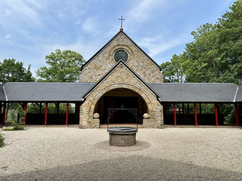
3. View of Chapel and Well

Regionally, it is in Europe, the European Union, Atlantic Europe, the Benelux Low Countries, the Schengen Area, Western Europe, and the Western World. Historically, it finds itself in what was once the Holy Roman Empire.
Other nearby markers. At least 8 other markers are within 5 kilometers of this marker, measured as the crow flies: Genadekapel / Chapel of Grace (here, next to this marker); Onze lieve Vrouwe ter Nood / Our Lady in Need (within shouting distance of this marker); Heilige Willibrordus / St. Willibrord (within shouting distance of this marker); Jan Brasser (approx. 0.8 kilometers away); Het Schuilveld / The Sheltering Field (approx. 0.8 kilometers away); Hervormde Kerk Limmen / Reformed Church of Limmen (approx. 2.2 kilometers away); Fusillade Monument Castricum / Castricum Execution Memorial (approx. 2.8 kilometers away); Woonhuis en Stolpboerderij / House and Farmhouse (approx. 4 kilometers away). Touch for a list and map
J.H. Schaefer Kunstchromo, courtesy Noord-Hollands Archief (Inventaris 21763), circa 1905
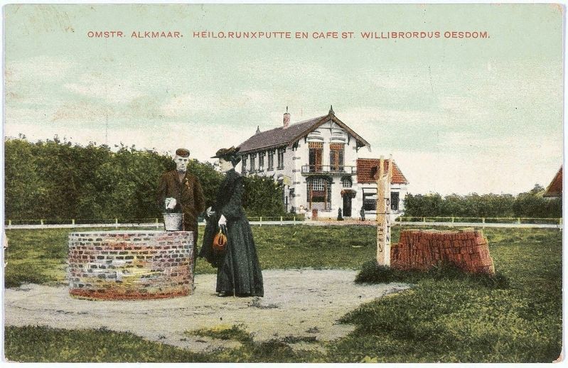
4. Runxputte and Cafe St. Willibrord
Also see . . . Het wonder van de Runxputte (Historiek, in Dutch). Overview (in translation):
A major pilgrimage site has existed near Heiloo since the Middle Ages. Centuries ago, believers flocked there in large numbers because the water from the so-called Runxputte was reputed to be holy. The site became known as the "Lourdes of the Diocese of North Holland." A chapel was built near the well in the fifteenth century but was destroyed by the Geuzen (Dutch rebels). Later, the Onze Lieve Vrouwe ter Nood (Our Lady in Need) shrine was erected on the site. Today, it is the largest Marian pilgrimage site in the Netherlands.(Submitted on July 12, 2026.)
The historic Runxputte may have been mentioned for the first time in an eleventh-century Latin text as puteus Rorikespit dictus (“the well named Roriksput”). In the nineteenth century, sources were cited to prove a connection between the spring and the story of Rorik—a ninth-century Viking chieftain who was granted part of the Frankish Empire as a fief and who, according to some accounts, converted to Christianity. However, there is no concrete evidence linking this Rorik to the well. Similarly, there is no proof of the alleged Marian apparition or the miraculous healing of horses at the well—stories that have circulated for centuries.
It is also unclear exactly when the spring was incorporated into Catholic rites. What is known is that a chapel near the spring was consecrated in 1409, reportedly following the discovery of a small statue of the Virgin Mary. Since the chapel was built, the site's current custodians note that:
“…more Hail Marys have been prayed on this beautiful stretch of land than there are tulips blooming in the surrounding bulb fields.”
The hill where the chapel was built became known as the kruipberg ("crawling hill") because some pilgrims took part in processions on their hands and knees.
Credits. This page was last revised on July 12, 2026. It was originally submitted on July 11, 2026, by Andrew Ruppenstein of Lamorinda, California. This page has been viewed 19 times since then. Photos: 1, 2, 3, 4. submitted on July 11, 2026, by Andrew Ruppenstein of Lamorinda, California.
