Cobalt in Timiskaming District, Ontario — Central Canada (North America)
Sinking Bucket

Photographed by Cosmos Mariner, June 1, 2022
1. Sinking Bucket Marker
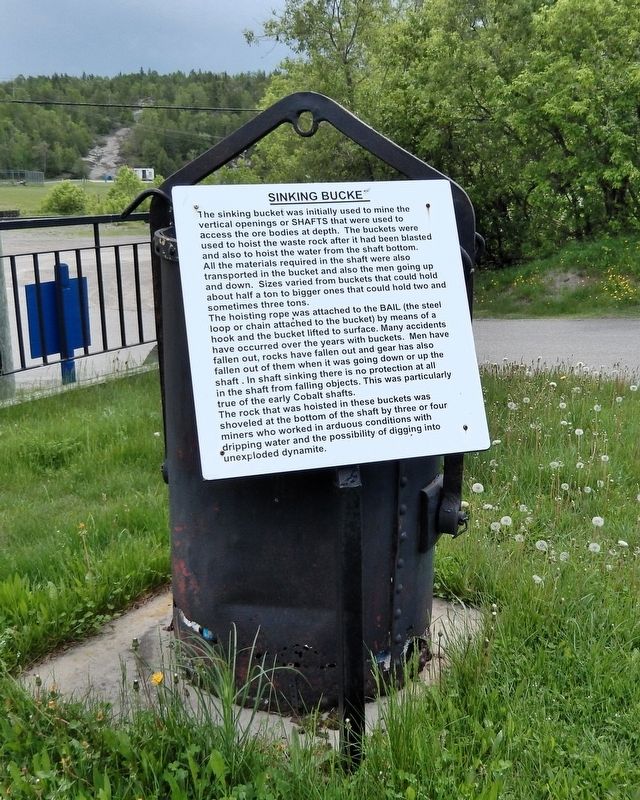
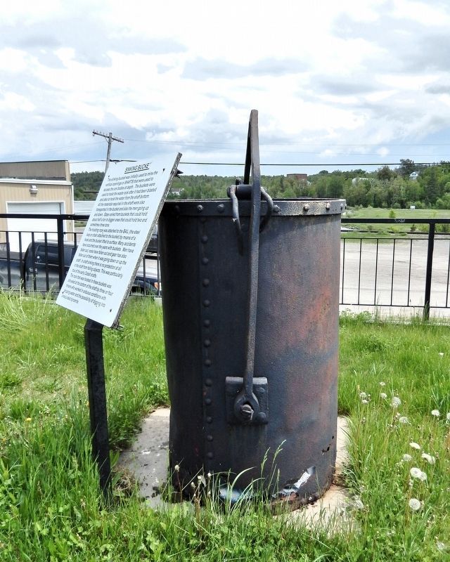
The sinking bucket was initially used to mine the vertical openings or SHAFTS that were used to access the ore bodies at depth. The buckets were used to hoist the waste rock after it had been blasted and also to hoist the water from the shaft bottom. All the materials required in the shaft were also transported in the bucket and also the men going up and down. Sizes varied from buckets that could hold about half a ton to bigger ones that could hold two and sometimes three tons.
The hoisting rope was attached to the BAIL (the steel loop or chain attached to the bucket) by means of a hook and the bucket lifted to surface. Many accidents have occurred over the years with buckets. Men have fallen out, rocks have fallen out and gear has also fallen out of them when it was going down or up the shaft. In shaft sinking there is no protection at all in the shaft from falling objects. This was particularly true of the early Cobalt shafts.
The rock that was hoisted in these buckets was shoveled at the bottom of the shaft by three or four miners who worked in arduous conditions with dripping water and the possibility of digging into
this page online
Topics. This historical marker is listed in this topic list: Industry & Commerce.
Location. 47° 23.724′ N, 79° 41.116′ W. Marker is in Cobalt, Ontario, in Timiskaming District. It can be reached from Silver Street just north of Bunker Lane, on the right when traveling north. The marker is in the interpretive park on the east side of the Pan Silver Headframe. Touch for map. Marker is at or near this postal address: 21 Silver Street, Cobalt ON P0J 1C0, Canada. Touch for directions.

Regionally, this marker is in Northeastern Ontario and specifically in Northern Ontario. It is also in Central Canada. Globally, it is in North America, the Great North Woods, the Western Hemisphere, the Western World, and the Anglosphere. Historically, it finds itself in what was once a British colony, the Viceroyalty of New France, the Haudenosaunee (Iroquois) Confederacy, and Rupert’s Land.
Other nearby markers. At least 8 other markers are within walking distance of this marker: The T & NO Railway / Le service ferroviaire T & NO (here, next to this marker); The Mine Hoist
Photographed by Cosmos Mariner, June 1, 2022
2. Sinking Bucket Marker
Also see . . . Shaft Sinking (Wikipedia).
Excerpt: Shaft mining or shaft sinking is the action of excavating a mine shaft from the top down, where there is initially no access to the bottom. Shaft sinking is one of the most difficult of all mining development methods: restricted space, gravity, groundwater and specialized procedures make the task quite formidable. Shafts may be sunk by conventional drill and blast or mechanized means. Historically, mine shaft sinking has been among the most dangerous of all the mining occupations and the preserve of mining contractors called sinkers. Today shaft sinking contractors are concentrated in Canada, Germany, China and South Africa.(Submitted on July 12, 2026, by Cosmos Mariner of Cape Canaveral, Florida.)
Photographed by Cosmos Mariner, June 1, 2022
3. Sinking Bucket
Credits. This page was last revised on July 12, 2026. It was originally submitted on July 12, 2026, by Cosmos Mariner of Cape Canaveral, Florida. This page has been viewed 11 times since then. Photos: 1, 2, 3. submitted on July 12, 2026, by Cosmos Mariner of Cape Canaveral, Florida.
