Lawrence Township in Mercer County, New Jersey — The American Northeast (Mid-Atlantic)
Province Line
| — | Lawrence-Hopewell Trail | — |

Photographed by Richard Peterson, July 12, 2026
1. Province Line Marker
As you hike or bike the LHT alongside Province Line Road, you are following in the footsteps of Surveyor-General George Keith. For two months in the spring of 1687, Keith surveyed a line through the wilderness of colonial New Jersey in an attempt to settle a land dispute between its English proprietors. The boundary he established, referred to as the Keith Line or the Province Line, for many years divided New Jersey into the two provinces of East Jersey and West Jersey.
Imagine a time when Europeans considered New Jersey virgin land, owned by divine right by the first monarch who could claim it and hold onto it. The English land grab started in 1664 when James, Duke of York, the brother of King Charles II, seized the New Netherland colony from the Dutch West India Company. James granted New Jersey to two courtiers, Sir George Carteret and John, Lord Berkeley, the first proprietors. They named their colony Jersey, after the Isle of Jersey in the English Channel.
In 1676, Carteret and four men who had bought Berkeley’s original half share agreed that a boundary splitting the colony in two should extend northwesterly from
this page online
The division of East and West Jersey was a recipe for confusion. The proprietors sold and subdivided land, never having set foot in the Jerseys and making use of sketchy maps. In 1686, Robert Barclay, the first governor of East Jersey, with the tacit approval of Dr. Daniel Coxe, the absentee governor of West Jersey, appointed George Keith to survey the dividing line between the two provinces. Starting in Little Egg Harbor, Keith completed about two thirds of his mission before being called to a halt. The Province Line was trending too far west and would rob the West Jersey proprietors of millions of acres. As a stopgap solution, the boundary was re-routed to the east, following major stream courses to a point on the New York border.
New Jersey might have remained two separate colonies but for the strained relations among the proprietors, the authorities back in England and the settlers over land rents and disputed deeds. In 1702, amidst

Photographed by Richard Peterson, July 12, 2026
2. Province Line Marker
(image captions)
— Daniel Coxe, Governor of West Jersey
— Robert Barclay, Governor of East Jersey
— George Keith, Surveyor-General
— Theodolite and Gunter's Chain (colonialinstruments.com and Antique Nauticals India).
— Colonial surveying tools relied on basic geometry and astronomy. Metal chains were stretched out on the ground to measure distances, magnetic compasses determined direction, and theodolites measured angles. The tools could be beautifully crafted, yet inaccurate, introducing large errors by the standards of modern land survey.
— Background images: Details from “Doodle Plat” of Land Granted to William LeFew, circa 1784 (Georgia Archives).
This
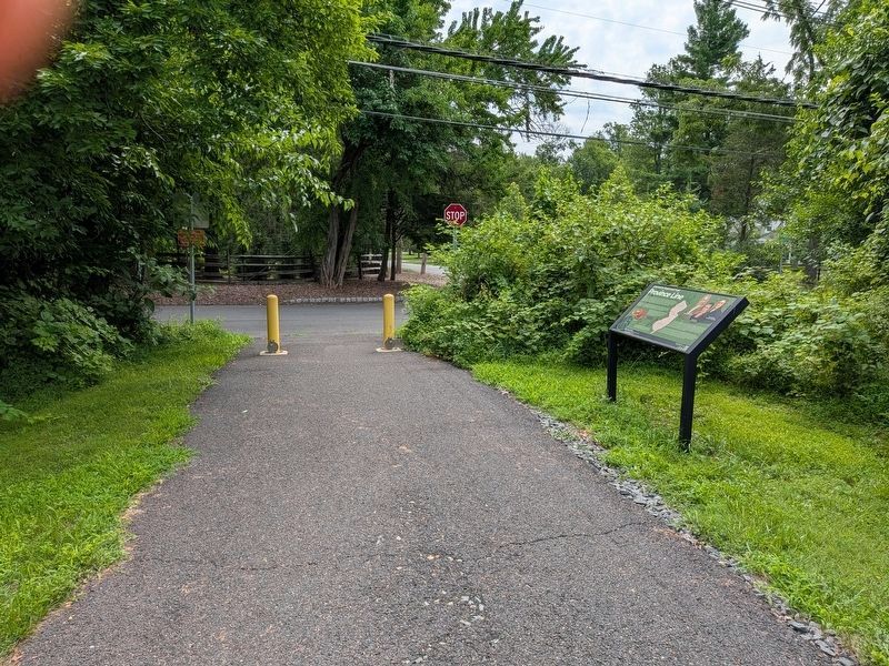
Photographed by Richard Peterson, July 12, 2026
3. Province Line Marker on the Lawrence-Hopewell Trail
Interested in the History of the Lawrence-Hopewell Trail? Visit lhtrail.org/history
Topics. This historical marker is listed in these topic lists: Colonial Era • Settlements & Settlers. A significant historical year for this entry is 1687.
Location. 40° 20.763′ N, 74° 42.396′ W. Marker is in Lawrence Township, New Jersey, in Mercer County. It is at the intersection of Province Line Road and Audubon Lane, on the right when traveling south on Province Line Road. Located on the Lawrence-Hopewell Trail where it joins Province Line Road. Touch for map. Marker is in this post office area: Princeton NJ 08540, United States of America. Touch for directions.

Regionally, this marker is in Central Jersey and in Greater Princeton. It is also in the American Northeast and in the Mid-Atlantic. Globally, it is in North America, the Western Hemisphere, the Western World, and the Anglosphere. Historically, it finds itself in what was once New Netherland and also one of the original Thirteen Colonies.
Other nearby markers. At least 8 other markers are within 2 miles of this marker, measured as the crow flies: Educational Testing Service HQ (approx. 0.4 miles away); A Mill and a Bridge in the Back Country (approx. half a mile away); Washington’s Spring (approx. 1.7 miles away); Olden House (approx. 1.7 miles away); Burial Site of those who fell in the Battle of Princeton (approx. 1.8 miles away); From Indian Path to Asphalt Highway (approx. 1.8 miles away); Historic Portico Preservation and Rebuilding (approx. 1.8 miles away); This is Hallowed Ground (approx. 1.8 miles away). Touch for a list and map of all markers in Lawrence Township.
Also see . . . Lawrence-Hopewell Trail. (Submitted on July 15, 2026, by Richard Peterson of East Windsor, New Jersey.)
Credits. This page was last revised on July 15, 2026. It was originally submitted on July 13, 2026, by Richard Peterson of East Windsor, New Jersey. This page has been viewed 14 times since then. Photos: 1, 2, 3. submitted on July 13, 2026, by Richard Peterson of East Windsor, New Jersey. • Michael Herrick was the editor who published this page.
