Great Yarmouth in Norfolk, England, United Kingdom — Northwestern Europe (the British Isles)
Tourism, Fish & Family Fun
Photographed by Ray Gurganus, April 26, 2026
1. Tourism, Fish & Family Fun Marker
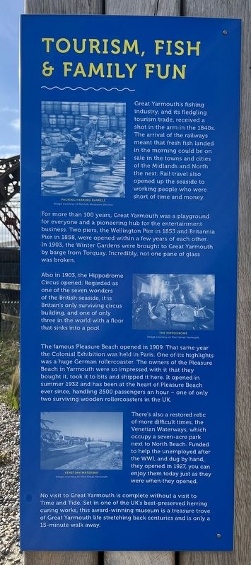
For more than 100 years. Great Yarmouth was a playground for everyone and a pioneering hub for the entertainment business. Two piers, the Wellington Pier in 1853 and Britannia Pier in 1858, were opened within a few years of each other. In 1903, the Winter Gardens were brought to Great Yarmouth by barge from Torquay. Incredibly, not one pane of glass was broken.
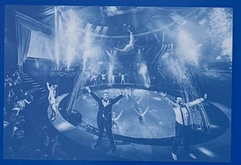
Also in 1903, the Hippodrome Circus opened. Regarded as one of the seven wonders of the British seaside, it is Britain's only surviving circus building, and one of only three in the world with a floor that sinks into a pool.
The famous Pleasure Beach opened in 1909. That same year the Colonial Exhibition was held in Paris. One of its highlights was a huge German rollercoaster. The owners of the Pleasure Beach in Yarmouth were so impressed with it that they bought it, took it to bits and shipped it here. It opened in summer 1932 and has been at the heart of Pleasure Beach ever since, handling 2500 passengers an hour one of only two surviving wooden rollercoasters in the UK.
There's also a restored relic of more difficult times, the Venetian Waterways, which occupy a seven-acre park next to North Beach. Funded to help the unemployed after the WWI, and dug by hand, they opened in 1927, you can enjoy them today just as they were when they opened.
No visit to Great Yarmouth is complete without a visit to Time and Tide. Set in one of the UK's best-preserved herring curing works, this award-winning
this page online
Erected by Greater Anglia.
Topics. This historical marker is listed in these topic lists: Entertainment • Parks & Recreational Areas.
Location. 52° 36.698′ N, 1° 43.299′ E. Marker is in Great Yarmouth, England, in Norfolk. It is on North Quay. The marker is just a few steps south of the Great Yarmouth Station car park. Touch for map. Marker is at or near this postal address: 90 N Quay, Great Yarmouth, England NR30 1JU, United Kingdom. Touch for directions.

Regionally, this marker is in East Anglia. Globally, it is on the Atlantic Ocean, in the North Atlantic Region, in Europe, in Atlantic Europe, on one of the British Isles, in the Western World, and in the Anglosphere. Historically, it finds itself in what was once the Roman Empire.
Other nearby markers. At least 8 other markers are within 21 kilometers of this marker, measured as the crow flies: The Marseille of the North (here, next to this marker); Yarn With Ernie (approx. 0.6 kilometers away);
Picture from the marker
2. The Hippodrome
Photographed by City Card Co., London, circa 1920
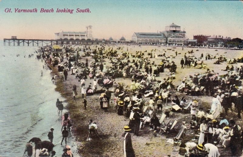
3. Great Yarmouth Beach lookin south
The Winter Gardens, mentioned on the marker, is the very large building on the right.
Credits. This page was last revised on July 14, 2026. It was originally submitted on July 14, 2026, by Ray Gurganus of Washington, District of Columbia. This page has been viewed 15 times since then. Photos: 1, 2. submitted on July 14, 2026, by Ray Gurganus of Washington, District of Columbia. 3. submitted on July 14, 2026. • Andrew Ruppenstein was the editor who published this page.
Editor’s want-list for this marker. photo of the marker within its surroundings • Can you help?
