Underhill in Chittenden County, Vermont — The American Northeast (New England)
Udney Hay
1739 - 1806
Photographed by Dennis Gilkenson, July 10, 2026
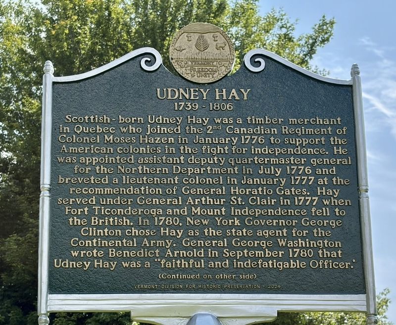
1. Udney Hay 1739-1806 Marker, Side One
Scottish-born Udney Hay was a timber merchant in Quebec who joined the 2nd Canadian Regiment of Colonel Moses Hazen in January 1776 to support the American colonies in the fight for independence. He was appointed assistant deputy quartermaster general for the Northern Department in July 1776 and breveted a lieutenant colonel in January 1777 at the recommendation of General Horatio Gates. Hay served under General Arthur St. Clair in 1777 when Fort Ticonderoga and Mount Independence fell to the British. In 1780, New York Governor George Clinton chose Hay as the state agent for the Continental Army. General George Washington wrote Benedict Arnold in September 1780 that Udney Hay was a "faithful and indefatigable Officer.
( back )
After the Revolutionary War, Udney Hay became involved in politics. He authored the constitution for the Democratic Society of the County of Chittenden in 1794 and was a member of the New York Democratic Society.
In 1795, Hay replaced DeWitt Clinton as a second for James Nicholson for a duel proposed by Alexander Hamilton. The dispute was resolved through negotiation
this page online
Erected 2024 by Vermont Division for Historic Preservation.
Topics. This historical marker is listed in these topic lists: Colonial Era • Patriots & Patriotism • War, US Revolutionary. A significant historical year for this entry is 1739.
Location. 44° 34.683′ N, 72° 55.343′ W. Marker is in Underhill, Vermont, in Chittenden County. It is on Poker Hill Road north of Iron Kettle Lane (Local Route 20), on the left when traveling north. Touch for map. Marker is at or near this postal address: 357 Poker Hill Road, Underhill VT 05489, United States of America. Touch for directions.

Regionally, this marker is in the Champlain Valley and in Greater Burlington. It is also in the American Northeast and in New England. Globally, it is in North America, the Western Hemisphere,

Photographed by Dennis Gilkenson, July 10, 2026
2. Udney Hay 1739-1806 Marker, Side Two
Other nearby markers. At least 8 other markers are within 8 miles of this marker, measured as the crow flies: District No. 5 Schoolhouse (approx. 5 miles away); G.A.R. Cambridge, VT (approx. 5.1 miles away); Grand Army of the Republic Highway (approx. 5.1 miles away); Mount Mansfield Natural Area (approx. 6.2 miles away); Chittenden Mills (approx. 6.4 miles away); Cambridge-Jeffersonville Veterans Monument (approx. 6.4 miles away); Cambridge Junction Bridge (approx. 7.3 miles away); Cambridge Rail Era History II (approx. 7.3 miles away). Touch for a list and map of all markers in Underhill.
Also see . . . Udney Hay (Wikipedia). (Submitted on July 15, 2026, by Michael Herrick of Southbury, Connecticut.)

Photographed by Dennis Gilkenson, July 10, 2026
3. Udney Hay Marker
Credits. This page was last revised on July 15, 2026. It was originally submitted on July 14, 2026, by Dennis Gilkenson of Saxtons River, Vermont. This page has been viewed 17 times since then. Photos: 1, 2, 3. submitted on July 14, 2026, by Dennis Gilkenson of Saxtons River, Vermont. • Michael Herrick was the editor who published this page.
