
Orangeville in Dufferin County, Ontario — Central Canada (North America)
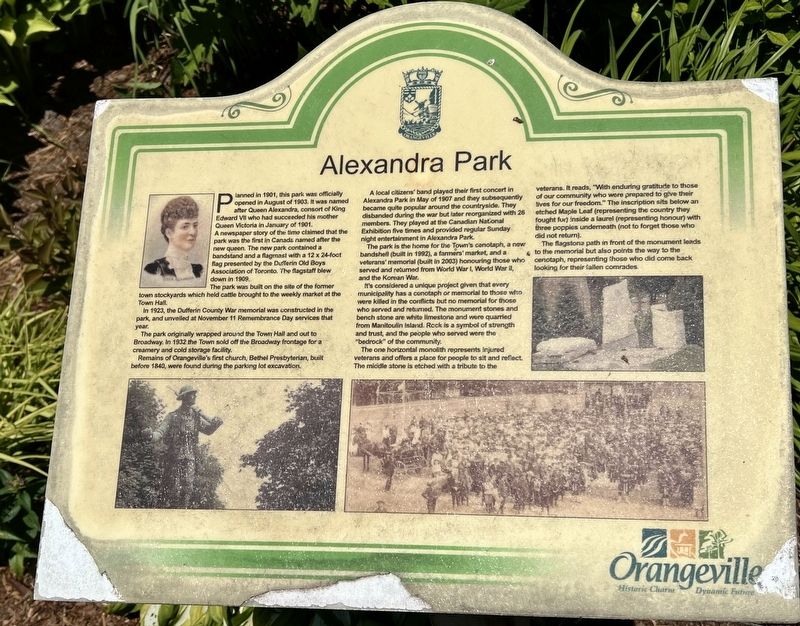
Alexandra Park
Photographed by Tim Boyd, July 12, 2026
1. Alexandra Park Marker
A newspaper story of the time claimed that the park was the first in Canada named after the new queen. The new park contained a bandstand and a flagmast with a 12 x 24-foaot flag presented by the Dufferin Old Boys Association of Toronto. The flagstaff blew down in 1909.
The park was built on the site of the former town stockyards which held cattle brought to the weekly market at the Town Hall.
In 1923, the Dufferin County War memorial was constructed in the park, and unveiled at November 11 Remembrance Day services that year.
The park originally wrapped around the Town Hall and out to Broadway. In 1932 the Town sold off the Broadway frontage for a creamery and cold storage facility.
Remains of Orangeville's first church, Bethel Presbyterian, built before 1840, were found during the parking lot excavation.
A local citizens band played their first concert in Alexandra Park in May of 1907 and they subsequently became
this page online
The park is the home for the Town's cenotaph, a new bandshell (built in 1992), a farmers' market, and a veterans' memorial (built in 2003) honouring those who served and returned from World War I, World War II, and the Korean War.
It's considered a unique project given that every municipality has a cenotaph or memorial to those who were killed in the conflicts but no memorial for those who served and returned. The monument stones and bench stone are white limestone and were quarried from Manitoulin Island. Rock is a symbol of strength and trust, and the people who served were the "bedrock" of the community.
The one horizontal monolith represents injured veterans and offers a place for people to sit and reflect. The middle stone is etched with a tribute to the veterans. It reads, "With enduring gratitude to those of our community who were prepared to give their lives for our freedom." The inscription
Photographed by Tim Boyd, July 12, 2024
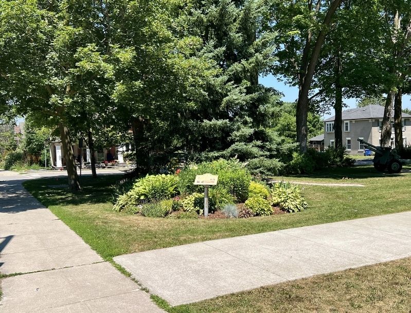
2. Alexandra Park Marker
The flagstone path in front of the monument leads to the memorial but also points the way to the cenotaph, representing those who did come back looking for their fallen comrades.
Erected by Town of Orangeville.
Topics. This historical marker is listed in these topic lists: Parks & Recreational Areas • War, Korean • War, World I • War, World II. A significant historical year for this entry is 1901.
Location. 43° 55.242′ N, 80° 5.676′ W. Marker is in Orangeville, Ontario, in Dufferin County. It is at the intersection of Second Street and First Avenue, on the right when traveling north on Second Street. Touch for map. Marker is at or near this postal address: 87 Broadway, Orangeville ON L9W 2B5, Canada. Touch for directions.

Regionally, this marker is in Ontario’s York, Durham and Headwaters Area, and in Southwestern Ontario. It is also in Central Canada. Globally, it is in North America, the Western Hemisphere, the

Photographed by Tim Boyd, July 12, 2024
3. The Dufferin County War Memorial, in Alexandra Park
Other nearby markers. At least 8 other markers are within 18 kilometers of this marker, measured as the crow flies: Dufferin County Court House (approx. 0.7 kilometers away); Speersville (approx. 8.6 kilometers away); Relessey (Maguire’s Corners) (approx. 15.2 kilometers away); Relessey (approx. 15.2 kilometers away); The Honourable William Grenville Davis (approx. 15.4 kilometers away); Stanley Park Gates and Arch (approx. 16 kilometers away); Stanley Park (approx. 16 kilometers away); Future Past 2412 (approx. 16.9 kilometers away).
Credits. This page was last revised on July 14, 2026. It was originally submitted on July 14, 2026, by Tim Boyd of Hamilton, Ontario. This page has been viewed 11 times since then. Photos: 1, 2, 3. submitted on July 14, 2026, by Tim Boyd of Hamilton, Ontario. • Andrew Ruppenstein was the editor who published this page.
