Hopewell Township in Mercer County, New Jersey — The American Northeast (Mid-Atlantic)
Horsin’ Around
| — | Lawrence Hopewell Trail | — |
Photographed by Richard Peterson, July 12, 2026
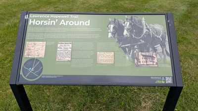
1. Horsin' Around Marker
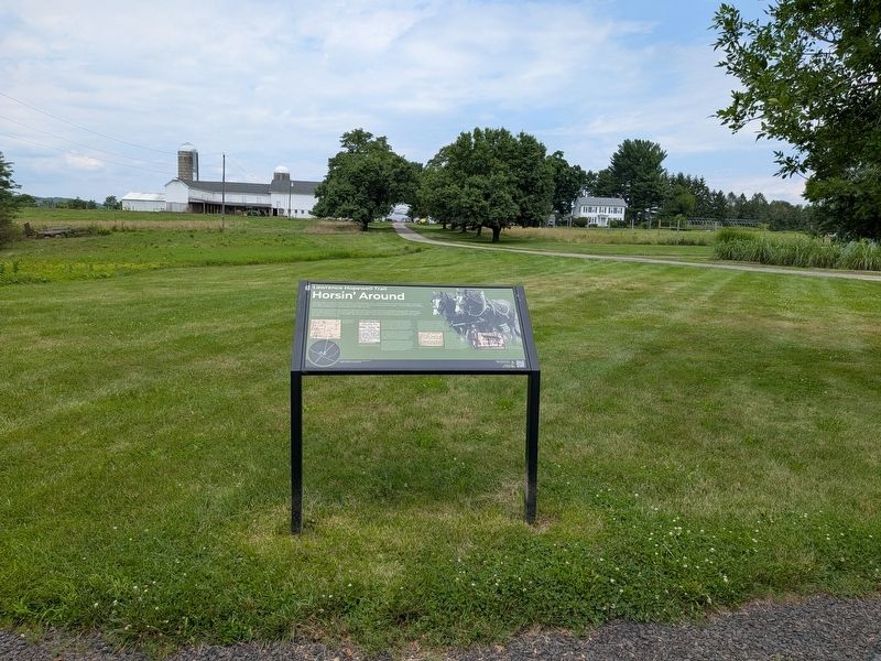
The impressive range of white frame farm buildings before you – the immense barn and silo complex to the left; the wagon houses and corn crib in the center; and the spacious farmhouse at the right – evoke Hopewell farming at its most prosperous around the turn of the 20th century.
Historically, this property was known as “Stony Brook Farm,” named for the meandering stream that drains the surrounding fertile land. This farm complex, with its characteristic linear arrangement of buildings, was a relative late comer, established in the late 1850s. By the early 1900s, it was one of the area’s leading stock farms, with a specialty in horse breeding.
Stony Brook Farm came into being following the death of local farmer Charles Clifford on the final day of 1856. It was sold by his executors in 1858, acquired first by lsaac Welling, who passed it on to James and Susan Thompson. By 1860, the Thompsons had erected a new farmhouse – the one you see today – and the census for that year shows their household numbering no less than 16 persons, including their nine children and two farm hands.
For almost four decades, the Thompson
this page online
Under the new owner, Edward B. Allen, the property was transformed, taking on the Stony Brook Farm name and a new, very different identity. An absentee owner who lived in Flemington, Allen was a horse aficionado and harness racing enthusiast. Over a quarter century, he built the property into one of the leading stock farms in the region, periodically holding public sales of racehorses, draft horses, dairy cattle and other farm animals.
Horses were Allen’s true passion. He shipped them in from all across the country to train and sell, and he traveled to Scotland to import Clydesdales, the well-known breed of draft horse. In January 1911, a 1,740-pound Clydesdale stallion named Maharajah was delivered to Stony Brook Farm. Less than six months later, 25 head of choice Clydesdale mares arrived.
Photographed by Richard Peterson, July 12, 2026
2. Horsin’ Around Marker and Farm
Edward B. Allen put Stony Brook Farm up for public sale in 1927 and devoted the remaining two decades of his life to running the Flemington Agricultural Fair. The farm passed through the hands of the Hicks and Kamenstein families before being acquired by the Socony Mobil Oil Company in 1957 and becoming part of its petroleum research center. The Mobil facility was succeeded in 1997 by the pharmaceutical research campus of Bristol Myers Squibb, which remained active until 2020.
(image captions)
— In the 1870s, the Thompson family farmed 170 fertile acres along the banks of Stony Brook (Everts & Stewart, Atlas of Mercer County, New Jersey, 1875).
— One of many horse sale advertisements placed in local newspapers by Edward B. Allen during the first decade of the 20th century (Trenton Evening Times, January 20, 1906).
— Edward B. Allen brings his stud Maharajah to Stony Brook Farm (Trenton Evening Times, January 24, 1911).
— The farmhouse at Stony Brook Farm as it appeared circa 1950; originally built around 1860, note how little this house has changed over the past century (Family of Reeves Hicks).
Content development by Hunter Research, Inc. Graphic design by Douglas Scott
Topics. This historical marker is listed in these topic lists: Agriculture • Animals. A significant historical year for this entry is 1860.
Location. 40° 20.401′ N, 74° 46.109′ W. Marker is in Hopewell Township, New Jersey, in Mercer County. It is at the intersection of Pennington Rocky Hill Road (County Route 624) and Elm Ridge Road (County Route 625), on the right when traveling south on Pennington Rocky Hill Road. Located on the Lawrence Hopewell Trail. Touch for map. Marker is at or near this postal address: 317 Pennington Rocky Hill Road, Pennington NJ 08534, United States of America. Touch for directions.

Regionally, this marker is in Central Jersey and in Greater Princeton. It is also in the American Northeast and in the Mid-Atlantic. Globally, it is in North America, the Western Hemisphere, the Western World, and the Anglosphere. Historically, it finds itself in what was once New Netherland and also one of the original Thirteen Colonies.
Other nearby markers. At least 8 other markers are within 3 miles of this marker, measured as the crow flies: Family Farming (approx. 0.4 miles away); Watershed Reserve (approx. 0.7 miles away); Parks for the People (approx. 0.8 miles away); Pennington (approx. 1.4 miles away); British Horses (approx. 1½ miles away); Delaware and Bound Brook RR (approx. 2.1 miles away); Mount Rose Distillery (approx. 2.2 miles away); Mount Rose The Landform (approx. 2.3 miles away). Touch for a list and map of all markers in Hopewell Township.
Also see . . . History along the LHT. An annotated list of historical markers along the Lawrence Hopewell Trail. (Submitted on July 14, 2026, by Richard Peterson of East Windsor, New Jersey.)
Credits. This page was last revised on July 18, 2026. It was originally submitted on July 14, 2026, by Richard Peterson of East Windsor, New Jersey. This page has been viewed 23 times since then. Photos: 1, 2. submitted on July 14, 2026, by Richard Peterson of East Windsor, New Jersey. • Michael Herrick was the editor who published this page.
