Manfred in Wells County, North Dakota — The American Midwest (Upper Plains)
Soo Line Railroad at Manfred
An Authentic Settlers' Community Celebrating Rural America
Photographed by Cosmos Mariner, June 28, 2024
1. Soo Line Railroad at Manfred Marker
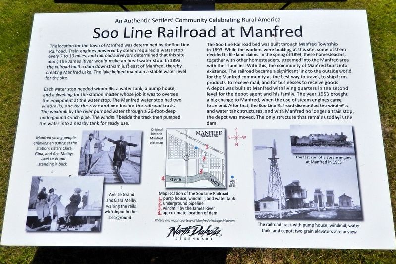
The location for the town of Manfred was determined by the Soo Line Railroad. Train engines powered by steam required a water stop every 7 to 10 miles, and railroad surveyors determined that this site along the James River would make an ideal water stop. In 1893 the railroad built a dam downstream just east of Manfred, thereby creating Manfred Lake. The lake helped maintain a stable water level for the site.
Each water stop needed windmills, a water tank, a pump house, and a dwelling for the station master whose job it was to oversee the equipment at the water stop. The Manfred water stop had two windmills, one by the river and one beside the railroad track. The windmill by the river pumped water through a 20-foot-deep underground 4-inch pipe. The windmill beside the track then pumped the water into a nearby tank for ready use.
The Soo Line Railroad bed was built through Manfred Township in 1893. While the workers were building at this site, some of them decided to file land claims. In the spring of 1894, these homesteaders, together with other homesteaders, streamed into the Manfred area with their families. With this,
this page online
Topics. This historical marker is listed in these topic lists: Railroads & Streetcars • Settlements & Settlers • Waterways & Vessels. A significant historical year for this entry is 1893.
Location. 47° 41.66′ N, 99° 44.936′ W. Marker is in Manfred, North Dakota, in Wells County. It is on Manfred Avenue just north of Railway Street, on the right when traveling north. Touch for map. Marker is in this post office area: Manfred ND 58465, United States of America. Touch for directions.

Regionally, this marker

Courtesy Manfred Heritage Museum
2. Marker detail: Soo Line Railroad building locations
1. Pump house, windmill, and water tank
2. Underground pipeline
3. Windmill by the James River
4. Approximate location of dam
2. Underground pipeline
3. Windmill by the James River
4. Approximate location of dam
Other nearby markers. At least 8 other markers are within walking distance of this marker: West Side of Main Avenue (here, next to this marker); The Elevators of Manfred (within shouting distance of this marker); North Side of Elevator Street (within shouting distance of this marker); Central Office and Neighborhood (within shouting distance of this marker); East Side of Main Avenue (within shouting distance of this marker); Manfred Lake on the James River (about 300 feet away, measured in a direct line); Lake Avenue Neighborhood (about 300 feet away); Le Grand's Addition (about 400 feet away). Touch for a list and map of all markers in Manfred.
Also see . . . Soo Line Railroad (Wikipedia).
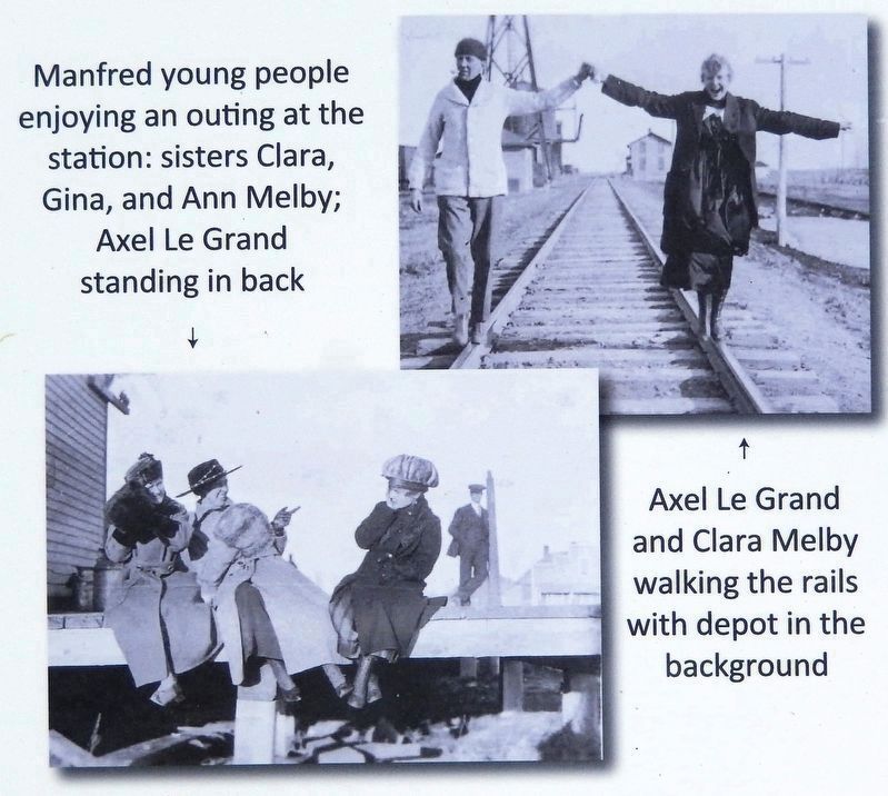
Excerpt: Although it is named for the Minneapolis, St. Paul and Sault Ste. Marie Railroad (MStP&SSM), which(Submitted on July 19, 2026, by Cosmos Mariner of Cape Canaveral, Florida.)was commonly known as the Soo Line after the phonetic spelling of Sault, it was formed in 1961 by the consolidation of that company with two other subsidiaries of CPKC predecessor Canadian Pacific: The Duluth, South Shore and Atlantic Railway, and the Wisconsin Central Railway. It is also the successor to other Class I railroads, including the Minneapolis, Northfield and Southern Railway (acquired 1982) and the Chicago, Milwaukee, St. Paul and Pacific Railroad (Milwaukee Road, acquired at bankruptcy in 1985).Courtesy Manfred Heritage Museum3. Marker detail: Young folks at the stationManfred young people enjoying an outing at the station: sisters Clara, Gina, and Ann Melby; Axel Le Grand standing in back.Axel Le Grand and Clara Melby walking the rails with depot in the background.
The company's main line begins at Portal, North Dakota, on the Canada–U.S. border, and extends southeast along former MStP&SSM trackage to the Twin Cities (Minneapolis–Saint Paul).
Courtesy Manfred Heritage Museum
4. Marker detail: The Steam Era
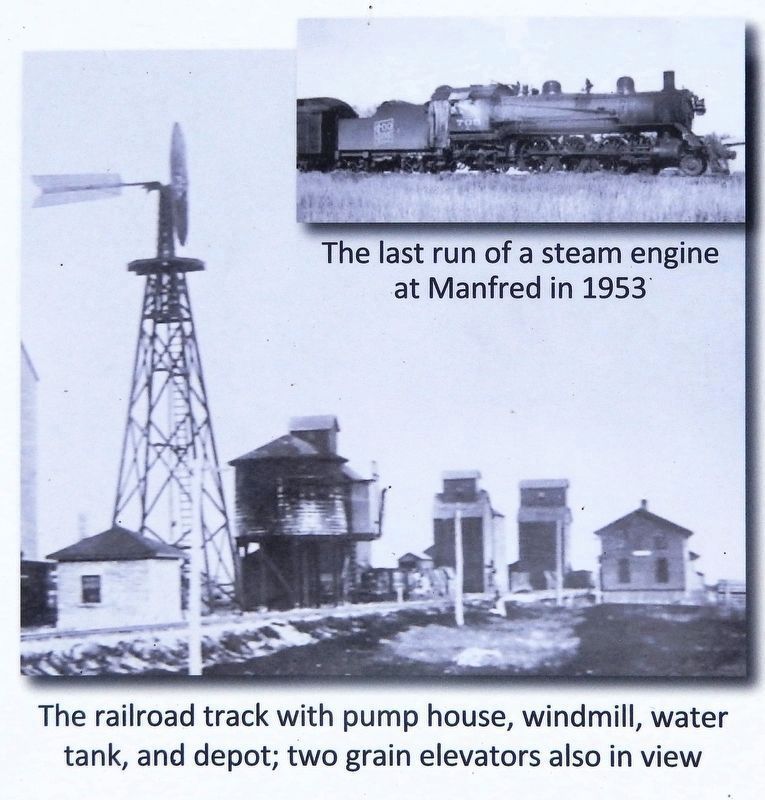
The last run of a steam engine at Manfred in 1953.
The railroad track with pump house, windmill, water tank, and depot; two grain elevators also in view.

Photographed by Cosmos Mariner, June 28, 2024
5. Soo Line Railroad at Manfred Marker
Looking south; Railway Street crosses in the background. The railroad line (single track) is just south of the street and runs parallel with it.
Credits. This page was last revised on July 19, 2026. It was originally submitted on July 15, 2026, by Cosmos Mariner of Cape Canaveral, Florida. This page has been viewed 20 times since then. Photos: 1, 2, 3, 4, 5. submitted on July 19, 2026, by Cosmos Mariner of Cape Canaveral, Florida.
