
Alliston in New Tecumseth in Simcoe County, Ontario — Central Canada (North America)
Agricultural Exhibit Hall

Photographed by Tim Boyd, July 12, 2026
1. Agricultural Exhibit Hall Marker
Agricultural Exhibit Hall
The Alliston Agricultural Society built the main building in 1914 as an agricultural exhibit hall where craft and food entries were displayed during the annual fall fair in Riverdale Park. During the First World War, 1914 to 1918, the building was also used as a drill hall and recruitment centre, as Base Borden in Angus hadn't fully opened yet.
The Lions Club Dance Hall (Riverdale Pavilion)
In 1937, the Lions Club leased the building from the Town for the annual fee of one dollar and renovated the building into a dance hall. Upwards of one thousand residents attended the inaugural dance on April 27, 1937. Dances were held weekly from April through to the late fall and continued into the early 1940s.
The Dorothea Knitting Mill
In 1945, the building was leased to the Dorothea Knitting Mill, a knitting mill in Toronto that manufactured berets, scarves, toques, gloves and mitts for the Armed Forces. The sole function of this local mill was to finish gloves and mitts that were shipped from the Toronto mill. The company eventually added equipment to produce men's sweaters. After years of instability
this page online
The South Simcoe Pioneer Museum
In 1959, the Town of Alliston passed a by-law establishing a 'Historical Museum' in Alliston. A museum board was established consisting of two people appointed by the Town of Alliston Council, and one person appointed by each of the councils for the Townships of Adjala, Essa, Tecumseth, Tosorontio and West Gwillimbury. The Town of Alliston offered this building and the newly named South Simcoe Pioneer Museum unofficially opened in 1960. Following a very successful first season, a grand opening was held the following year.
The Museum on the Boyne
After the amalgamation of several municipalities in South Simcoe and the establishment of the Town of New Tecumseth in 1991, the museum board consisted of appointed council members and citizens appointed from the municipalities of Adjala-Tosorontio, Bradford West Gwillimbury, Essa, Innisfil, and New Tecumseth. In 1996, the building underwent major renovations to better protect the artifacts
Photographed by Tim Boyd, July 21, 2026
2. Agricultural Exhibit Hall Marker
Centre of photo
Erected by The Town of New Tecumseth.
Topics. This historical marker is listed in these topic lists: Agriculture • Entertainment • Industry & Commerce. A significant historical year for this entry is 1914.
Location. 44° 9.356′ N, 79° 52.676′ W. Marker is in New Tecumseth, Ontario, in Simcoe County. It is in Alliston. It is on Fletcher Crescent 0.2 kilometers east of King Street North, on the left when traveling east. Touch for map. Marker is at or near this postal address: 251 Fletcher Crescent, New Tecumseth ON L9R 1M1, Canada. Touch for directions.

Regionally, this marker is in Central Ontario Cottage Country and specifically in Georgian Bay Country. It is also in Central Canada. Globally, it is in North America, on the Great Lakes, in the Western Hemisphere, in the Western World, and in the Anglosphere. Historically, it finds itself in what was once a British colony, the Viceroyalty of New

Photographed by Tim Boyd, July 21, 2026
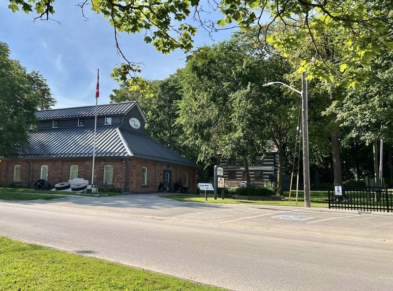
3. Former Agricultural Exhibit Hall in 2026
Other nearby markers. At least 8 other markers are within 3 kilometers of this marker, measured as the crow flies: The Fountain/The Alliston Jail (a few steps from this marker); The Barn (a few steps from this marker); The McDonald Log House (a few steps from this marker); The Revere House and Brown Building (approx. 0.9 kilometers away); The Alliston Monument Works (approx. 0.9 kilometers away); Sir Frederick Grant Banting (approx. 1.4 kilometers away); Canada's Gift to the World (approx. 2.8 kilometers away); Sir Frederick Banting (approx. 2.8 kilometers away). Touch for a list and map of all markers in New Tecumseth.
Credits. This page was last revised on July 18, 2026. It was originally submitted on July 18, 2026, by Tim Boyd of Hamilton, Ontario. This page has been viewed 17 times since then. Photos: 1, 2, 3. submitted on July 18, 2026, by Tim Boyd of Hamilton, Ontario. • Andrew Ruppenstein was the editor who published this page.
