Punxsutawney in Jefferson County, Pennsylvania — The American Northeast (Mid-Atlantic)
Before the Revolutionary War
Photographed by Mark Parker, July 16, 2026
1. Before the Revolutionary War Marker
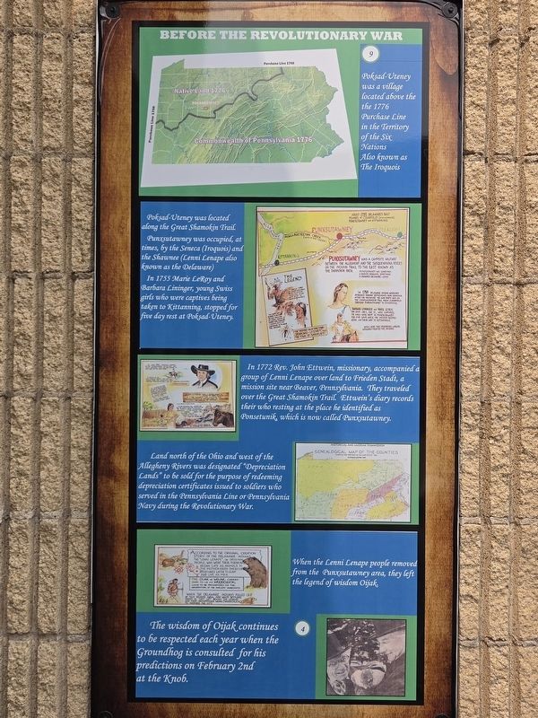
Poksad-Uteney was a village located above the 1776 Purchase Line in the Territory of the Six Nations Also known as The Iroquois.
Poksad-Uteney was located along the Great Shamokin Trail.
Punxsutawney was occupied, at times, by the Seneca (Iroquois) and the Shawnee (Lenni Lenape also known as the Delaware)
In 1755 Marie LeRoy and Barbara Lininger, young Swiss girls who were captives bring taken to Kittanning, stopped for five day rest at Poksad-Uteney.
In 1772 Rev. John Ettwein, missionary, accompanied a group of Lenni Lenape over land to Frieden Stadt, a mission site near Beaver, Pennsylvania. They traveled over the Great Shamokin Trail. Ettwein's diary records their who resting at the place he identified as Ponsetunik, which is now called Punxsutawney.
Land north of the Ohio and west of the Allegheny Rivers was designated "Depreciation Lands" to be sold for the purpose of redeeming depreciation certificates issued to soldiers who served in the Pennsylvania Line or Pennsylvania Navy during the Revolutionary War.
When the Lenni Lenape people removed from the Punxsutawney area, they left the legend of
this page online
The wisdom of Oijak continues to be respected each year when the Groundhog is consulted for his predictions on February 2nd at the Knob.
Erected by Punxsutawney Area Historical & Genealogical Society, Inc.
Topics. This historical marker is listed in these topic lists: Indigenous Peoples and Communities • Settlements & Settlers. A significant historical year for this entry is 1755.
Location. 40° 56.633′ N, 78° 58.078′ W. Marker is in Punxsutawney, Pennsylvania, in Jefferson County. It can be reached from the intersection of East Union Street and Merchants Alley, on the left when traveling west. Location of the marker is at the Punxsutawney Municipal Building between the Police Department and the library. Touch for map. Marker is at or near this postal address: 301 E Mahoning St, Punxsutawney PA 15767, United States of America. Touch for directions.

Regionally, this marker is in the Pennsylvania Wilds. It is also in the American Northeast, in the Mid-Atlantic, in Appalachia, and specifically in Northern Appalachia. Globally, it is in North America, the Western Hemisphere, the Western World, and the Anglosphere.

Photographed by Mark Parker, July 16, 2026
2. Wide view of Before the Revolutionary War Marker
Location is the far left of the history series on the right wall.
Other nearby markers. At least 8 other markers are within walking distance of this marker: Early Settlement in Punxsutawney (here, next to this marker); "Punxsutawney Seasons" (here, next to this marker); Industrial Development (here, next to this marker); Modern Punxsutawney (here, next to this marker); Punxsutawney (a few steps from this marker); SFC Scott R. Smith (within shouting distance of this marker); World War II Memorial (within shouting distance of this marker); Weather Capital of the World (within shouting distance of this marker). Touch for a list and map of all markers in Punxsutawney.
More about this marker. The numbers on the marker are locations of groundhog statues placed around the Punxsutawney Area.
Credits. This page was last revised on July 22, 2026. It was originally submitted on July 19, 2026, by Mark Parker of Hickory, North Carolina. This page has been viewed 25 times since then. Photos: 1, 2. submitted on July 19, 2026, by Mark Parker of Hickory, North Carolina. • Devry Becker Jones was the editor who published this page.
